
Areas of morning fog; temps rebound a bit
Rain/snow showers north late Wednesday
Go Deeper.
Create an account or log in to save stories.
Like this?
Thanks for liking this story! We have added it to a list of your favorite stories.


March is our third-snowiest month of the year in the Twin Cities. We saw some flakes in the metro area Tuesday evening. Three-tenths of an inch was the snow total at Minneapolis-St. Paul International Airport.
Snow reports will continue to come in, but here are a few:

Apple Valley reported 1.4 inches. Sartell, which is near St. Cloud, had 3.5 inches.
Areas of fog
Areas of fog are expected in the Twin Cities and much of central and southern Minnesota plus parts of western Wisconsin this Wednesday morning. Some locations could see freezing fog.
Turn Up Your Support
MPR News helps you turn down the noise and build shared understanding. Turn up your support for this public resource and keep trusted journalism accessible to all.
A dense fog advisory continues until 10 a.m. in six counties of far southwestern Minnesota.
Temperatures
Most of Minnesota and western Wisconsin will have highs in the 40s today, with some 50s in southwestern and south-central Minnesota:
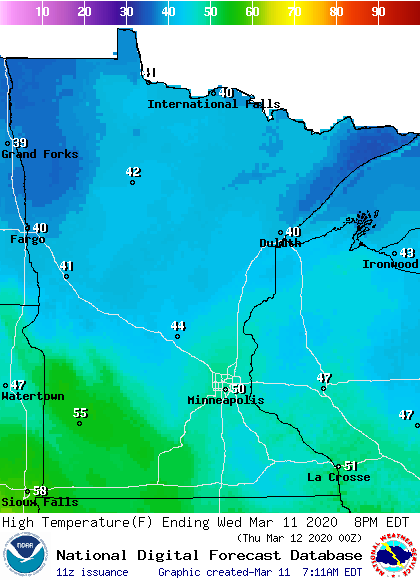
The Twin Cities will top out around 50.
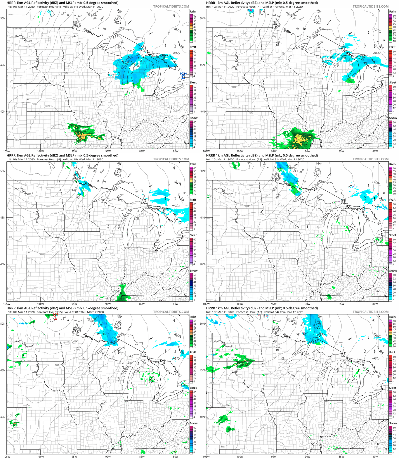
Rain/snow chances north
Portions of northern Minnesota may see some rain showers and snow showers late Wednesday and Wednesday evening. Here’s NOAA’s High Resolution Rapid-Refresh (HRRR) model for Wednesday and Wednesday evening:
You can hear updated weather information on the MPR network, and you’ll see updated weather info on the MPR News live weather blog.

