
Twin Cities temps recover Wednesday afternoon. How snowy is March?
Updated snow totals from Tuesday
Go Deeper.
Create an account or log in to save stories.
Like this?
Thanks for liking this story! We have added it to a list of your favorite stories.


We’re dealing with areas of dense fog in parts of southern Minnesota this Wednesday morning. Fog will diminish in most areas by midday.
Tuesday snow recap
Snow reports from Tuesday afternoon into Tuesday night are still coming in. You can see snow amounts plotted by the National Weather Service here. This is how the snow report map looked Wednesday morning:

You can click on any snow report at the NWS link to see the snow amount, the exact location and the time of measurement.
The official snow total at Minneapolis-St. Paul International Airport was three-tenths of an inch Tuesday evening. There was a report of 3 inches of snow in Lakeville and 2.5 inches in Apple Valley.
Turn Up Your Support
MPR News helps you turn down the noise and build shared understanding. Turn up your support for this public resource and keep trusted journalism accessible to all.
Other reports across the state: Veseli, in Rice County, reported 3 inches of new snow. North Mankato had 2 inches, and Sartell, near St. Cloud, reported 3.5 inches of snow.
Our neighbors in Menomonie Wis., measured 2 inches of fresh snow.
Temperature trends
Our average Twin Cities high temperature is 39 degrees this time of year. We could top out near 50 Wednesday afternoon. Southwestern and south-central Minnesota will see some highs in the 50s, with mostly 40s elsewhere in Minnesota plus western Wisconsin.
Thursday highs reach the 30s north with 40s central and south:
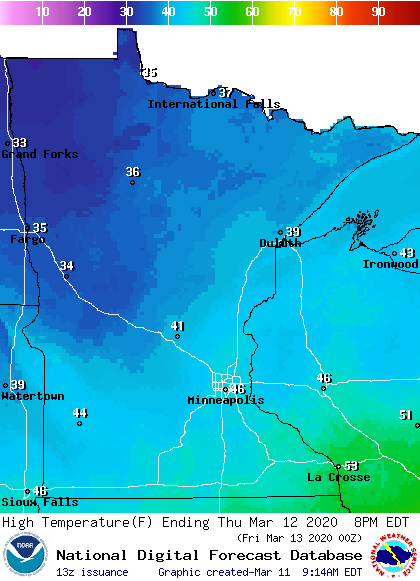
Twin Cities metro area highs are projected to reach the the upper 30s Friday and Saturday, followed by mid 40s on Sunday.
Precipitation chances
North-central and northeastern Minnesota could see some patchy rain showers Wednesday afternoon and evening, with a few snowflakes mixed in at times.
You can hear updated weather information on the MPR network, and you’ll see updated weather info on the MPR News live weather blog.
On Thursday, some periods of rain are expected in southern Minnesota, the Twin Cities and western Wisconsin. with a rain/snow mix at times in central and northern Minnesota. The National Oceanic and Atmospheric Administration’s North American Mesoscale forecast model shows the potential precipitation pattern for Thursday:
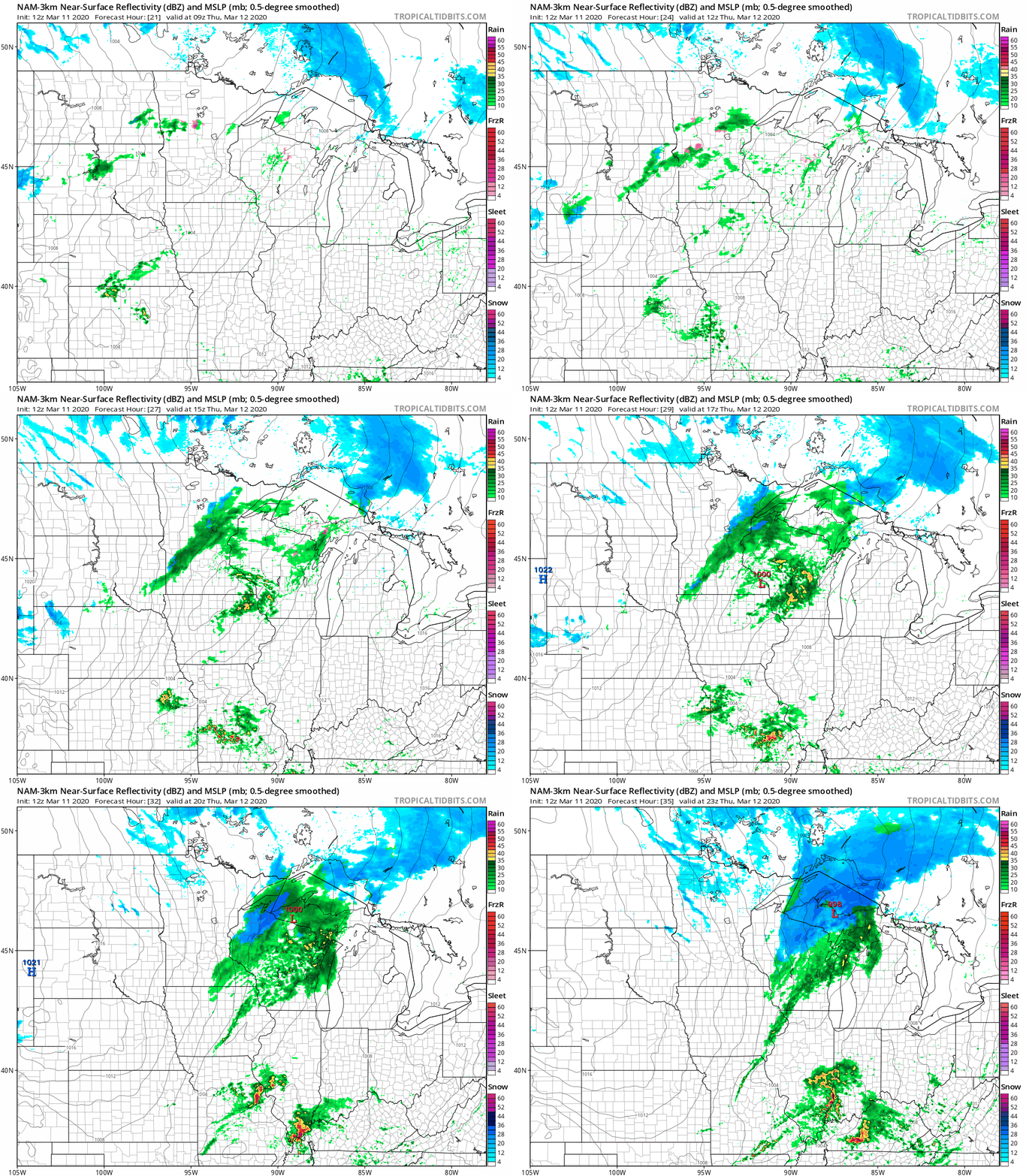
Some light snow showers will be possible Thursday evening.
March snow
March is our third-snowiest month of the year in the Twin Cities, with an average snow total of 10.2 inches for the entire month:

On average, January is our snowiest month of the year in the Twin Cities and December is our second-snowiest month.
As you may imagine, our March snow total can vary quite a bit. The snowiest March in Twin Cities weather records was in 1951, with 40 inches. In March of 2010, the official Twin Cities snow total at MSP airport was zero!
Here are monthly snow totals for the Twin Cities over the past 12 snow seasons:

The Twin Cities recorded 10.5 inches of snow in March of 2019, but we’ve only seen double-digit March snow totals in two of the past eleven years.
There aren’t any big March snowstorms in sight over the next week or so.

