
A gray Wednesday, followed by a stronger storm Thursday
Most of the state sees accumulating snow by Thursday night
Go Deeper.
Create an account or log in to save stories.
Like this?
Thanks for liking this story! We have added it to a list of your favorite stories.


Lighter precipitation targets Minnesota Wednesday, then a potent storm brings the state rain, snow and wind Thursday and Friday.
Wednesday’s forecast
A weather disturbance moving across Minnesota has returned widespread cloud cover across the state, including some lower clouds and areas of light fog.
Because of this, temperatures are very mild Wednesday morning, and by the afternoon, most of the state will be in the 30s and 40s.
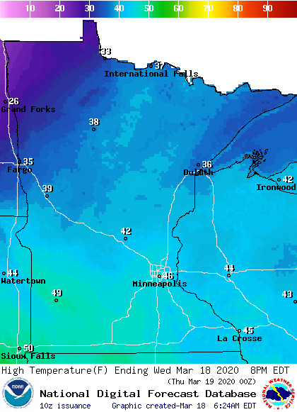
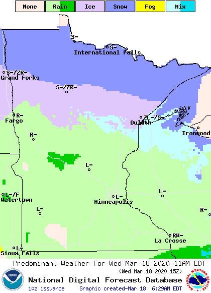
Precipitation will remain predominantly light, with southern Minnesota seeing periods of drizzle, and a line from Moorhead to Duluth northward most likely to see light freezing drizzle and snow, which could make roads slick.
Turn Up Your Support
MPR News helps you turn down the noise and build shared understanding. Turn up your support for this public resource and keep trusted journalism accessible to all.
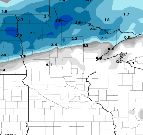
While the daytime snow will be light, a more persistent band of snow will likely move in late Wednesday through Thursday morning, bringing northern Minnesota 1 to 3 inches of snow, with some isolated higher amounts.
Thursday and Friday
Already by early Thursday, a stronger storm will bring more rain, snow, and higher winds through the state. Northern Minnesota will also see a mix of precipitation including light snow, light rain and even light freezing rain through Thursday. Because the storm will slide to the south of Minnesota, southern portions of the state will feel the greatest impacts.
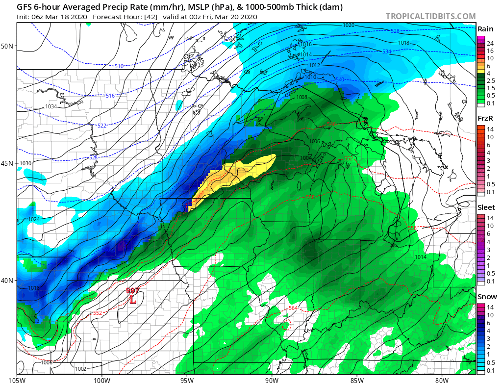
This storm is bringing a lot of moisture with it, so southern Minnesota could see periods of heavy rain during the day on Thursday. Then as temperatures drop, rain will switch to snow for southwestern Minnesota by Thursday afternoon, then for the rest of the state, including the Twin Cities, by Thursday night. By the time all the snow clears out Friday morning, most of southern Minnesota and up through the Arrowhead will see a dusting of snow up to 2 inches, and southwestern Minnesota is likely to see a few higher reports of 3 to 4 inches or more.
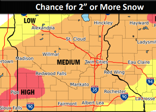
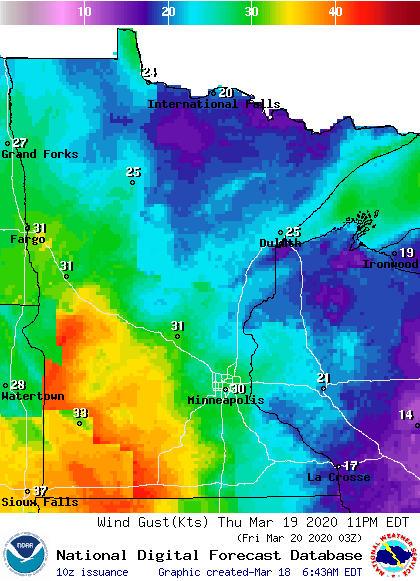
The snow forecast is challenging, because it will depend on exactly when the rain switches to snow. Winds Thursday into early Friday will gust over 20 and 30 mph.
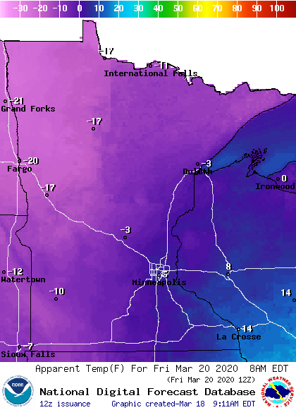
After the snow clears out early Friday, some sunshine will return, but it will be colder and stay windy, with wind chills for much of Minnesota dipping below zero, especially Friday morning.
The weekend
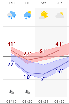
Saturday will remain sunny, but colder than average, with northern Minnesota starting the day with temperatures below zero. By Sunday, temperatures will be milder again, but more clouds return with a slight chance for sprinkles or flurries.
Here is the forecast trend for the Twin Cities through the weekend:
Programming note
You can hear my live weather updates on Minnesota Public Radio at 7:48 a.m. Monday through Friday morning.

