
The start of spring brings rain, snow and high winds
Friday turns colder
Go Deeper.
Create an account or log in to save stories.
Like this?
Thanks for liking this story! We have added it to a list of your favorite stories.


Just in time for the start of spring, a strong storm will bring parts of Minnesota soaking rain, accumulating snow, and gusty winds, followed by colder weather.
Spring begins at 10:49 p.m. Thursday night, and it will be the earliest start to spring in 124 years!
A potent storm
A strong storm that will slide south of Minnesota is already bringing snow to northern Minnesota and areas of rain and drizzle to southern Minnesota as of Thursday morning. Temperatures across the state started off mild, but due to colder air from the storm, it will not warm much Thursday and western Minnesota will see some temperatures begin to fall by afternoon. Here are the expected temperatures by 5 p.m.:
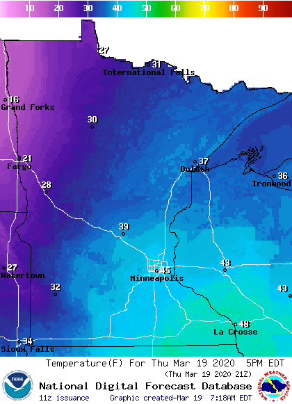
By Friday, the entire state will be noticeably colder.
Turn Up Your Support
MPR News helps you turn down the noise and build shared understanding. Turn up your support for this public resource and keep trusted journalism accessible to all.
It will also become very windy across the entire state, with western Minnesota seeing the highest winds and gusts over 40 mph.
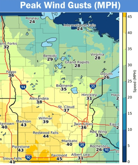
Between the colder air and high winds, the western edge of the state will likely see wind chills below zero by Thursday night.
Because the storm center will pass south, southern parts of Minnesota could see some heavy rain at times, with some rain totals up to an inch or more.
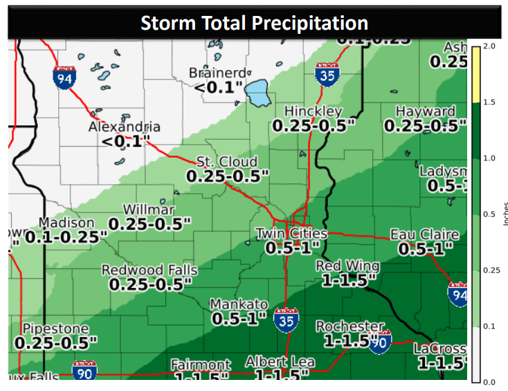
As temperatures cool, the rain in southern Minnesota will start to switch over to snow, starting in southwestern Minnesota by afternoon.
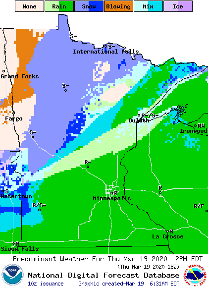
The timing of the shift from rain to snow for southeastern Minnesota, including the Twin Cities, is most likely to come late Thursday evening. Most of the state will see light amounts of snow under an inch, which will end by Friday morning. Southwestern Minnesota could see slightly higher amounts at 1 to 2 inches, and the Arrowhead could see 1 to 3 inches of snow with a little freezing precipitation mixed in.
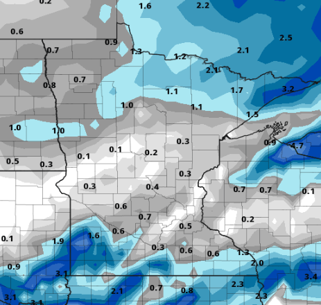
Because of the active weather, much of Minnesota is under weather advisories Thursday.
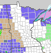
The areas highlighted in brown are in a wind advisory for winds that could exceed 40 mph. The areas in purple are winter weather advisories for snow and blowing snow in northwestern and southwestern Minnesota and for snow and possible freezing rain in the Arrowhead. As the snow moves out, skies clear quickly on Friday, and most of the state will see sunshine by late morning. However, it will stay cold and windy all of Friday.
Weekend weather
Colder air will remain over Minnesota into Saturday, when northern parts of Minnesota could start the day below zero.
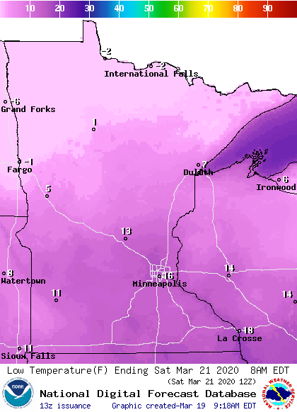
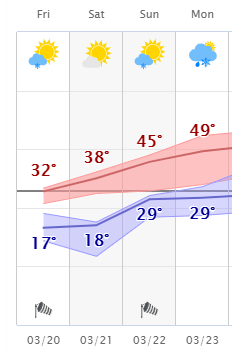
By Saturday afternoon, under partly sunny skies, most of the state will see temperatures rebound into the 30s. Sunday will be even milder, with highs in the 30s and 40s. Sunday into early Monday, isolated chances for light rain and snow return across the state. Here is the extended forecast for the Twin Cities through Monday:
Programming note
You can hear my live weather updates on Minnesota Public Radio at 7:48 a.m. Monday through Friday morning.

