
Sunshine returns, but Friday remains cold
Wind chills below zero for western Minnesota
Go Deeper.
Create an account or log in to save stories.
Like this?
Thanks for liking this story! We have added it to a list of your favorite stories.


The storm that brought rain and snow to Minnesota on Thursday has moved out leaving higher winds and colder weather in its wake.
Friday’s forecast
The strong storm that impacted the state Thursday and into part of the overnight is moving out quickly, and skies have rapidly cleared across the state, which will make for a mostly sunny day. Here is the satellite as of 6:46 a.m.:
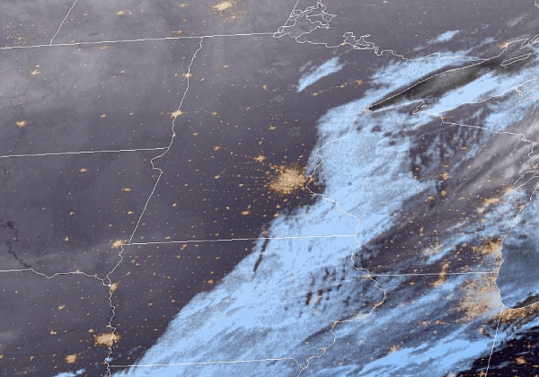
The one exception is the Arrowhead, which is still seeing some light snow as of Friday morning, but this will be lessening and then ending by midday.
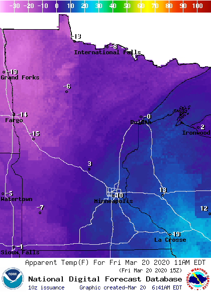
It is still very windy across the state behind the storm, with many parts of southern Minnesota still seeing gusts over 30 mph Friday morning. Winds will slowly diminish through the day, but the combination of high winds and colder air means the entire state will be feeling a wind chill through the day. Much of western Minnesota will see wind chills below zero through at least noon.
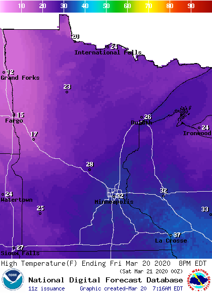
Highs will also be noticeably colder, with temperatures ranging from the teens to low 30s.
Milder weather returns by the weekend. That extended forecast will be updated around 9 a.m.
Programming note
You can hear my live weather updates on Minnesota Public Radio at 7:48 a.m. Monday through Friday morning.
Turn Up Your Support
MPR News helps you turn down the noise and build shared understanding. Turn up your support for this public resource and keep trusted journalism accessible to all.

