Cooler and wet for Wednesday
Cloudy skies prevail
Go Deeper.
Create an account or log in to save stories.
Like this?
Thanks for liking this story! We have added it to a list of your favorite stories.


A cold front is bringing cooler temperatures across the entire state, plus areas of snow and rain to central and southern Minnesota.
Wednesday’s forecast
The same weather system that brought the warmer air Tuesday is now pushing a cold front across the state. The cooler air along with that front means temperatures will not rise much from where they are starting Wednesday morning. Highs will be predominantly in the 30s and 40s, which is seasonable for late March.
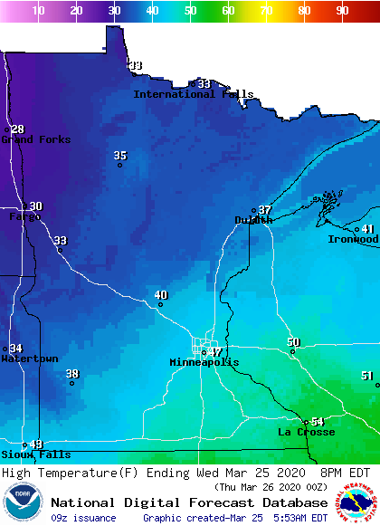
Because of the front, winds will also be breezier, with wind gusts occasionally in the teens. There are also patches of fog throughout southern Minnesota that will lift as the winds increase.
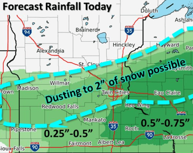
The precipitation with the system should stay south of a line from Moorhead to Duluth, and most of the measurable rain or snow is likely to stay south of St. Cloud.
Turn Up Your Support
MPR News helps you turn down the noise and build shared understanding. Turn up your support for this public resource and keep trusted journalism accessible to all.
Here is the radar as of 6:28 a.m., showing that moisture moving in from the Dakotas.
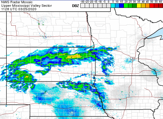
Central Minnesota is more likely to see light snow, while parts of southeastern Minnesota could see half an inch of rain or more.
The weather remains unsettled through Saturday. That extended forecast will be updated around 9 a.m.
Programming note
You can hear my live weather updates on Minnesota Public Radio at 7:48 a.m. Monday through Friday morning.