
A strong storm brings soaking rain by Saturday
A few sprinkles and seasonable temperatures Thursday
Go Deeper.
Create an account or log in to save stories.
Like this?
Thanks for liking this story! We have added it to a list of your favorite stories.


Thursday brings a chance for sprinkles under mostly cloudy skies, then a stronger storm brings widespread rain the first half of the weekend.
Thursday’s forecast
Temperatures Thursday will stay typical to slightly above average, with much of the state will seeing highs in the 40s.

There is a disturbance already bringing light rain to Iowa as of Thursday morning that will push some sprinkles or drizzle into southern Minnesota. Another minor disturbance could bring the northern edge of the state a few sprinkles or isolated flurries.

Little to no accumulation is expected with any precipitation on Thursday. It will all be light and spotty, so there will still be plenty of chances to head outside. Skies will stay mostly cloudy across the state through the day, although northern Minnesota could see a bit more sunshine.
Turn Up Your Support
MPR News helps you turn down the noise and build shared understanding. Turn up your support for this public resource and keep trusted journalism accessible to all.
Heavier rain targets the state
Friday starts with areas of fog and otherwise dry conditions, and it will stay mild with highs in the 40s and 50s.
Already Friday afternoon, some sprinkles or light rain could start moving into the state ahead of a potent storm. The area of rain will expand through the evening, and by the overnight, all but the northern Minnesota has chances for widespread rain and possible snow on the northern edge of the precipitation.
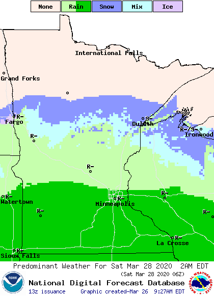
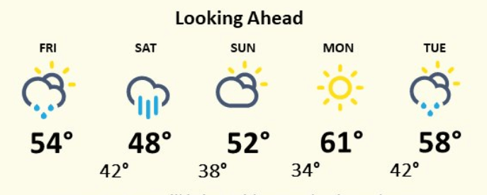
The storm will pass south of Minnesota Saturday bringing the heaviest precipitation to southern Minnesota, with many locations seeing the possibility for over an inch of rainfall.
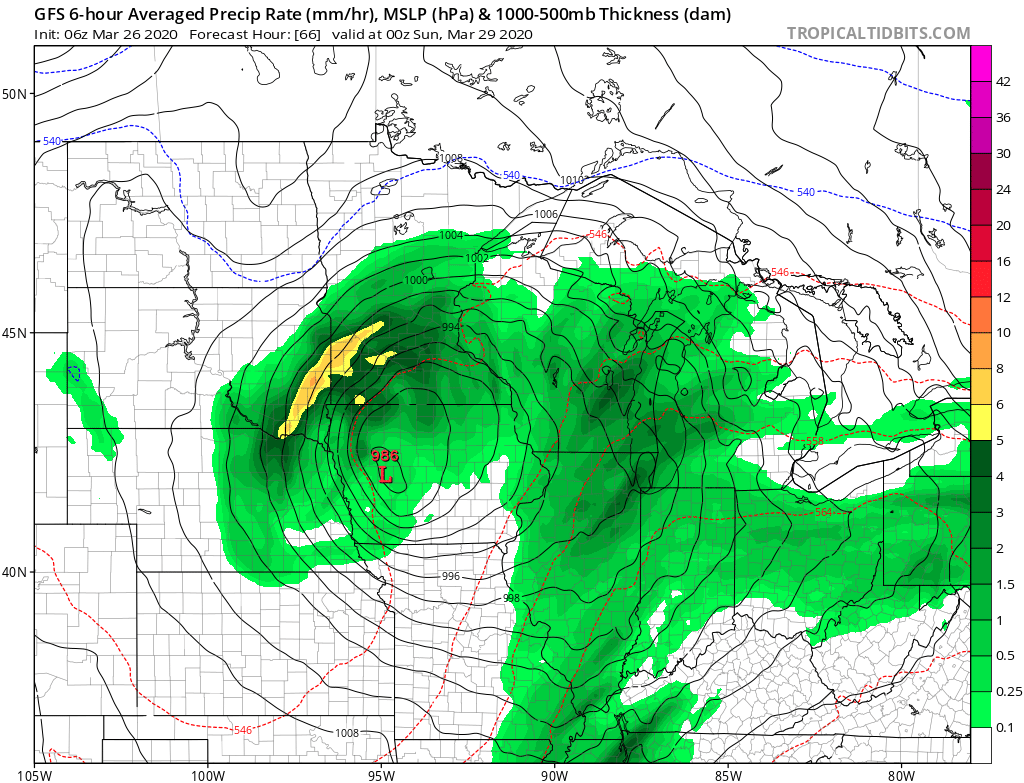
All but northwestern Minnesota is likely to see some precipitation with the storm, and it will be predominantly rain.
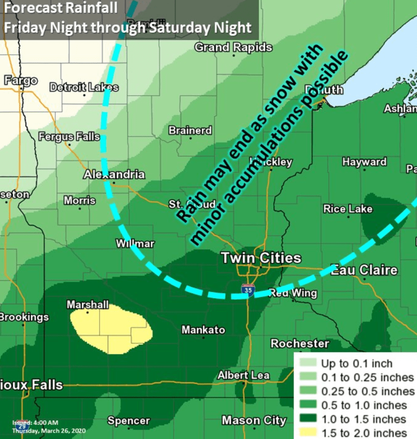
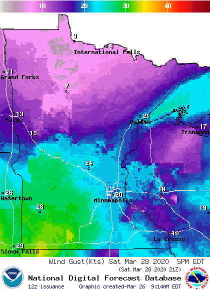
Any snow that mixes in would have only light accumulations. Strong winds will also accompany this storm. Southern Minnesota will likely see gusts over 30 mph Saturday evening.
The storm starts clearing out overnight Saturday, with any lingering precipitation ending by Sunday morning. Clouds will decrease the rest of Sunday, and sunshine is expected by Sunday afternoon.
Mild weather continues
Temperatures remain at or above average for most of the week ahead, with much of the state seeing highs in at least the 40s and 50s through the middle of next week. Here is the forecast for the Twin Cities through Tuesday:
Programming note
You can hear my live weather updates on Minnesota Public Radio at 7:48 a.m. Monday through Friday morning.

