
Another sunny day, then widespread rain and snow return
Temperatures fall by the end of the week
Go Deeper.
Create an account or log in to save stories.
Like this?
Thanks for liking this story! We have added it to a list of your favorite stories.


Tuesday remains sunny and mild. Then another spring storm targets Minnesota with rain, snow and falling temperatures.
Tuesday’s forecast
Tuesday started mild, with all but parts of northeastern Minnesota in the 30s.
Highs will stay slightly above average, with all but a couple spots in northern Minnesota making it into the 50s.

Skies remain mostly sunny Tuesday, with more clouds moving into western Minnesota through the afternoon.

Overall, it will be another pleasant day for outdoor plans.
Turn Up Your Support
MPR News helps you turn down the noise and build shared understanding. Turn up your support for this public resource and keep trusted journalism accessible to all.
Wet weather Wednesday to Friday
The increasing clouds late Tuesday are the leading edge of the next weather system, which will begin to move precipitation across the state overnight Tuesday. By Wednesday morning, most of Minnesota has chances for rain, with some snow and possible freezing rain or sleet mixing in northward.
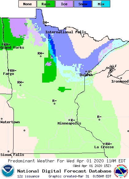
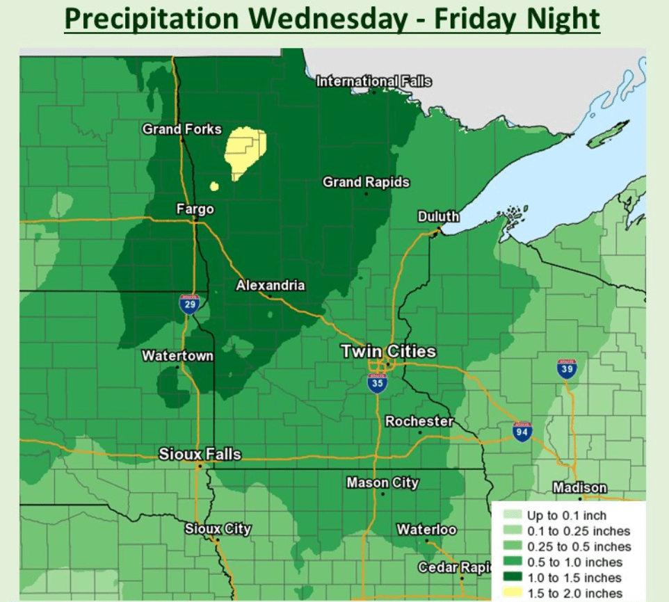
Periods of rain, snow, and breezy conditions then linger through Friday. Precipitation on Wednesday will stay lighter and more scattered, then the rain and snow becomes more widespread Thursday and Friday.
The entire state is likely to see close to an inch of precipitation through Friday, which will elevate possible river flooding.
A cold front moves across the state Thursday, keeping temperatures cold enough that north, and especially northwestern, Minnesota will see snow chances through the day Thursday. Some ice could also mix in, particularly for the Arrowhead.
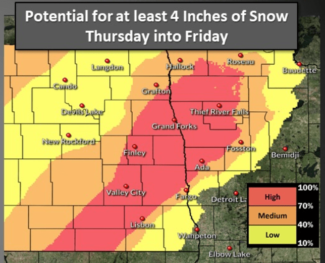
As temperatures cool across the state Friday, most of the state has at least chances for some snow to mix in with the rain. Most of northern Minnesota will see snow accumulation, with northwestern Minnesota likely to see some reports of 4 or 5 inches or more.
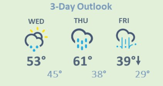
The storm will finally depart by Friday night, leaving cooler temperatures in its wake. In fact, some parts of the state, including the Twin Cities, are likely to see falling temperatures on Friday. Here is that forecast:
Extended forecast
Skies clear and more sunshine returns Saturday, but temperatures will be slightly below average behind the storm with highs in the 40s.
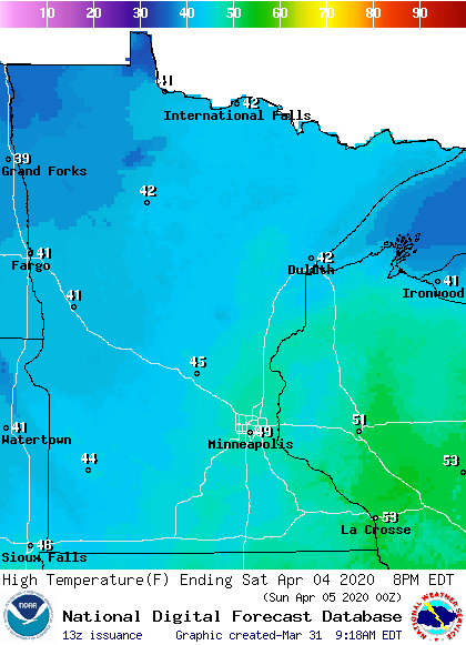
Temperatures climb back above average by Sunday, and much of next week looks mild, with highs in the 50s and 60s across the state. Next week will also stay active with more rain chances.
Programming note
You can hear my live weather updates on Minnesota Public Radio at 7:48 a.m. Monday through Friday morning.

