
Milder Sunday temps; dry in most areas
Update on the flooding along some rivers
Go Deeper.
Create an account or log in to save stories.
Like this?
Thanks for liking this story! We have added it to a list of your favorite stories.


It was great to have sunshine on Saturday as people walked, jogged or biked while practicing social-distancing.
Most of Sunday will be sun-splashed in southern Minnesota, the Twin Cities metro area and western Wisconsin. Northern Minnesota may see more of a sun/cloud mix. Sunday highs will be several degrees milder than Saturday’s highs.
Temperature trends
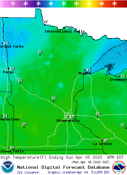
Sunday high temps are forecast to reach the 50s across most of Minnesota plus western Wisconsin, with some 40s in northwestern Minnesota and up along the North Shore of Lake Superior:
Turn Up Your Support
MPR News helps you turn down the noise and build shared understanding. Turn up your support for this public resource and keep trusted journalism accessible to all.
It’ll be a bit breezy by Sunday afternoon, with wind gusts of 14 to 20 mph at times:
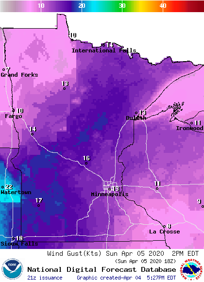
Plotted values are in knots. 13 knots is around 15 mph.
Twin Cities metro area highs are projected to reach the lower 60s on Monday, followed by lower 70s Tuesday, then upper 50s Wednesday, mid 40s Thursday and upper 40s on Friday.
Rain chances hold off
Parts of northwestern Minnesota may see a flurry Sunday morning, but the daylight hours of Sunday are expected to be dry in most of Minnesota and western Wisconsin.
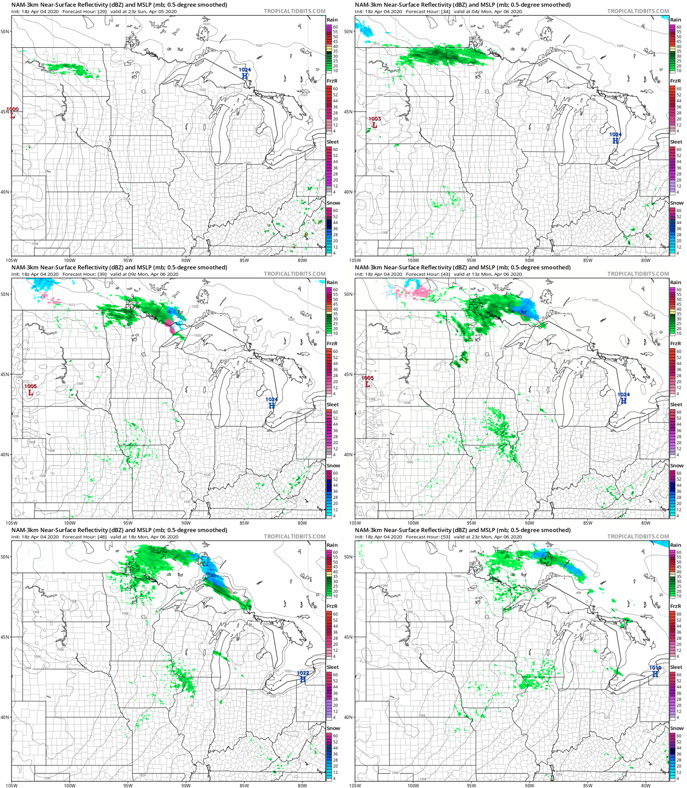
A few rain/snow showers could develop over portions of northwestern Minnesota Sunday evening. Areas of rain showers and snow showers will probably spread across portions of far northern Minnesota overnight Sunday night, then transition to mainly rain showers in the north on Monday. Some very scattered rain showers are possible in central and southern Minnesota on Monday.
The National Oceanic and Atmospheric Administration’s North American Mesoscale forecast model shows the potential precipitation pattern Sunday evening through Monday afternoon:
You can hear updated weather information on the MPR network, and you’ll see updated weather info on the MPR News live weather blog.
Flooding along some rivers
Flood warnings have been issued along many rivers in Minnesota, and the warnings are shaded green on these maps:


You can click on any green-shaded location at the Twin Cities NWS site or the Grand Forks NWS site to get flood warning details.
River level forecasts
River level forecasts are updated on a regular basis. You can click on any location on the NWS Advanced Hydrologic Prediction Service (AHPS) site to get recent and forecast river levels. Some locations list levels in feet above sea level, others list levels in feet above a local reference point.
Here’s the hydrograph for the Red River at East Grand Forks, Minnesota:

It shows the Red River at East Grand Forks cresting late Sunday or early Monday,
Hydographs for central/southern Minnesota and Twin Cities metro area rivers can be found here. Here’s the hydrograph for the Mississippi River at St. Paul:

The hydrograph shows the Mississippi River at St. Paul cresting late on Tuesday, then slowly falling later next week. According to the AHPS site, the 14-foot level forecast for Sunday would cause portions of the Lilydale park area to begin to experience flooding.
Programming note
You can hear my live weather updates on MPR News at 7:35 a.m., 9:35 a.m. and 4:35 p.m. each Saturday and Sunday.

