
Weekend forecast: Mild Saturday; wintry hit Sunday, plowable snow possible
Gusty winds on Sunday
Go Deeper.
Create an account or log in to save stories.
Like this?
Thanks for liking this story! We have added it to a list of your favorite stories.


April can throw just about any kind of weather at us. Sometimes April even gives us a wintry relapse. Close your eyes if you don’t want to read another discussion about snow.
Weekend precipitation
Far southern Minnesota may see some rain showers Saturday afternoon and evening, but Saturday will be a dry day elsewhere.
Forecast models don’t agree on the location of the swath of snow that will be deposited in parts of the Upper Midwest Sunday and Sunday night.
The National Oceanic and Atmospheric Administration’s Global Forecast System (GFS) model shows the following precipitation pattern Saturday morning through Sunday evening:
Turn Up Your Support
MPR News helps you turn down the noise and build shared understanding. Turn up your support for this public resource and keep trusted journalism accessible to all.
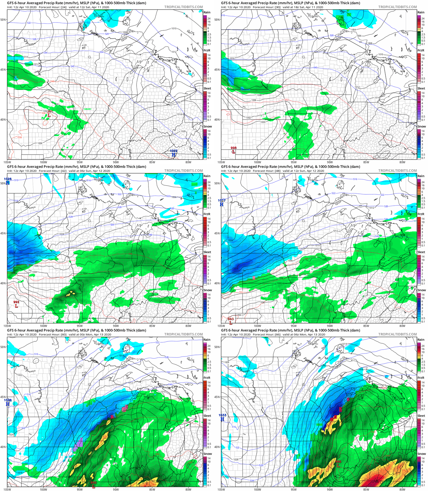
The Twin Cities metro area would see very minor snow accumulations with the GFS track, and plowable snow would be mainly in far southern Minnesota and much of Wisconsin.
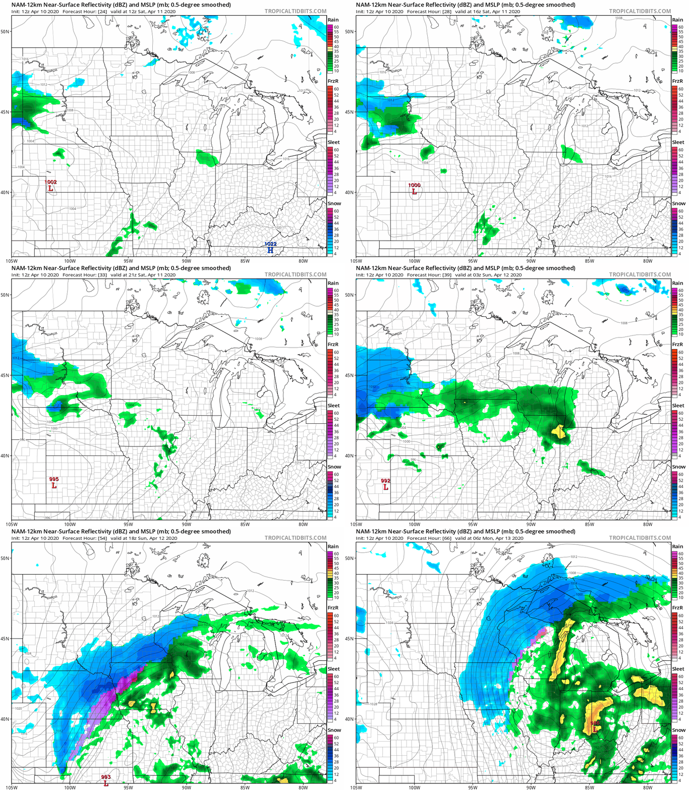
NOAA’s North American Mesoscale (NAM) forecast model includes the Twin Cities metro area in its swath of plowable snow Sunday and Sunday evening:
I should mention that the latest run of the European Centre for Medium-Range Weather Forecasts model shows several inches of snow in the Twin Cities metro area Sunday through Sunday night.
Hopefully there will be more agreement among the models as we get closer to Sunday. One wild card is the amount of moisture that is transported northward by this storm system.
The thunderstorms that are expected Sunday in Missouri, Illinois and parts of Iowa and southern Wisconsin may reduce the amount of moisture that spreads over Minnesota and western Wisconsin.
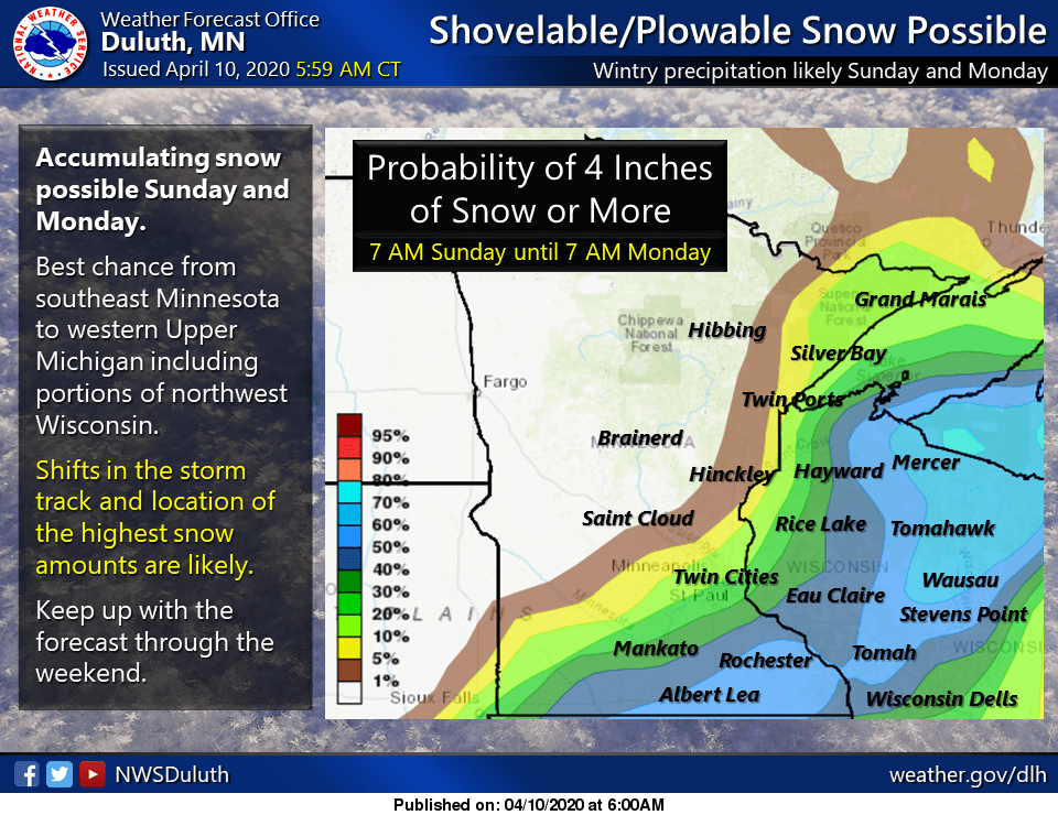
Here’s an early look at the odds of 4 or more inches of snow Sunday and overnight Sunday night, via the Duluth office of the National Weather Service:
You can hear updated weather information on the MPR network, and you’ll see updated weather info on the MPR News live weather blog.
Weekend temperatures and winds
Saturday highs are expected to reach the 50s across southern and central Minnesota, plus western Wisconsin, with 40s in northern Minnesota:
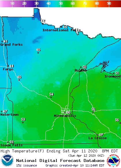
Winds will be light across the southern half of Minnesota on Saturday, but winds could be a bit gusty in the north by Saturday afternoon.
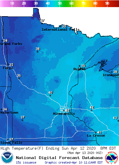
Sunday highs will be cool, with 40s in east-central and southeastern Minnesota and western Wisconsin, with 30s elsewhere:
It’ll be windy Sunday afternoon, with gusts of 15 to 25 mph:
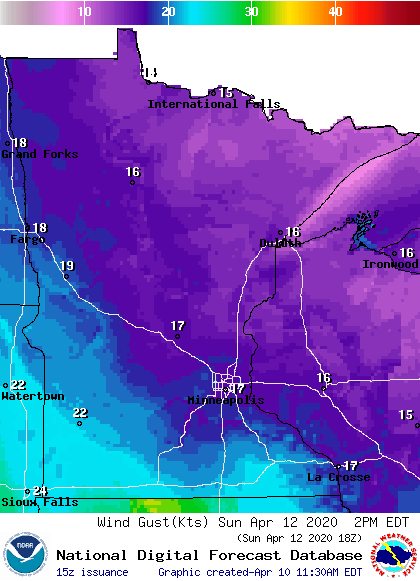
Plotted values are in knots, with 17 knots equal to around 20 mph.
Visibility will be very low in areas that see snow Sunday and Sunday night. On a positive note, April snow typically melts in a few days.

