
Monday remains cold and light snow returns
Windy conditions are causing single-digit windchills
Go Deeper.
Create an account or log in to save stories.
Like this?
Thanks for liking this story! We have added it to a list of your favorite stories.


Temperatures Monday will be well below average, and it will stay windy with light snow moving across the state.
Monday’s forecast
The strong storm that impacted Minnesota Sunday has moved east of the state, taking the heavy snow southern Minnesota saw along with it. Behind the storm, it will still be windy Monday, with gusts over 20 or 30 mph at times.
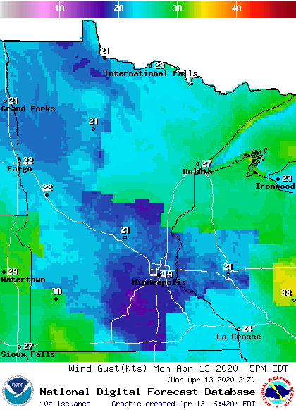
That wind out of the north and now northwest has drawn much colder air across the state, putting morning temperatures in the teens and 20s. Highs will be 15 to 20 degrees below average, and only in the 30s.
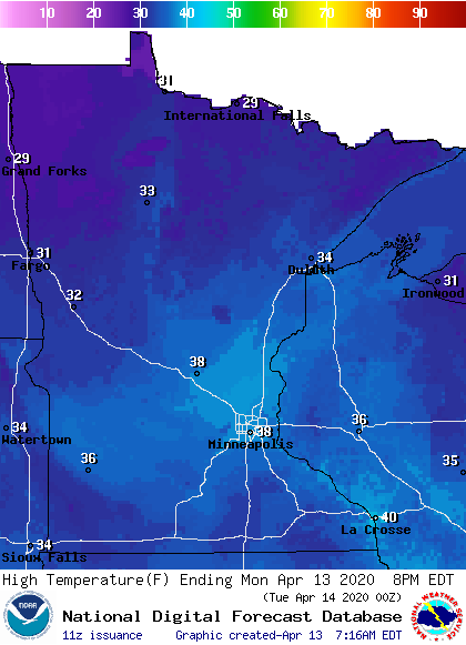
The wind will make it feel even colder though, in fact, some of the morning wind chills are in the single digits.
Turn Up Your Support
MPR News helps you turn down the noise and build shared understanding. Turn up your support for this public resource and keep trusted journalism accessible to all.
A minor disturbance on the back side of Sunday’s storm will bring light snow across Minnesota Monday. For most places, it will be just a few flurries or a light dusting, and nothing more than a half inch of snow is expected anywhere. In southern Minnesota, a little light rain could mix in with the light snow.
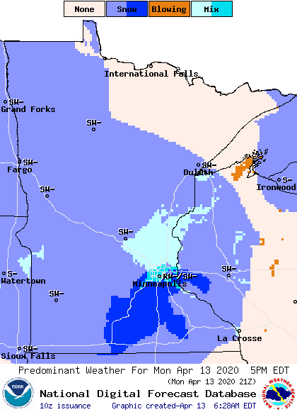
For the Twin Cities, the most likely time to see any precipitation is in the afternoon.
The weather for the rest of the week is looking much quieter and predominantly dry. That extended forecast will be updated around 9 a.m.
Programming note
You can hear my live weather updates on Minnesota Public Radio at 7:48 a.m. Mondays through Fridays.

