
Very cold through Tuesday, then a slow warmup this week
Light snow moves across the state Monday
Go Deeper.
Create an account or log in to save stories.
Like this?
Thanks for liking this story! We have added it to a list of your favorite stories.


After another round of light snow Monday, the weather becomes much quieter for the rest of the week, but temperatures remain cold.
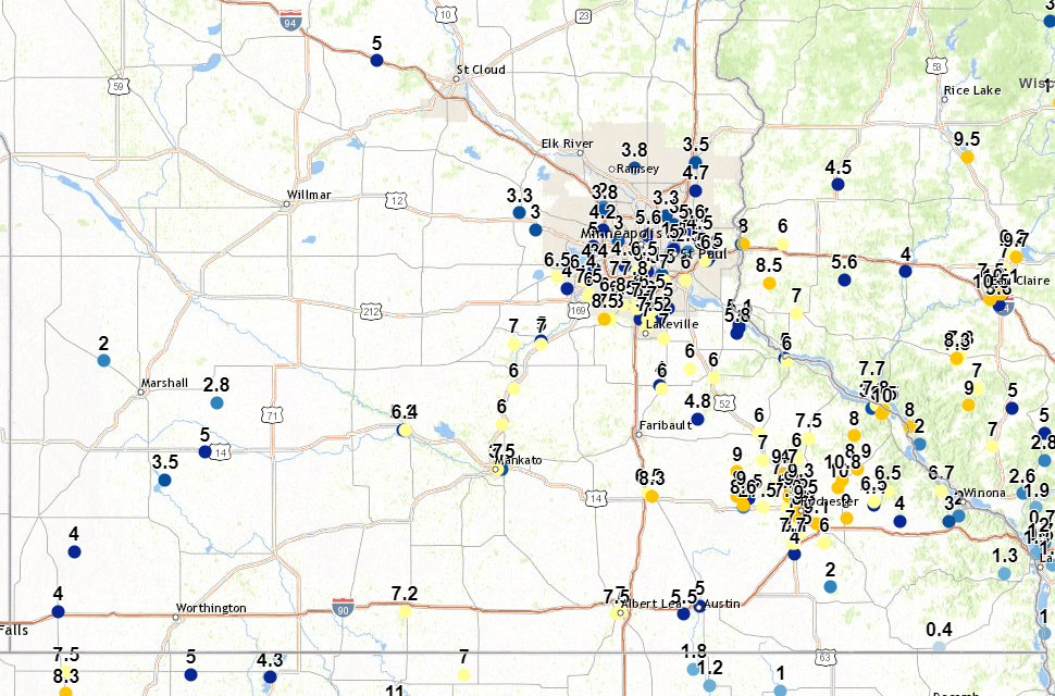
The strong storm that hit Minnesota over the weekend has moved off east of the state, but not before leaving heavy snow across Minnesota on Sunday.
As forecast, the snow was heaviest for southeastern Minnesota, where the highest total reported was in Elgin (northeast of Rochester) at 10.8 inches. Around the Twin Cities, may of the totals ranged from 3 or 4 inches north to 6 to 8 inches in the southern suburbs.
Monday’s forecast
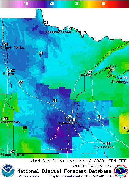
Behind that storm, it will stay windy Monday, with gusts over 20 and 30 mph at times.
Turn Up Your Support
MPR News helps you turn down the noise and build shared understanding. Turn up your support for this public resource and keep trusted journalism accessible to all.
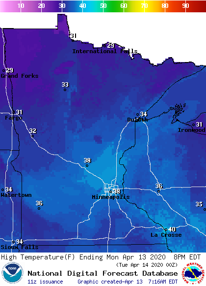
That wind out of the north and now northwest has drawn much colder air across the state, which put morning temperatures in the teens and 20s. Highs will be 15 to 20 degrees below average, and only in the 30s by Monday afternoon.
Because of those winds, there will be a wind chill all day making it feel even colder.
A minor disturbance on the back side of Sunday’s storm will bring light snow across Minnesota Monday. For most places, it will be just a few flurries or a light dusting, and nothing more than a half inch of snow is expected anywhere. In southern Minnesota, a little light rain could mix in with the light snow.
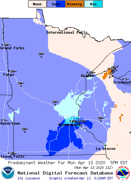
For the Twin Cities, the most likely time to see any precipitation is in the afternoon.
Temperatures this week
Temperatures will remain below average until the weekend. Tuesday will see cold temperatures similar to Monday due to the continued colder air funneling into the state.
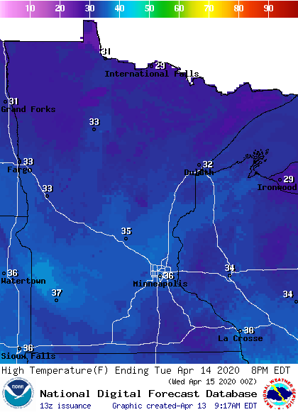
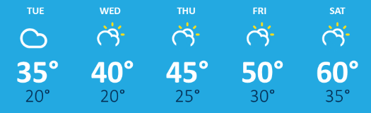
After that, temperatures slowly rise the rest of the week, but because temperatures are expected to remain about 20 degrees below average on Tuesday, it will likely take until Saturday for the state to return to average April temperatures.
Here is the Twin Cities temperature trend for the rest of the week:
Precipitation this week
After the light snow chances on Monday, there are no storms on the horizon for the rest of the week. A couple minor disturbances could possibly bring isolated light rain or snow chances, but those are very minor. Much of the second half of the week brings sunshine.
Programming note
You can hear my live weather updates on Minnesota Public Radio at 7:48 a.m. Monday through Friday morning.

