
Yes, this has been a very cold week for mid-April
Light now chances continue Wednesday afternoon
Go Deeper.
Create an account or log in to save stories.
Like this?
Thanks for liking this story! We have added it to a list of your favorite stories.


Wednesday remains cold with light afternoon snow, but overall the rest of the week remains fairly dry and temperatures will be on the rise.
Much colder than average
If it feels like we’ve been extra cold this week, it’s not your imagination!
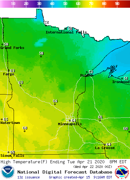
Except along Lake Superior, where average highs are in the 40s, all of Minnesota sees average highs in the 50s this time of year. For April 15, even as far north as International Falls has an average high of 51 degrees, and for the Twin Cities it’s 58.
That means the highs in the 20s and 30s this week have put Minnesota 15 to 25 degrees below average. Tuesday was so cold that just across the border in North Dakota both Grand Forks and Fargo saw a high of only 26, setting records at both locations for cold high temperatures.
Turn Up Your Support
MPR News helps you turn down the noise and build shared understanding. Turn up your support for this public resource and keep trusted journalism accessible to all.
On Minnesota’s Iron Range Wednesday morning, Hibbing shattered its previous record low temperature, dropping to only 6 degrees.
So, yes, this week has been a cold one so far!
Wednesday’s forecast
Much like the past two days, and as shown by the record low in Hibbing, Wednesday started off very cold for April. Morning temperatures were in the single digits and teens, and only a couple locations managed to stay in the 20s.
Temperatures remain about 15 to 20 degrees below average into the afternoon, with highs in the 30s.
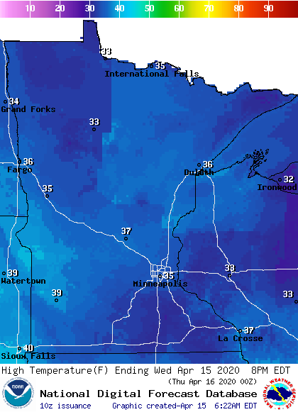
It will be breezier again in the afternoon, with winds gusting 10 to 20 mph. Some scattered afternoon snow showers or flurries are possible again, although less moisture is available, so the snow is likely to be even lighter and the snow showers will be less widespread.
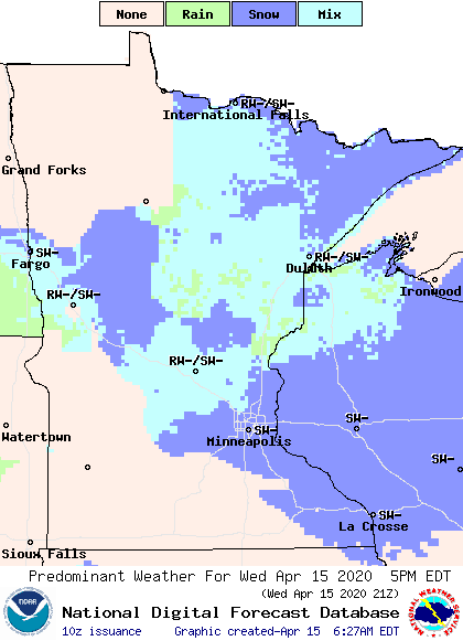
Sprinkles could also mix in with the light snow, and any precipitation should end by evening.
Extended forecast
Drier air should limit any chances for the afternoon snow showers past Wednesday, meaning the rest of the week is likely to stay dry. The last half of the week will also bring more sunshine.
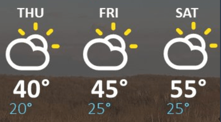
Temperatures will slowly rise over the next few days, already into the 40s for most of Minnesota by Thursday. Then it takes until Saturday before most of the state is back near average highs again.
Here is the Twin Cities temperature trend for the rest of the week:
A cold front will move through Minnesota Saturday afternoon and evening. There is not a lot of moisture with the front, but northern Minnesota could see light rain or snow.
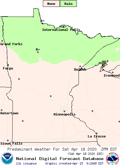
The front also cools temperatures again for Sunday, but temperatures rebound quickly. By the middle of next week, more 50s and 60s return, and it is possible southern Minnesota could even see some isolated temperatures near 70 degrees.
Programming note
You can hear my live weather updates on Minnesota Public Radio at 7:48 a.m. Monday through Friday morning.

