
Warmer weather finally on the way to Minnesota
Predominantly dry skies through the next week
Go Deeper.
Create an account or log in to save stories.
Like this?
Thanks for liking this story! We have added it to a list of your favorite stories.


Thursday starts a slow warming trend that will finally bring temperatures back to average by the weekend. Predominantly dry weather is in the forecast for next week.
Thursday’s weather
Thursday is going to be milder than the past few days, in fact most of Minnesota started off not as cold as Wednesday, with more teens and 20s to start the day. However, for Rochester, it was the third day of record lows, with a morning temperature that ultimately dropped down to 16 degrees.
Afternoon highs will climb into the 40s across most of Minnesota, which is still 10 to 15 degrees below average, but still warmer than the cold snap we saw Monday through Wednesday.
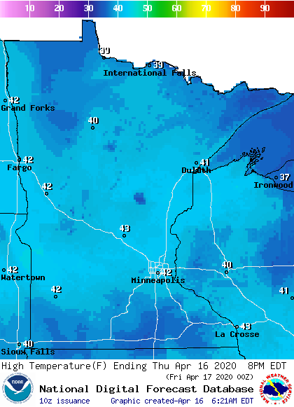
It will also be the first day all week with dry skies and no snow in the forecast anywhere in the state.
Turn Up Your Support
MPR News helps you turn down the noise and build shared understanding. Turn up your support for this public resource and keep trusted journalism accessible to all.
Most of the state will stay sunny through the morning, then a few more clouds move in during the afternoon, especially for the northern border and across southern Minnesota. It will be a little breezy in the afternoon, especially for the Arrowhead, but overall it will be a comfortable although cool day.
Remember, as part of Severe Weather Awareness Week many communities will be testing their tornado sirens at 1:45 p.m and 6:45 p.m.

It’s a good time to think about your plan and safe place to shelter for when severe weather eventually happens!
Extended forecast
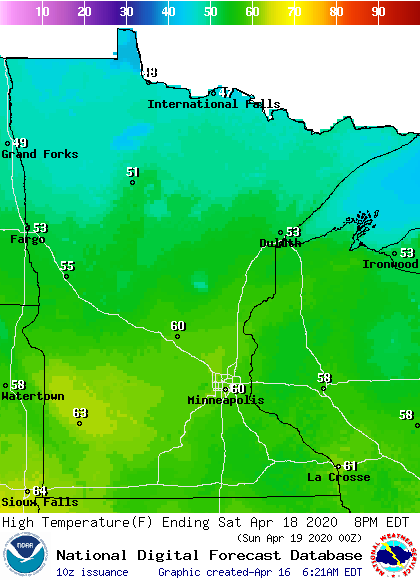
Temperatures will slowly rise over the next couple days, into the upper 40s Friday, then back near average Saturday with more 50s and even 60s.
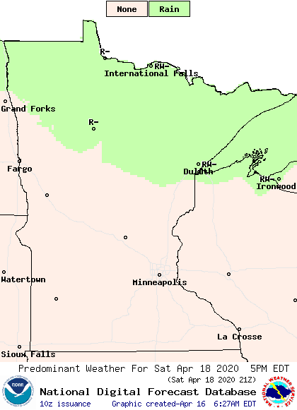
A cold front will move through Minnesota Saturday afternoon and evening. There is not a lot of moisture with the front, but northern Minnesota could see light rain or snow.
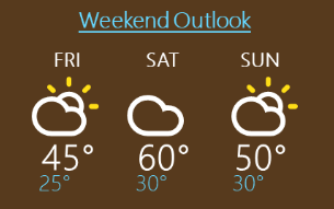
The front also cools temperatures again slightly for Sunday. Here is the Twin Cities forecast through the weekend:
Temperatures rebound quickly after the dip on Sunday, and more 50s and 60s return for the rest of next week. It is possible a few spots in southern Minnesota could even hit 70 degrees once or twice in the week ahead. The forecast also remains predominantly dry, with ample sunshine most days.
Programming note
You can hear my live weather updates on Minnesota Public Radio at 7:48 a.m. Monday through Friday morning.

