
Cooler on Sunday, but less windy; a shot at 70 next Wednesday
Update on Red River flooding
Go Deeper.
Create an account or log in to save stories.
Like this?
Thanks for liking this story! We have added it to a list of your favorite stories.


The high temperature at Minneapolis-St. Paul International Airport was 67 degrees Saturday afternoon. That was 8 degrees higher than our average April 18 high temp in the Twin Cities.
I walked past Highland National Golf Course in St. Paul Saturday afternoon, and I noticed that most golfers were practicing good social distancing.

It’s good to get outdoors these days. We can walk, jog, run or ride a bike while maintaining adequate distance from other people.
Sunday forecast
Turn Up Your Support
MPR News helps you turn down the noise and build shared understanding. Turn up your support for this public resource and keep trusted journalism accessible to all.
We’ll have plenty of sunshine on Sunday across most of Minnesota and western Wisconsin. The National Oceanic and Atmospheric Administration’s North American Mesoscale forecast model shows the Sunday cloud cover:
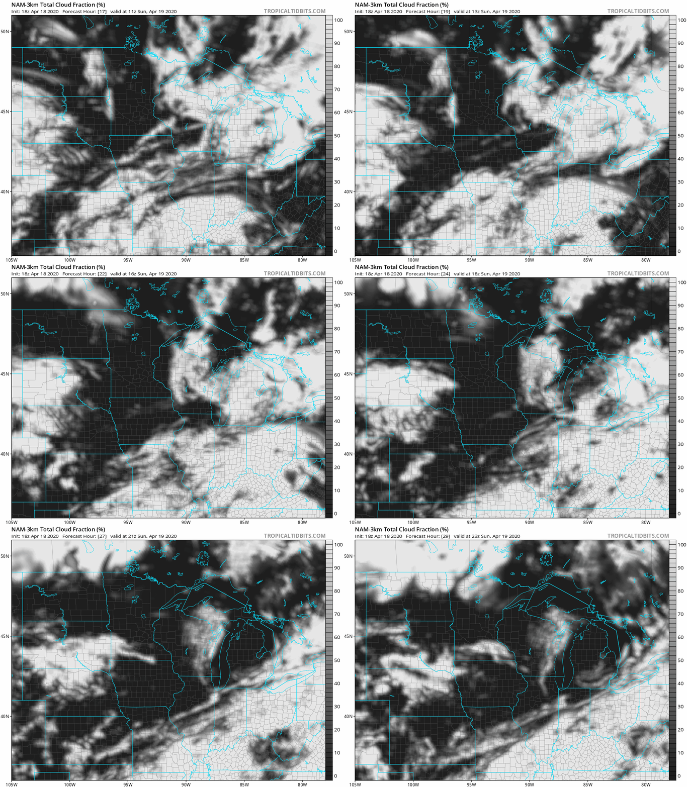
Parts of northeastern Minnesota and northwestern Wisconsin may have some clouds early on Sunday. The NAM model shows a lot of sunshine in most other areas on Sunday, with some clouds moving into the northwest and the far south later in the afternoon.
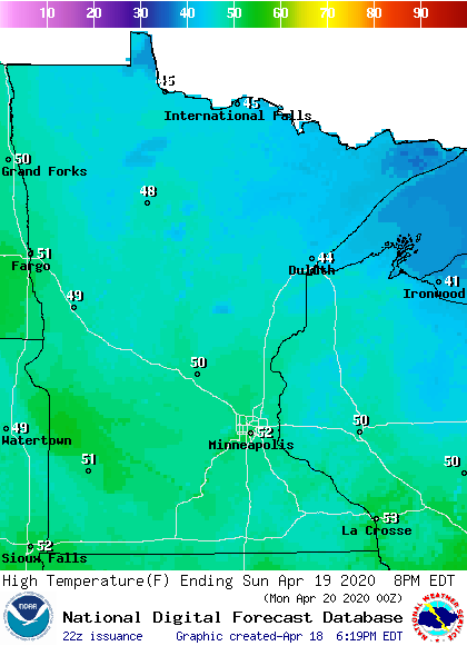
Sunday highs are expected to be in the 40s in roughly the northern half of Minnesota, with some lower 50s elsewhere:
Winds will be much lighter on Sunday.
Some mild days in the week ahead
Twin Cities metro area highs are projected to reach the upper 50s on Monday, followed by mid 50s Tuesday, around 70 Wednesday, then mid 60s Thursday and around 60 on Friday.
River level update
Flood warnings continue along portions of the Red River, affecting parts of northwestern Minnesota. The warnings are shaded green on the following map:

You can click on any green-shaded location at the Grand Forks NWS site to get flood warning details.
River level forecasts are updated on a regular basis. You can click on any location on the NWS Advanced Hydrologic Prediction Service (AHPS) site to get recent and forecast river levels. Some locations list levels in feet above sea level, others list levels in feet above a local reference point.
Here’s the hydrograph for the Red River at Oslo, Minnesota:

The Red River was still at major flood stage at Oslo Saturday afternoon, with the river level forecast to slowly fall over the next few days.
The lack of heavy rain over the past week has been a good thing for communities along the Red River.
Programming note
You can hear my live weather updates on MPR News at 7:35 a.m., 9:35 a.m. and 4:35 p.m. each Saturday and Sunday.

