
Week ahead weather: Milder with a few chances for rain
Monday brings high winds and a fire risk
Go Deeper.
Create an account or log in to save stories.
Like this?
Thanks for liking this story! We have added it to a list of your favorite stories.


A cold front Monday is bringing everything from rain and high winds to a fire risk, but overall this week is going to be much milder and more seasonable than last week.
Monday’s forecast
Monday started off mild, with temperatures across most of the state in the 30s and 40s. Because of a cold front that is already moving through northern Minnesota as of Monday morning, northern Minnesota will not warm much during the day, and will only see highs in the 40s.
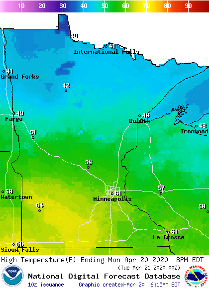
The front will pass south through the rest of the state during the day, but central and southern Minnesota will be able to make it into the 50s and 60s before the cooler air moves in.
The front has limited moisture, so most of the state will see chances for light rain with a little light snow mixing in for northern Minnesota. There could also be a couple isolated thunderstorms in the afternoon for central and southern parts of the state.
Turn Up Your Support
MPR News helps you turn down the noise and build shared understanding. Turn up your support for this public resource and keep trusted journalism accessible to all.
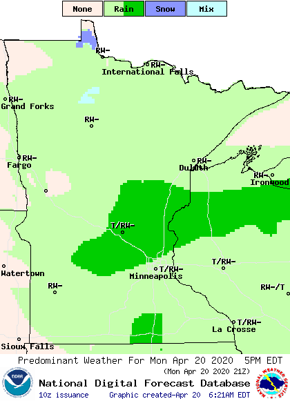
There is a marginal risk some of the storms in southeastern Minnesota could become severe, with damaging wind the primary threat. For the Twin Cities, light rain is possible all afternoon, with the best chance for a shower or storm late in the afternoon.
The front is also bringing high winds along with it, especially in the afternoon. Sustained winds will be in the teens and 20s, with wind gusts over 30 or 40 mph.
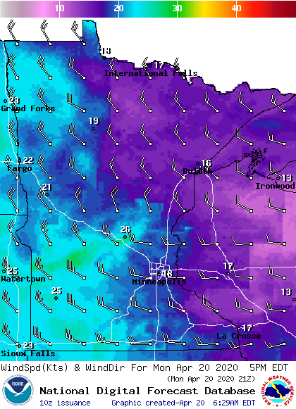
Because precipitation has been below average for most of the state so far in April, the humidity is low even with the light rain chances. The combination of warm weather, low humidity, and high winds will cause an elevated fire risk through Monday afternoon.
Because of this, central and southern Minnesota are under a red flag warning.
Tuesday’s forecast
Tuesday will bring the return of much quieter weather. With the exception of some light rain possible for northern Minnesota in the afternoon, it will be drier with more sunshine. Winds will still be a little breezy, but it won’t be the high winds of Monday, nor will we see the elevated fire risk.
Temperatures will be cooler because of the cold front on Monday, with most of the highs in the 40s and 50s.
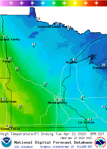
However, a warm front that will be pushing in from the west could bring parts of southwestern Minnesota into the 60s.
Extended forecast
The warm front that starts to push in Tuesday will bring state-wide milder weather by Wednesday, with more 50s and 60s and possibly even a couple 70s for southern Minnesota. Isolated light rain is possible, but most of the state should remain dry on Wednesday.
Widespread chances for rain return across the state Thursday and Friday, with an area of low pressure that will slide across southern Minnesota.
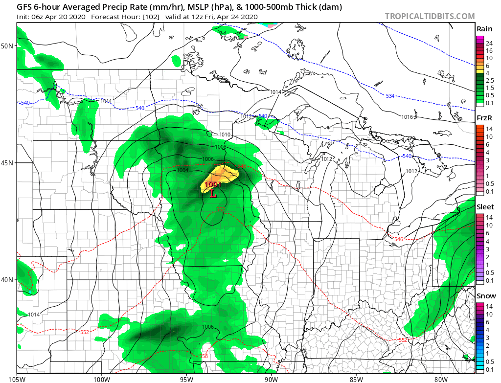
There could also be a little light snow mixing in for northern Minnesota and isolated afternoon thunderstorms for southern Minnesota.
While precipitation currently looks like it will remain predominantly light on Thursday and Friday, southern Minnesota could see one-quarter to one-half inch of total rain.
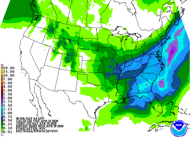
That would help reduce the rain deficits southern parts of the state have seen so far in April. Temperatures toward the end of the week will stay seasonable, mostly in the 50s and 60s.
Programming note
You can hear my live weather updates on Minnesota Public Radio at 7:48 a.m. Monday through Friday morning.

