
A large temperature contrast for Wednesday, with 80s possible
Northern Minnesota remains cooler with showers
Go Deeper.
Create an account or log in to save stories.
Like this?
Thanks for liking this story! We have added it to a list of your favorite stories.


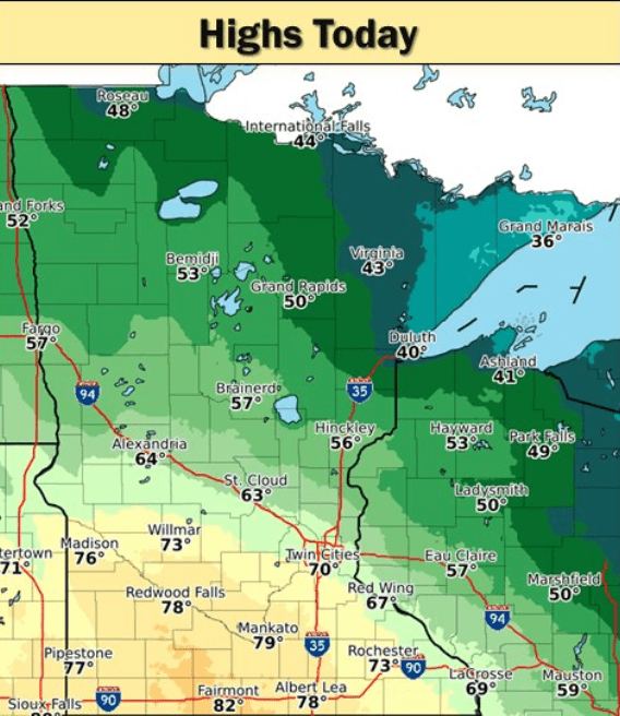
Minnesota will see a dramatic temperature range this Earth Day, from highs only in the 30s for some areas near Lake Superior to 70s and possible 80s for southern Minnesota.
Wednesday’s forecast
Temperatures are starting off mild Wednesday thanks to a warm front that is extending across southwestern Minnesota. Morning temperatures are mostly in the 30s with a few 40s and 50s for southern Minnesota. Because of the front, there will be a large contrast across the state in high temperatures Wednesday. The warmer air won’t make it to northern Minnesota, so temperatures will be at or slightly below average, with more 40s and some areas near Lake Superior only in the 30s. The rest of the state will be warm, with 50s and 60s for central Minnesota, and 70s and maybe a couple 80s south.
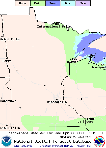
There are a few light rain showers moving across northern Minnesota already Wednesday morning, and occasional light rain, sprinkles and even a couple flakes of snow could linger through the afternoon in the Arrowhead. Southern Minnesota could also see an isolated shower or thunderstorm in the afternoon.
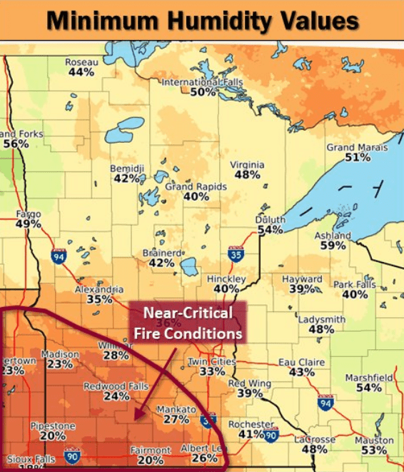
Most of Minnesota will see sunshine and dry skies through the day. In fact, afternoon humidity will be so low in the southwestern corner of the state that fire conditions will be a concern.
Temperatures return closer to average the rest of the week. That extended forecast will be updated around 9 a.m.
Programming note
You can hear my live weather updates on Minnesota Public Radio at 7:48 a.m. Mondays through Fridays.
Turn Up Your Support
MPR News helps you turn down the noise and build shared understanding. Turn up your support for this public resource and keep trusted journalism accessible to all.

