
Earth Day turns 50 on a day parts of Minnesota could hit 80
Northern Minnesota remains cooler
Go Deeper.
Create an account or log in to save stories.
Like this?
Thanks for liking this story! We have added it to a list of your favorite stories.


Southern Minnesota celebrates Earth Day Wednesday with some of the warmest weather so far this year. More seasonable and rainy weather returns for the rest of the week.
Earth Day turns 50
April 22, 2020 marks the 50th Anniversary of Earth Day. Environmental activism grew in the 1960s, and in 1970 U.S. Sen. Gaylord Nelson of Wisconsin came up with the idea for Earth Day, hoping to help unify the environmental movement and help get environmental issues more attention on the national political agenda.
Over 12,000 events took place across the United States on the first Earth Day, with an estimated 20 million people participating.

The Environmental Protection Agency was established later that year, and Earth Day helped lead to a wide variety of legislation in the 1970s including the Clean Water Act and the Endangered Species Act.
Turn Up Your Support
MPR News helps you turn down the noise and build shared understanding. Turn up your support for this public resource and keep trusted journalism accessible to all.
Wednesday’s forecast
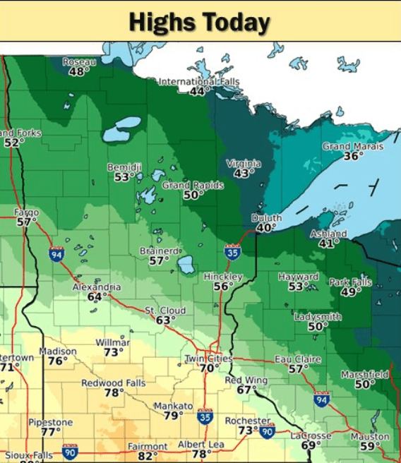
Because of a warm front extending across southwestern Minnesota, there will be a large contrast across the state in high temperatures Wednesday.
The warmer air won’t influence northern Minnesota, so temperatures will be at or slightly below average, with more 40s and some areas near Lake Superior only in the 30s. The rest of the state will be warm, with 50s and 60s for central Minnesota, and 70s and maybe a couple 80s south.
There are a few light rain showers moving across northern Minnesota already Wednesday morning, and occasional light rain, sprinkles, or even a couple snowflakes could linger in the Arrowhead into the afternoon. Southern Minnesota could also see an isolated shower or thunderstorm in the afternoon.
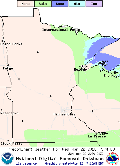
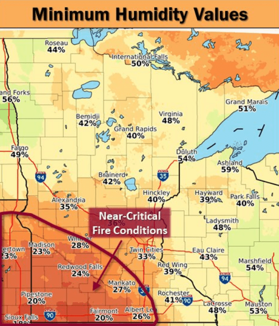
However, most of Minnesota will see sunshine and dry skies through the day. In fact, it will be so dry in the southwestern corner of the state, fire conditions will be a concern in the afternoon.
Extended forecast
Temperatures return closer to average for the rest of the week, which will be milder for northern Minnesota, but not as warm for southern Minnesota. Most of the highs will be in the 50s and 60s. Here is the Twin Cities forecast through Sunday:
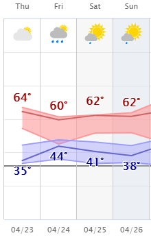
The weather also remains unsettled enough from Thursday through the end of the week to bring occasional light rain showers across the state. Rain will likely start spreading across the state Thursday, then become more widespread Friday.
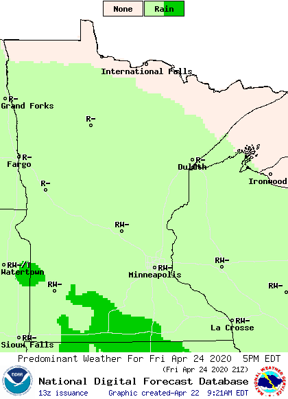
Precipitation remains light enough that most of the state will see a quarter inch or less of total precipitation all the way through Saturday, with possibly up to one-half inch in southwestern Minnesota.
Programming note
You can hear my live weather updates on Minnesota Public Radio at 7:48 a.m. Monday through Friday morning.

