
Weekend forecast: Comfortable temps, Saturday p.m. shower chance for some areas
April 25 weather extremes
Go Deeper.
Create an account or log in to save stories.
Like this?
Thanks for liking this story! We have added it to a list of your favorite stories.


It’s great to get outdoors for a while in these days of social distancing. Our weekend weather will cooperate with your plans to walk, jog, run or take a bike ride.
Weekend temperatures
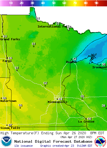
Our average Twin Cities high temperature for April 25 and April 26 is 63 degrees. Metro area temps are projected to reach the lower 60s both days this weekend.
Saturday highs in the lower 60s are forecast for most of southern and central Minnesota, with some 50s in the north:
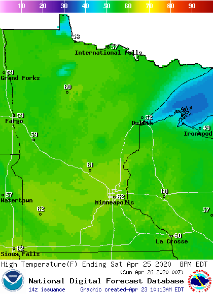
A few spots along the North Shore of Lake Superior might only reach the upper 40s.
Turn Up Your Support
MPR News helps you turn down the noise and build shared understanding. Turn up your support for this public resource and keep trusted journalism accessible to all.
On Sunday, 60s expand into northwestern and north-central Minnesota. Highs will only reach the upper 40s to lower 50s on Sunday near Lake Superior:
Weekend shower chances?
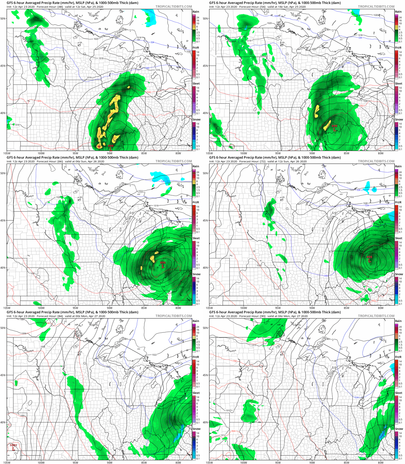
Areas of rain showers may spread into portions of Minnesota Saturday afternoon and linger into Saturday night and early Sunday. The best shower chances appear to be in western Minnesota, with lower shower chances in eastern Minnesota and western Wisconsin.
The National Oceanic and Atmospheric Administration’s Global Forecast System (GFS) model shows the following precipitation pattern Saturday morning through Sunday afternoon:
You can hear updated weather information on the MPR network, and you’ll see updated weather info on the MPR News live weather blog.
April weather extremes
I was born in Minnesota and I’ve lived here most of my life. I know about our fickle April weather, where it often feels like spring or early summer but sometimes turns wintry.
Saturday is April 25. The Twin Cities record high for April 25 is 91 degrees, set in 1962. Contrast that to the Twin Cities record coldest high temp for April 25 of 37 degrees, which was set in 1950. The Twin Cities also tallied 3.2 inches of new snow on April 25, 1950.
Sometimes we see heavy snow in Minnesota in late April. The National Weather Service “Day in Weather History” site shows this snowstorm in northern Minnesota on April 25, 1996:
1996: Heavy snow falls over northern Minnesota, including 10 inches of snow at Baudette. The International Falls Airport is forced to close for only the second time in history.
This "Day in Weather History" contains some memorable weather events and trivia from 1805 to the present day for much of Minnesota and west central Wisconsin. Many sources were used to research and compile the data. The Twin Cities/Chanhassen National Weather Service would especially like to thank the Minnesota State Climatology Office and its contributors for their input into this database.
This would be a strange time of year to fire up the snowblower!

