
After a warm Monday, showers and storms target Minnesota Tuesday
Temperatures dip with the rain, then rebound quickly
Go Deeper.
Create an account or log in to save stories.
Like this?
Thanks for liking this story! We have added it to a list of your favorite stories.


While the rain from Monday morning gives way to sunshine, another round of heavier rain will impact Minnesota Tuesday.
Monday’s forecast
An area of rain that moved across Minnesota overnight is still bringing rain to the very eastern edges of Minnesota Monday morning.
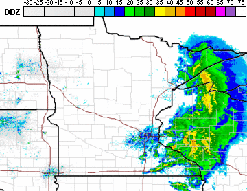
For northern and central Minnesota, the precipitation left behind enough moisture to cause some areas of fog. The remaining rain moves out and fog lifts through the morning, bringing extensive sunshine across Minnesota.
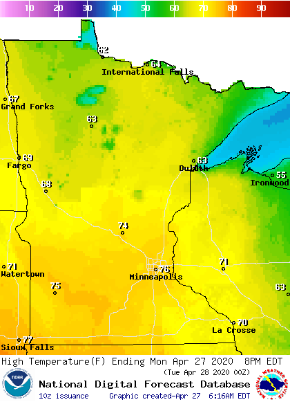
Under the afternoon sunshine the entire state will be 5 to 10 degrees above average with widespread high in the 60s and 70s.
More rain arrives Tuesday
Already overnight Monday, some light rain will start moving into western Minnesota. By Tuesday morning, rain becomes more widespread with occasional thunderstorms, and most of the day will be gray and wet.
Turn Up Your Support
MPR News helps you turn down the noise and build shared understanding. Turn up your support for this public resource and keep trusted journalism accessible to all.
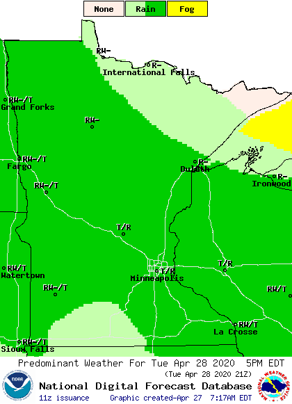
Because the center of the weather system bringing the rain will pass over southern Minnesota, that portion of the state can expect the heaviest rain.
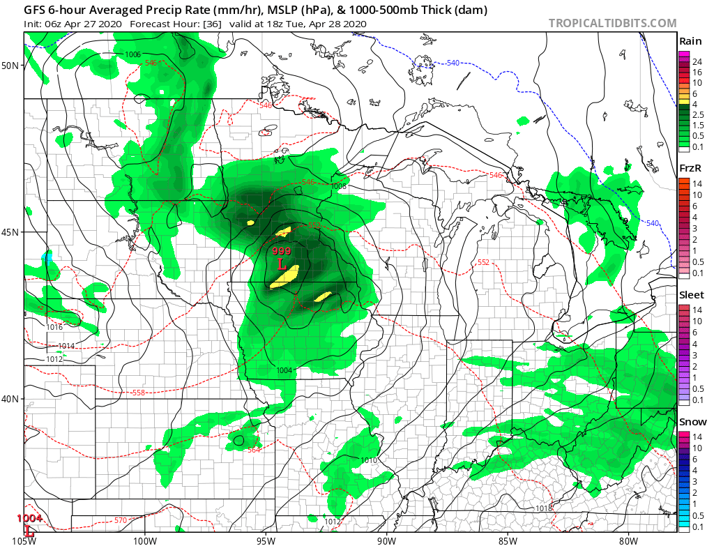
Much of southern Minnesota will see rain totals from a half inch to an inch of rain through Wednesday morning. Northern Minnesota can expect lower totals ranging mostly from trace amounts to a quarter inch of precipitation.
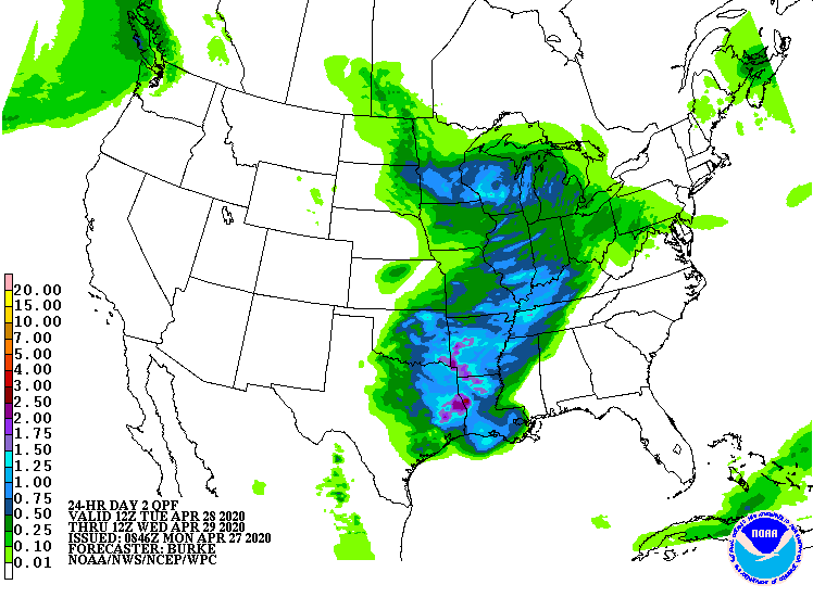
Because southern Minnesota will see the heavier rain, the rain-cooled air will keep that part of the state in the 50s, while northern Minnesota sees more highs in the 60s Tuesday.

Most of the rain tapers-off Wednesday morning, with increasing sunshine by afternoon. That helps most of the state return to highs in the 60s Wednesday.
Extended forecast
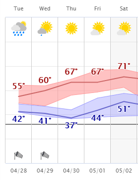
Widespread sunshine returns for Thursday as temperatures continue to warm. By Friday, a few more clouds return and there will be a very spotty chance for light showers and a couple isolated storms late Friday into Saturday. The end of the week will be warm, with most of the highs in the 60s and 70s. Here is the extended forecast for the Twin Cities through Saturday:
Programming note
You can hear my live weather updates on Minnesota Public Radio at 7:48 a.m. Monday through Friday morning.

