
Tuesday brings soaking rain and possibly strong storms
Dense morning fog for the North Shore
Go Deeper.
Create an account or log in to save stories.
Like this?
Thanks for liking this story! We have added it to a list of your favorite stories.


Minnesota will see widespread clouds, rain and some thunderstorms Tuesday, with noticeably cooler temperatures for southern parts of the state.
A soggy Tuesday
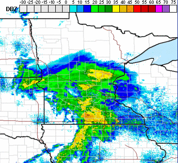
A large storm is pushing through the central U.S., with the center of the storm moving across southern Minnesota through the day on Tuesday. Because of this, there is already widespread rain and a few storms across the state as of Tuesday morning, and most of the day will be gray and wet.
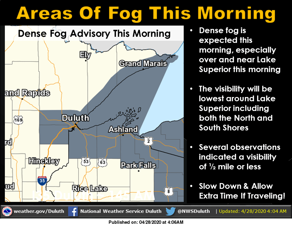
The North Shore will not see rain chances until later in the day, but is dealing with areas of thick fog Tuesday morning and under a Dense Fog Advisory until 10 a.m.
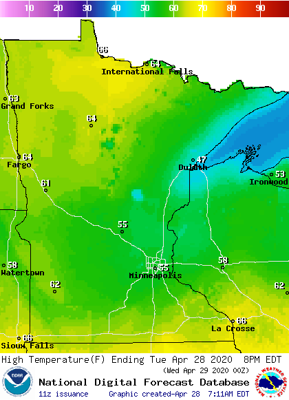
In terms of rain, southern Minnesota will see the highest totals, while the rain in northern Minnesota will be spottier. Much of southern Minnesota will see rain totals from a half inch to an inch of rain through Wednesday morning. Northern Minnesota can expect lower totals ranging mostly from trace amounts to a quarter inch of precipitation. Because southern Minnesota will see the heavier rain, the rain-cooled air will keep that part of the state in the 50s, while northern Minnesota sees more highs in the 60s Tuesday.
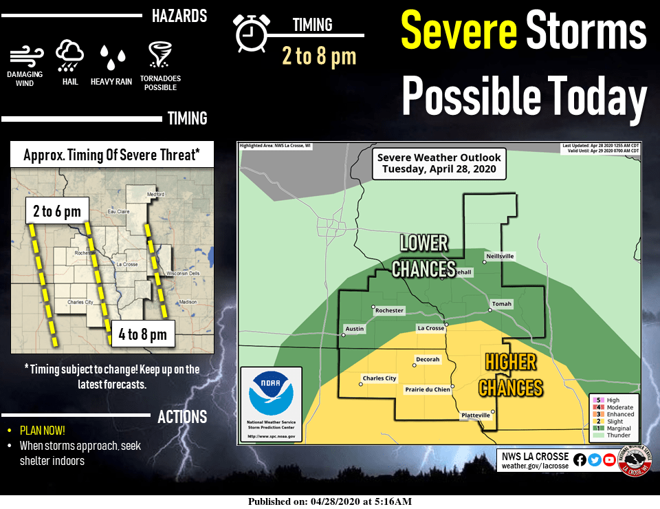
Southern and particularly southeastern Minnesota also have a slight risk for severe weather Tuesday afternoon. Wind and hail are the primary threat, but a tornado risk is not out of the question.
Most of the rain tapers-off Wednesday morning, with increasing sunshine by afternoon. That extended forecast will be updated around 9 a.m.
Programming note
You can hear my live weather updates on Minnesota Public Radio at 7:48 a.m. Monday through Friday morning.
Turn Up Your Support
MPR News helps you turn down the noise and build shared understanding. Turn up your support for this public resource and keep trusted journalism accessible to all.

