
Weekend weather: Warm and drier
Gusty winds help elevate the fire risk in northern Minnesota
Go Deeper.
Create an account or log in to save stories.
Like this?
Thanks for liking this story! We have added it to a list of your favorite stories.


The rest of the week brings more sunshine, warming temperatures, and only very slight chances for needed precipitation.
Wednesday’s forecast
The storm on Tuesday that brought needed, soaking rain to most of central and southern Minnesota has now cleared out. However, behind that storm it remains windy Wednesday, especially for southern Minnesota where winds could gust over 20 and even 30 mph through the afternoon.
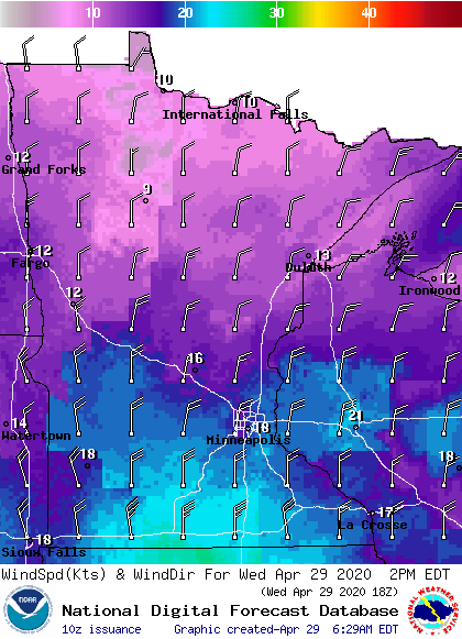
In northeastern Minnesota, where April has been very dry and little rain fell on Tuesday, the combination of low humidity and gusty winds will bring an elevated fire risk during the day.
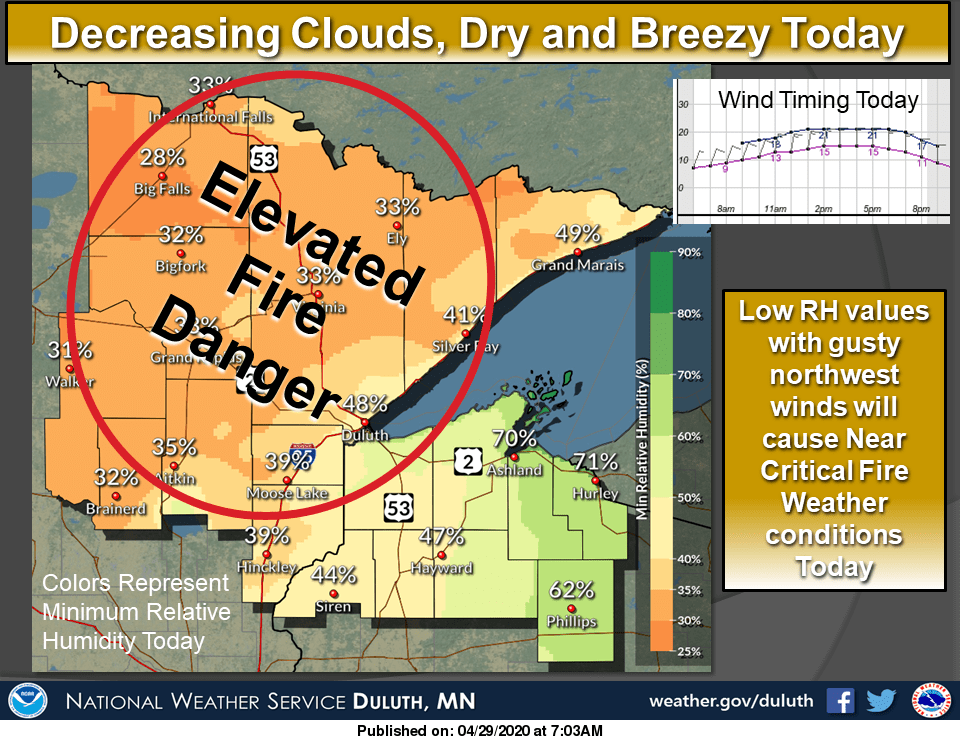
Clouds will continue to clear Wednesday morning, making way for plentiful sunshine across the state by afternoon. That will help most of the state make it into the 60s for high temperatures.
Turn Up Your Support
MPR News helps you turn down the noise and build shared understanding. Turn up your support for this public resource and keep trusted journalism accessible to all.
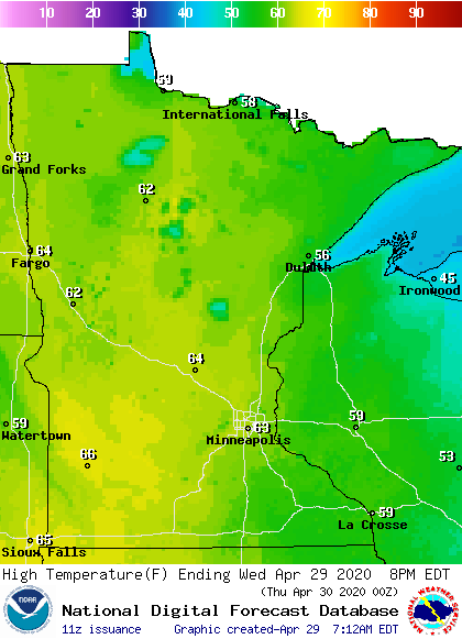
Although almost the entire state stays dry, southwestern Minnesota could see a couple isolated showers or storms develop in the afternoon.
The rest of the week
Overall, the rest of the week will stay predominantly dry with warming temperatures. There are a couple minor chances for showers and storms, especially on Friday for northern Minnesota.
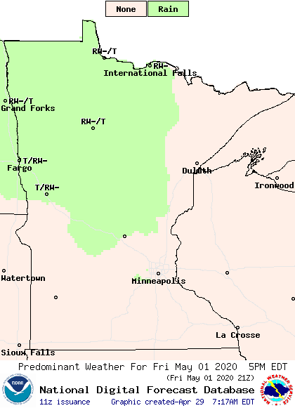
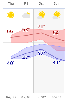
Unfortunately for places that have been very dry in April, like the Arrowhead, it looks like most of that precipitation stays light. Highs remain mostly in the 60s for the rest of the week, with a few more places seeing 70s by Saturday.
Here is the Twin Cities forecast through Sunday:
Extended forecast
After the warm weather on Saturday, slightly cooler air returns for Sunday along with a slight chance for showers and storms in southern Minnesota.
Temperatures are then expected to stay slightly below average for most of next week, with highs predominantly in the 50s and 60s across the state.
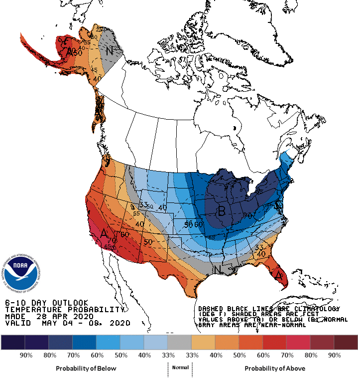
It also appears the first week of May is likely to have below average precipitation. Currently, the best chance for widespread rain looks like Tuesday, but that is almost a week away, so we’ll keep you posted as it gets closer to next week!
Programming note
You can hear my live weather updates on Minnesota Public Radio at 7:48 a.m. Monday through Friday morning.

