
Sunny and dry Thursday followed by rain chances Friday
Cooler weather likely next week
Go Deeper.
Create an account or log in to save stories.
Like this?
Thanks for liking this story! We have added it to a list of your favorite stories.


After a quiet Thursday weather, Friday brings another chance for showers and storms. Below average temperatures return next week.
Thursday’s forecast
After a very windy Wednesday with some winds gusting over 40 mph, the most noticeable change in Thursday’s weather is the much lighter wind.
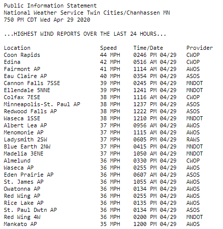
Most of the wind through the day will stay under 10 mph, and a few parts of central and northern Minnesota are even starting the day with calm winds.
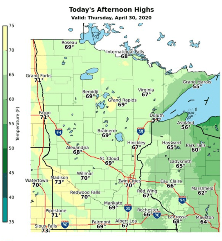
Under plentiful sunshine across the state, highs will be slightly above average in the 60s and low 70s.
Turn Up Your Support
MPR News helps you turn down the noise and build shared understanding. Turn up your support for this public resource and keep trusted journalism accessible to all.
Rain chances Friday
Already Thursday night, a few more clouds start to move into northern Minnesota, and mostly cloudy skies prevail by Friday.
A weak weather disturbance moving across the state Friday not only brings the clouds, the state will also see some scattered light rain showers and possibly a couple isolated storms during the day.
Rain totals will remain low, with most places getting one-tenth of an inch or less, with a few reports possible up to one-quarter inch, especially with any thunderstorms.
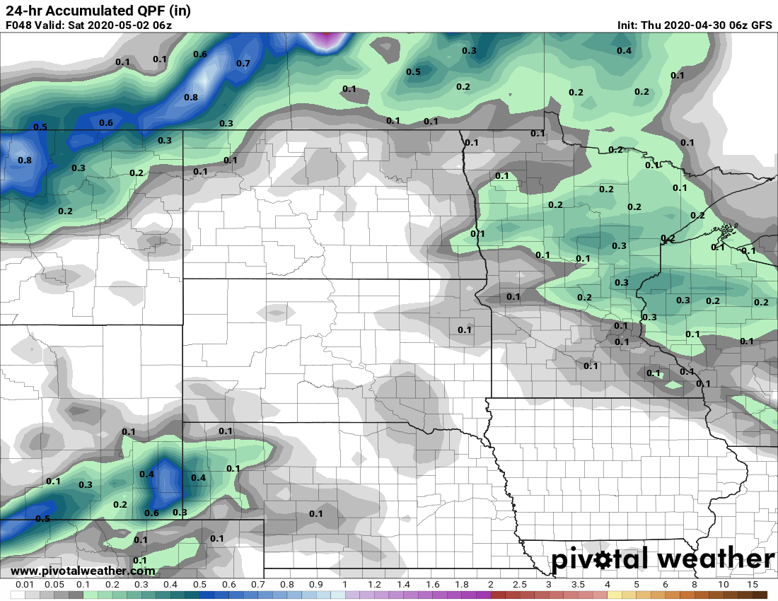
Any rain should clear out by late Friday. It will also be breezy Friday afternoon, with wind gusts in the teens and low 20 mph range.
Extended forecast
Wet weather south of Minnesota could clip the southwestern corner of the state with light rain Saturday, but otherwise we can expect mostly sunny, predominantly dry, and mild weather over the weekend.
Saturday will be the warmer day, with 60s and 70s across the state. A dry cold front passes through Saturday that drops temperatures a couple degrees by Sunday, with highs ranging form the upper 50s to low 70s.
More of the cooler air moves in Monday, and then rest of next week will be slightly below average, with highs predominantly in the 50s and 60s.
It also appears the first week of May is likely to have below average precipitation as well. Currently the best chance for rain is a system that starts impacting Minnesota with showers Monday, then brings more widespread rain and a thunderstorm potential on Tuesday.
Northern Minnesota could be cold enough for a little light snow to mix in overnight Monday.
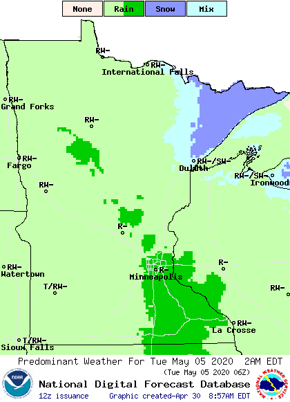
Here is the Twin Cities forecast for early next week, showing the cooler temperatures and rain potential:

Most of Minnesota is wrapping up April well below average for precipitation, so any rain next week would be beneficial.
Programming note
You can hear my live weather updates on Minnesota Public Radio at 7:48 a.m. Monday through Friday morning.

