
Rain chances through Tuesday, then cooler air sticks around
More sunshine the second half of the week
Go Deeper.
Create an account or log in to save stories.
Like this?
Thanks for liking this story! We have added it to a list of your favorite stories.


Rain chances increase Monday and linger Tuesday, while temperatures fall and likely stay below average the entire week ahead.
Rainy and cooler Monday into Tuesday
A spring storm that will keep most of it impacts south of Minnesota is slowly moving rain toward the western edge of the state as of Monday morning, bringing isolated rain chances. More of the rain moves in Monday afternoon and becomes widespread through the western half of the state by Monday evening.
Ahead of the rain, the rest of Minnesota sees increasing clouds Monday. Overnight, rain continues to spread, with most of the state seeing precipitation chances by Tuesday morning.
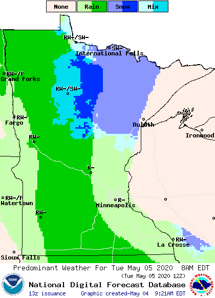
Northern Minnesota could see a little light snow mixing in overnight Monday and early Tuesday, when temperatures are at their coolest, but no accumulation is expected. Periods of light rain then linger through the rest of Tuesday.
Turn Up Your Support
MPR News helps you turn down the noise and build shared understanding. Turn up your support for this public resource and keep trusted journalism accessible to all.
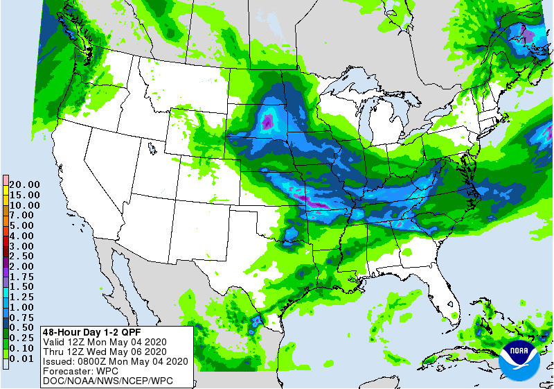
Much of western Minnesota will see a half-inch or more of precipitation through Tuesday night, while the eastern half of the state sees lighter amounts.
Temperatures already dip a couple degrees below average Monday, thanks in part to the increasing clouds.
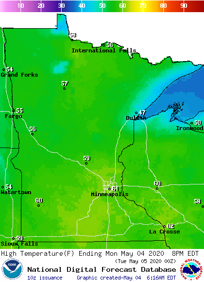
Tuesday will be even cooler, with most of the state stuck in the 50s for highs.
Below average temperatures linger
After Tuesday, there are no major precipitation chances for the rest of the week, and partly cloudy to mostly sunny skies prevail.
Even with the sunshine, temperatures never make it back to average, and most of the state spends the week with temperatures 5-15 degrees below average.
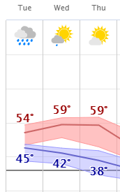
That means most of the state will have highs only in the 50s through the weekend, and parts of northern Minnesota may see a couple days that don’t make it out of the 40s.
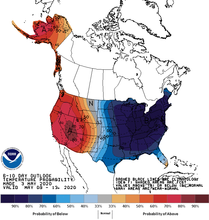
Next week may also be on the cool side. The 6-10 day outlook, which goes through May 13, also puts Minnesota in a high probability for below-average temperatures.
Programming note
You can hear my live weather updates on Minnesota Public Radio at 7:48 a.m. Monday through Friday morning.

