
Cold air starts moving across Minnesota Thursday
Dry and breezy conditions create a fire risk
Go Deeper.
Create an account or log in to save stories.
Like this?
Thanks for liking this story! We have added it to a list of your favorite stories.


Thursday brings the initial taste of some very cold weather that will settle across Minnesota, while dry air continues to elevate the fire risk across the state.
Thursday’s forecast
Northerly winds are starting to funnel colder air across the state Thursday. Despite mostly sunny skies, this will keep parts of northern Minnesota in the 40s, and much of the rest of the state in the 50s. A couple spots in southern Minnesota, including the Twin Cities, may get to 60 before getting the full influence of the colder air on Friday.
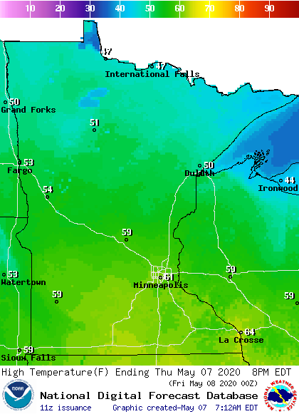
The weather will remain mostly dry across the state. A system passing south of Minnesota will increase clouds in southern Minnesota in the afternoon and brings a very slight chance for the southern border to see isolated light rain in the afternoon.
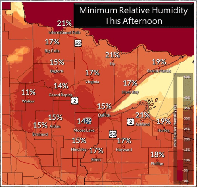
Breezy conditions plus dry air and low humidity will increase the fire risk for much of the state Thursday afternoon. Parts of northeastern Minnesota may see relative humidities dip under 20 percent during the afternoon, which is very dry.
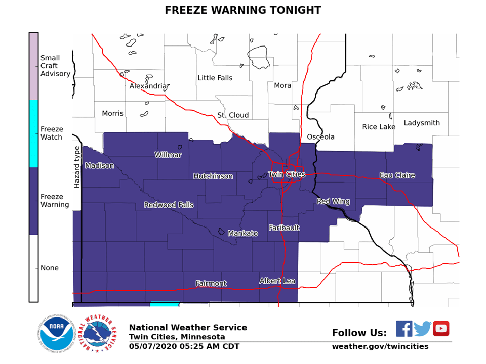
So much cold air will continue to spread across Minnesota overnight that parts of southern Minnesota are under a freeze warning for Friday morning.
That chilly extended forecast will be updated around 9 a.m.
Programming note
You can hear my live weather updates on Minnesota Public Radio at 7:48 a.m. Monday through Friday morning.
Turn Up Your Support
MPR News helps you turn down the noise and build shared understanding. Turn up your support for this public resource and keep trusted journalism accessible to all.

