
A breezy and cool Mother's Day
Saturday snow reports
Go Deeper.
Create an account or log in to save stories.
Like this?
Thanks for liking this story! We have added it to a list of your favorite stories.


The Saturday showers held off until mid-afternoon in much of the Twin Cities metro area. We topped out at 60 degrees at Minneapolis-St. Paul International Airport Saturday afternoon, which was well below our average May 9 Twin Cities high of 68 degrees.
Yes, it can snow during the Minnesota Fishing Opener. Parts of northern Minnesota saw accumulating snow on Saturday. Here are some snow reports posted by the National Weather Service, including 3 inches in Deerwood, 2 inches in Staples and 1.5 inches near Brainerd:

Additional reports will be posted by the NWS Saturday night and early Sunday. You can click on (or hover over) any snow report on the NWS site for the snow total and the exact location and time of the snow measurement.
Some additional snow is possible Saturday evening and overnight Saturday night for those same areas and points toward Mora and Hinckley and into portions of northwestern Wisconsin. A mix of rain and snow is expected to the south of the main snow area.
Turn Up Your Support
MPR News helps you turn down the noise and build shared understanding. Turn up your support for this public resource and keep trusted journalism accessible to all.
Southern Minnesota and the Twin Cities metro area, plus west-central Wisconsin, are expected to see periods of rain into early Saturday evening, then a mix of rain and snow overnight Saturday night. The metro area could see some minor snow accumulations on grassy areas overnight.
I should mention that there’s a freeze warning for parts of southwestern Minnesota from 2 .am. to 9 a.m. Sunday:

You can hear updated weather information on the MPR network, and you’ll see updated weather info on the MPR News live weather blog.
Chilly and breezy Mother’s Day
Some rain showers or snow showers could linger over southeastern Minnesota and parts of western Wisconsin Sunday morning. Other locations will have a chance of a stray sprinkle or flurry.
Sunday highs will be in the 40s in most of Minnesota and western Wisconsin:
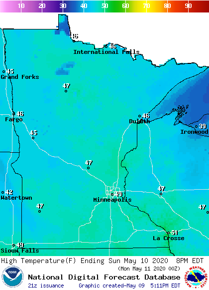
A few spots in the Twin Cities metro area may touch 50.
It’ll be a breezy Sunday, with wind gusts of 25-30 mph possible by afternoon:
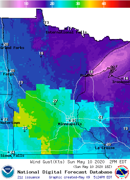
Plotted gusts are in knots, with 25 knots equal to about 29 mph.
The coming week
Monday and Tuesday look mostly dry. Some periods of rain are possible Wednesday and Thursday. The National Oceanic and Atmospheric Administration’s Global Forecast System (GFS) model shows the potential precipitation pattern Wednesday through Thursday:
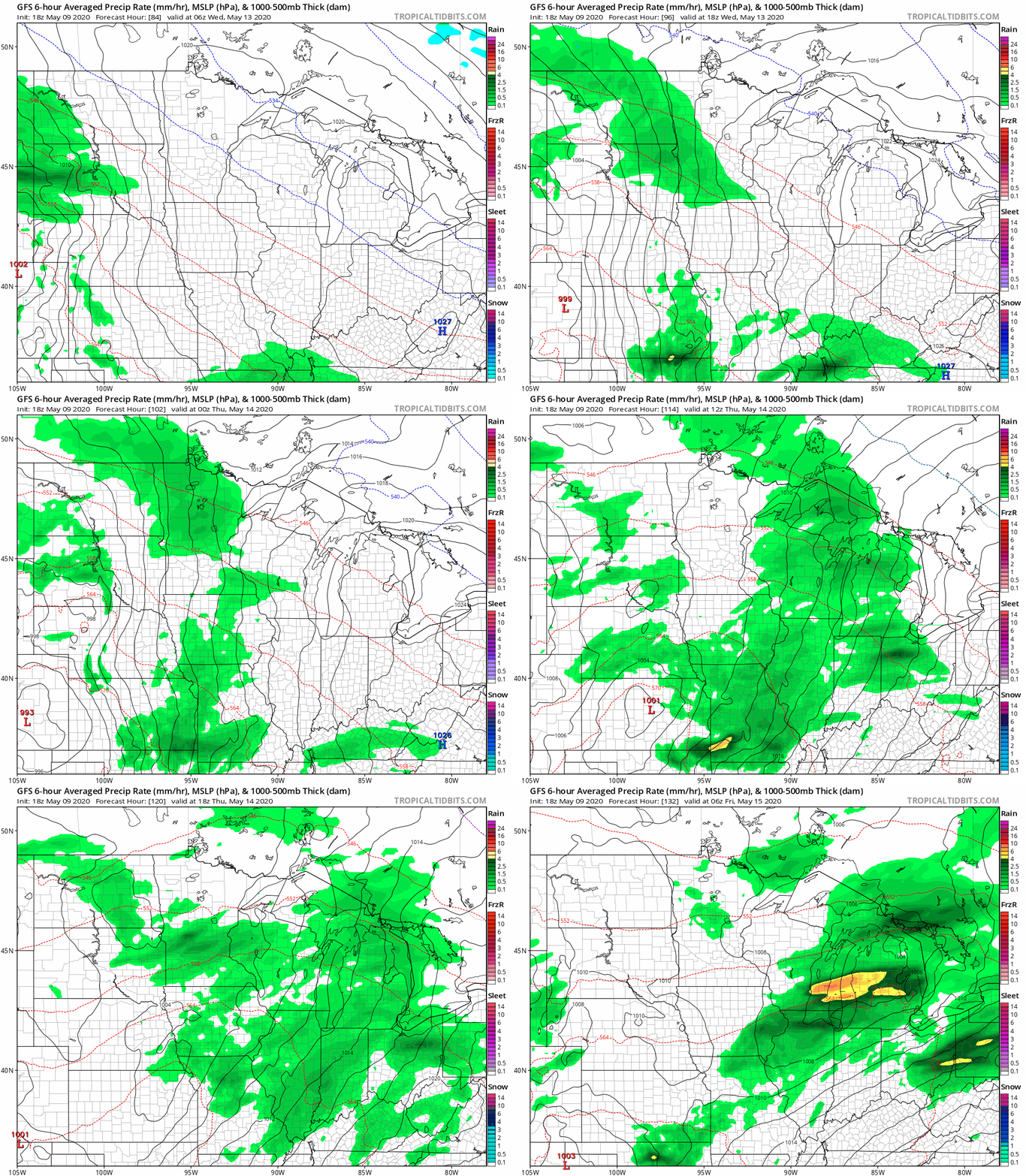
Twin Cities metro area highs are projected to reach the mid 50s on Monday, followed by upper 50s Tuesday and around 60 on Wednesday. We could reach the upper 60s Thursday and the lower 70s on Friday.
Programming note
You can hear my live weather updates on MPR News at 7:35 a.m., 9:35 a.m. and 4:35 p.m. each Saturday and Sunday.

