
One more cold night, then a warm-up
Rain returns Wednesday
Go Deeper.
Create an account or log in to save stories.
Like this?
Thanks for liking this story! We have added it to a list of your favorite stories.


Temperatures remain cool for the first part of the week, including another freeze potential Tuesday morning. Then an extended stretch of warmer weather moves in.
Monday and Tuesday
Most of the clouds from Sunday cleared out by Monday morning, and under mostly clear skies, Monday started cold again. Even with the sunshine, temperatures will remain 10 to 15 degrees below average through the day, putting highs only in the 40s and 50s.
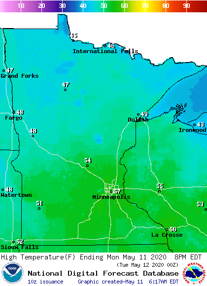
Tuesday will see similar conditions, with clear skies Monday night allowing much of the state to see morning temperatures near or below freezing.
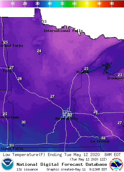
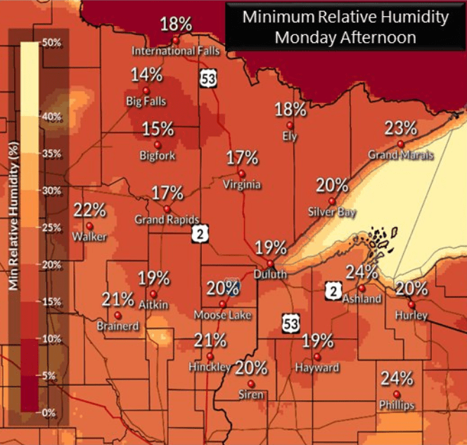
This means Freeze Warnings could be issued again for Tuesday morning. The rest of Tuesday will stay sunny with more of the state making it into to 50s by the afternoon. The dry conditions both days will cause an elevated fire risk for portions of northern Minnesota, especially in the afternoon.
Turn Up Your Support
MPR News helps you turn down the noise and build shared understanding. Turn up your support for this public resource and keep trusted journalism accessible to all.
Rain returns Wednesday
Not only did April end drier than average for most of the state, but now much of Minnesota is also below average precipitation for May. The next rain chance comes with a weather system that impacts the state Wednesday into Thursday.
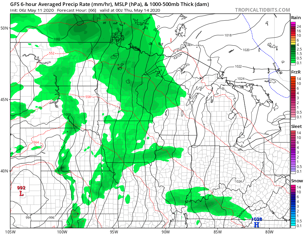
Showers and possibly a few storms are possible, along with cloudier skies, especially Wednesday. Rain totals likely remain low, with most of the state expected to see well under a half inch of rain between both days.
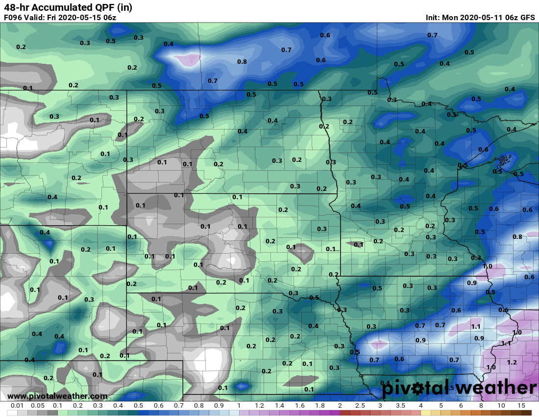
Spotty showers and isolated storms are possible again Friday afternoon through Saturday, but that is also likely to stay lighter rain.
Warmer weather ahead
Highs Wednesday stay below average and mostly in the 50s under more clouds and rain. Then finally by Thursday and through the end of the week, a warmer air flow into the state brings back more seasonable May temperatures in the 60s and 70s.

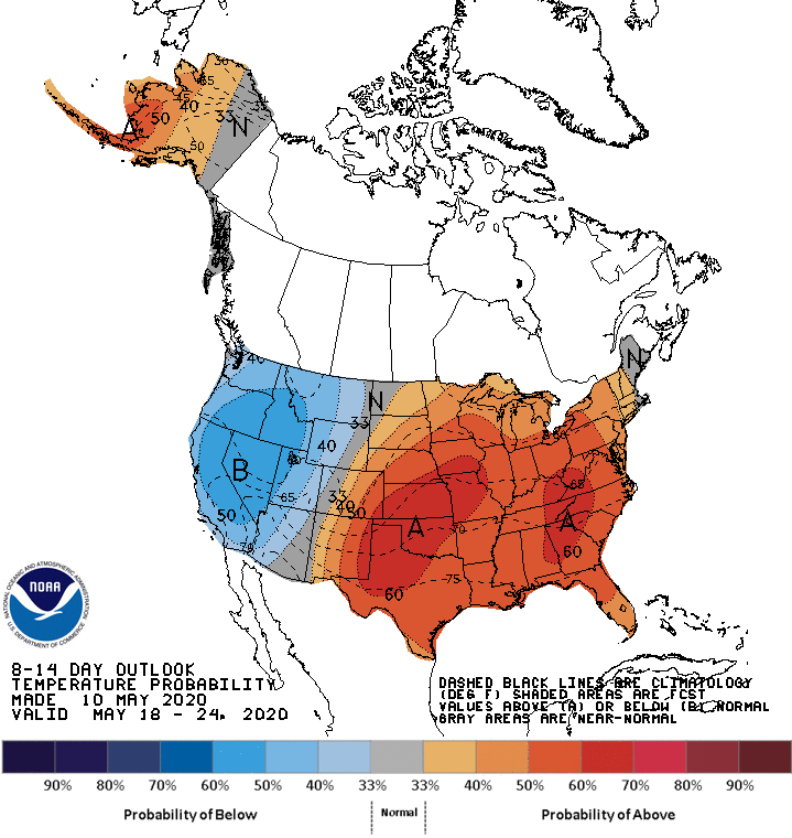
Then temperatures remain much more seasonable for the rest of the week. Temperatures are likely to be above average next week, and parts of the state could even see temperatures into the 80s!
Programming note
You can hear my live weather updates on Minnesota Public Radio at 7:48 a.m. Monday through Friday morning.

