
Thursday will be the warmest day in almost 2 weeks
Another chance for light rain
Go Deeper.
Create an account or log in to save stories.
Like this?
Thanks for liking this story! We have added it to a list of your favorite stories.


Thursday brings morning fog and another chance for light rain, along with the warmest weather much of Minnesota has seen since early May.
Thursday’s forecast
The rain from Wednesday has cleared out, but the moisture it left behind is bringing areas of fog across Minnesota and a couple spots of drizzle as of Thursday morning. Northwestern Minnesota is under a dense fog advisory until 9 a.m. for visibilities under a quarter-mile in some areas.
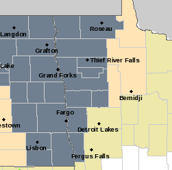
The fog and drizzle will diminish through the morning, replaced by more sunshine. There is another weak disturbance that will pass across northern Minnesota Thursday afternoon and evening bringing a few showers and storms across that part of the state.
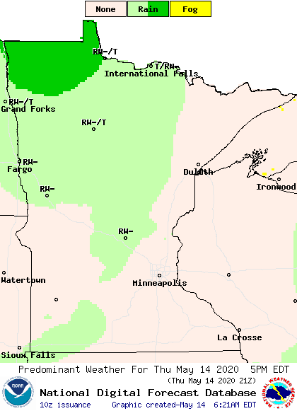
A couple isolated showers could make it into southern Minnesota, including a slight chance for evening sprinkles in the Twin Cities. Most of the state will see less than a tenth of an inch of rain, with northern Minnesota seeing up to a quarter-inch.
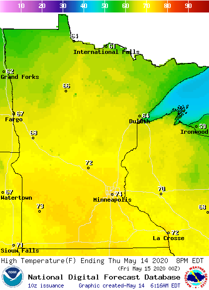
Otherwise, under more sunshine, much of the state will see the warmest weather since the beginning of May, almost two weeks ago, with highs back in the 60s and 70s.
More rain is on the way for Minnesota over the weekend That extended forecast will be updated around 9 a.m.
Programming note
You can hear my live weather updates on Minnesota Public Radio at 7:48 a.m. Monday through Friday morning.
Turn Up Your Support
MPR News helps you turn down the noise and build shared understanding. Turn up your support for this public resource and keep trusted journalism accessible to all.

