
Weekend forecast: Driest to the north, with rain chances best in the south
Coolest day is Sunday
Go Deeper.
Create an account or log in to save stories.
Like this?
Thanks for liking this story! We have added it to a list of your favorite stories.


Yes, we could use some rain in many parts of Minnesota and western Wisconsin. The official rain bucket at Minneapolis-St. Paul International Airport recorded only four-hundredths of an inch of rain on Wednesday. That brought our Twin Cities May rainfall total to .19 of an inch, which is 1.23 inches below average for the month to date. Last May was much wetter; May rainfall at MSP airport was 1.72 inches through May 13.
Weekend rain opportunities
A low pressure system will pass to our south Saturday into early Sunday. It’ll spin some periodic rain over southern and central Minnesota and much of Wisconsin. There could also be an embedded thunderstorm to the south.
The National Oceanic and Atmospheric Administration’s North American Mesoscale (NAM) forecast model shows the potential rain pattern Saturday morning through Sunday morning:
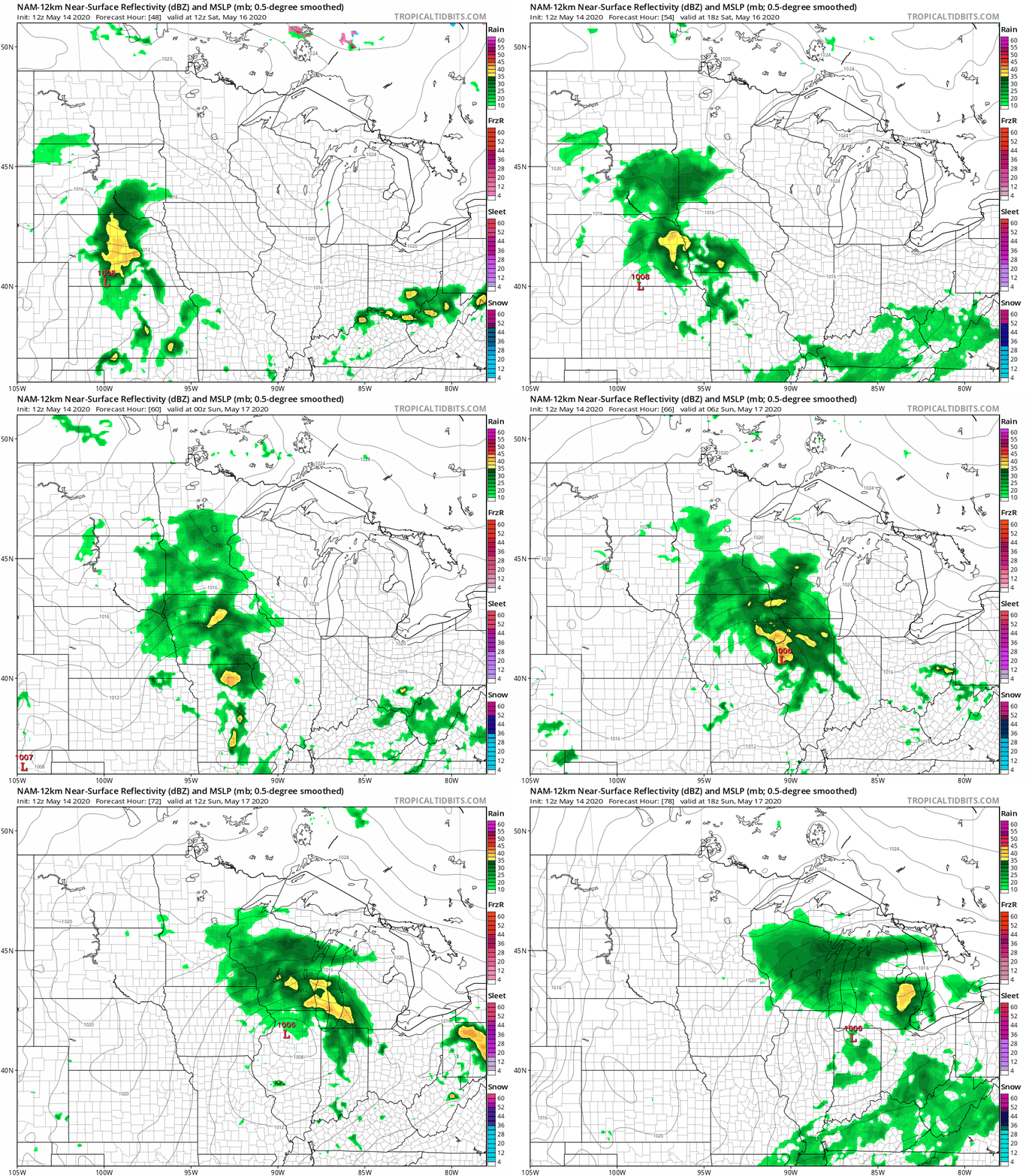
The best chance of rain in the Twin Cities metro area appears to be from around mid-afternoon on Saturday into Saturday night, with a few lingering showers Sunday morning.
Turn Up Your Support
MPR News helps you turn down the noise and build shared understanding. Turn up your support for this public resource and keep trusted journalism accessible to all.
You can hear updated weather information on the MPR network, and you’ll see updated weather info on the MPR News live weather blog.
Weekend temps and winds
Our average Twin Cities high temp is 69 degrees on May 16. We expect metro area highs of around 70 degrees this Saturday. Many spots in Minnesota and western Wisconsin will top out in the 60s:
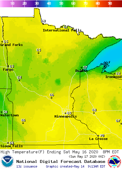
Portions of northeastern Minnesota will have highs in the 50s on Saturday.
Saturday afternoon wind gusts of 15-20 mph are possible in southern and eastern Minnesota plus western Wisconsin:
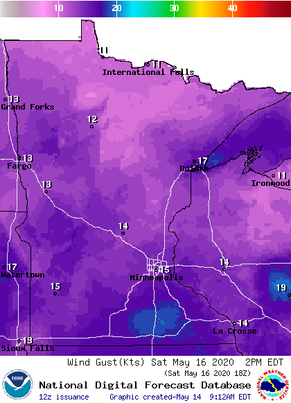
Plotted gusts are in knots, with 15 knots equal to 17 mph.
Sunday high temps will be warmest in northwestern Minnesota, where ample sunshine may deliver some lower 70s:
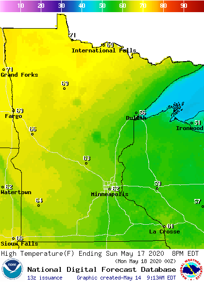
There will be a lot of 60s elsewhere, and some 50s near Lake Superior. The Twin Cities metro area could reach the lower 60s Sunday afternoon.
Highs in the 70s return to the Twin Cities on Monday, with a shot at 80 on Tuesday.

