
As rain clears, temperatures rise; northern Minnesota fire risk
Go Deeper.
Create an account or log in to save stories.
Like this?
Thanks for liking this story! We have added it to a list of your favorite stories.


Southern Minnesota is recovering from a soaking weekend rain, while northern parts of the state are so dry there is an elevated fire risk. Temperatures rise through the week, bringing some 80s by the end of the week.
Rainy recap
A soaking rain impacted southern Minnesota over the weekend, with many locations, including the Twin Cities, setting daily rainfall records.
Numerous locations, especially just south of the metro saw 2 or 3 inches of total rain, and there were even a couple reports of over 4 inches, including near Bloomington and Savage.
However, northern Minnesota, generally from about Fergus Falls to Duluth and northward, saw little to no rain. In fact, northern Minnesota was seeing sunshine and 70s at times over the weekend, while southern Minnesota was seeing rain and 60s or even 50s.
Turn Up Your Support
MPR News helps you turn down the noise and build shared understanding. Turn up your support for this public resource and keep trusted journalism accessible to all.

Monday’s forecast
That rain has now moved out except for a couple isolated showers in southeastern Minnesota, which diminish through the morning. Although skies are drier, lingering clouds and higher humidity left behind from the rain will keep temperatures in southern Minnesota from warming up much through the day.
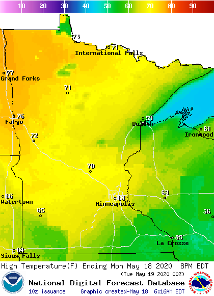
Therefore, northern Minnesota will see the warmest temperatures for the state again Monday, thanks to sunshine and lower humidity.
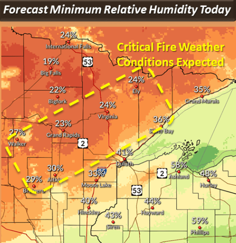
Unfortunately, that low humidity and windy conditions during the afternoon mean parts of the Arrowhead will be under a red flag warning from 1 p.m. to 7 p.m.
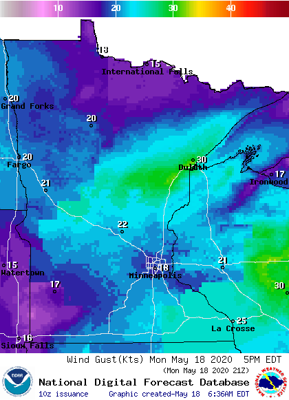
Most of the state stays breezy through the day, and a corridor from around Brainerd toward Duluth is likely to see gusts over 30 mph.
Extended forecast
Temperatures warm a bit more for southern Minnesota by Tuesday, putting much of the state back in the 70s.
Then highs are likely to remain in the 70s for most of the week, with a few more 80s possible by the weekend.
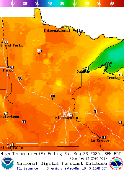
For much of the state, it would be the first time this year with a temperature in the 80s.
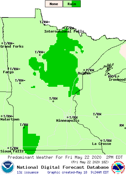
Most of the week remains dry, meaning we will continue to monitor fire concerns for portions of northern Minnesota. Instability increases toward the end of the week, bringing back chances for scattered showers and storms from Thursday night into the weekend.
Programming note
You can hear my live weather updates on Minnesota Public Radio at 7:48 a.m. Monday through Friday morning.

