
Northeastern Minnesota sees a fire risk Monday
Lingering rain finally moves out for southern Minnesota
Go Deeper.
Create an account or log in to save stories.
Like this?
Thanks for liking this story! We have added it to a list of your favorite stories.


As southern Minnesota starts drying out from record weekend rain, parts of northern Minnesota are parched enough to see a fire risk.
Monday’s forecast
The heavy rain that southern Minnesota saw over the weekend has moved out except for a couple persistent, isolated showers in southeastern Minnesota that will dwindle through the morning.
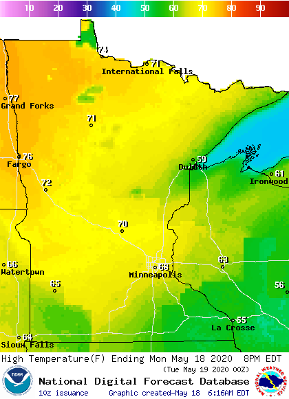
While most of the rain has moved out, lingering clouds and higher humidity left behind from the rain will keep temperatures in southern Minnesota from rising much through the day. So, northern Minnesota will see the warmest weather Monday, thanks to more sunshine and lower humidity.
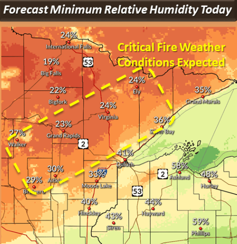
Unfortunately, low humidity and windy conditions during the afternoon mean parts of the Arrowhead will be under a red flag warning from 1 p.m. to 7 p.m.
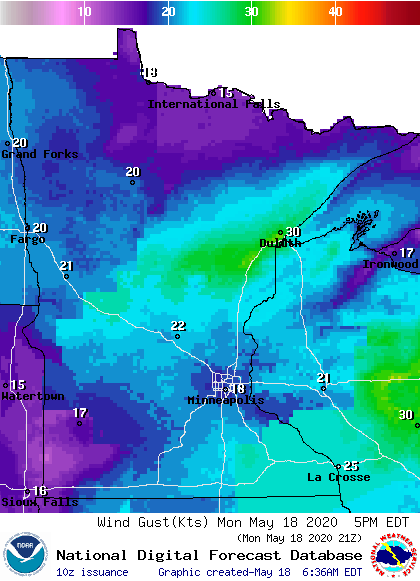
Most of the state stays breezy through the day, and a corridor from around Brainerd toward Duluth is likely to see gusts over 30 mph.
Temperatures continue to rise through the week, and 80s are possible by the end of the week. That extended forecast will be updated around 9 a.m.
Programming note
You can hear my live weather updates on Minnesota Public Radio at 7:48 a.m. Monday through Friday morning.
Turn Up Your Support
MPR News helps you turn down the noise and build shared understanding. Turn up your support for this public resource and keep trusted journalism accessible to all.

