
Temperatures finally warm for southern Minnesota
A fire risk continues across northern portions of the state.
Go Deeper.
Create an account or log in to save stories.
Like this?
Thanks for liking this story! We have added it to a list of your favorite stories.


The heavy weekend rain did not make it to northern Minnesota, where dry conditions elevate the fire risk the next few days. Temperatures will slowly be on the rise this week, with the next chance for showers and storms moving in by Thursday evening.
Rain totals
The storm that passed south of the state over the weekend brought record-setting rain to many parts of southern Minnesota. Numerous places saw two or three inches total, and just south of the Twin Cities there was a corridor with many reports over four inches of rain.

Meanwhile, from about Fergus Falls toward Duluth and northward, little to no rain fell over the weekend, meaning that portion of the state is still very dry.
Temperature forecast
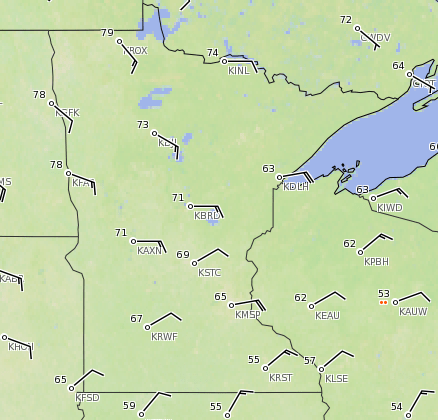
Because of the cloud cover and moisture in southern Minnesota versus drier and sunnier weather in northern parts of the state, we’ve seen a temperature trend since the weekend where highs have been warmer north. Monday brought a similar pattern, with 70s north, while parts of southeastern Minnesota were stuck in the 50s. Here are the temperatures from 5 p.m. Monday showing the large contrast between Roseau at 79 degrees and Rochester at 55:
Turn Up Your Support
MPR News helps you turn down the noise and build shared understanding. Turn up your support for this public resource and keep trusted journalism accessible to all.
Southern Minnesota will warm the next couple days, already bringing more of the state back into the 70s by Tuesday.
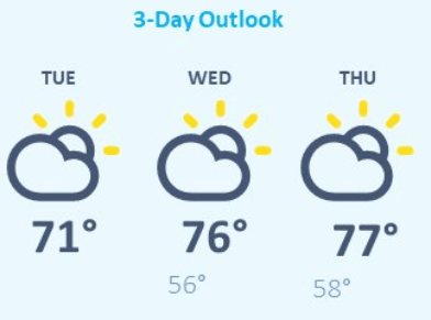
By the end of the week 80s are possible.
Precipitation forecast
Because of ongoing dry conditions along with winds gusting over 40 mph near Duluth, a Red Flag Warning was issued for portions of the Arrowhead on Monday. Fire concerns will need to be monitored through the week in northern Minnesota, including Tuesday, when the gustier winds are more likely to impact the northwestern corner of the state.

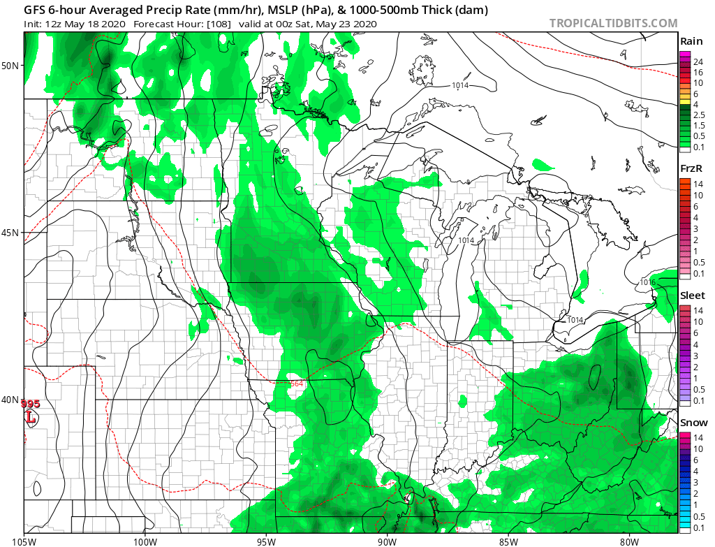
The next opportunity for statewide precipitation moves in Thursday afternoon, then chances for scattered showers and storms linger through the weekend.
Programming note
You can hear my live weather updates on Minnesota Public Radio at 7:48 a.m. Monday through Friday.

