
Highs of 80 finally arrive, later than normal
Showers and storms likely by the weekend
Go Deeper.
Create an account or log in to save stories.
Like this?
Thanks for liking this story! We have added it to a list of your favorite stories.


Much of Minnesota has a chance to hit 80 degrees this week, which is late in the season to see that spring milestone. More showers and storms return late this week.
Tuesday’s forecast
Cloud cover is still lingering over the southern part of the state, which will keep afternoon temperatures cooler.
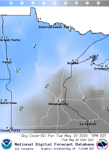
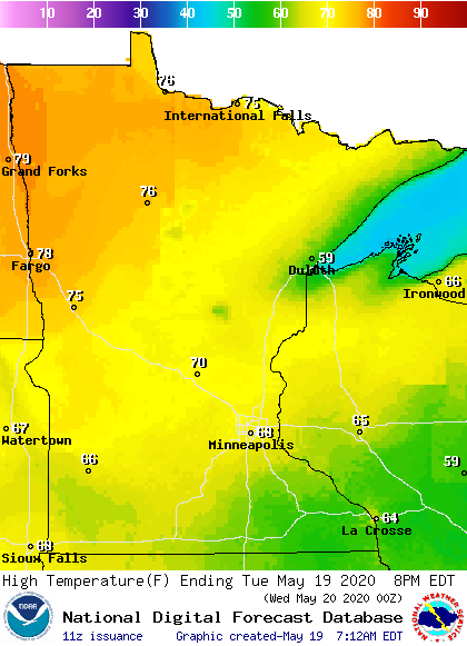
Under plenty of sunshine, northeastern Minnesota will be the warm spot yet again Tuesday, which has been the trend since the weekend.
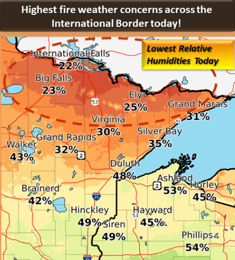
However, the warm weather, dry air, and breezy conditions will elevate the fire risk again during the afternoon, especially near the Canadian border.
Turn Up Your Support
MPR News helps you turn down the noise and build shared understanding. Turn up your support for this public resource and keep trusted journalism accessible to all.
Which part of the state sees the 80s first?
With the exception of southwestern Minnesota, where many locations saw 80s at the start of May, most of the state, including the Twin Cities, has not reached 80 since last September.
It’s late in the spring to have not hit this milestone, as the average for first 80s across most of the state is the first week of May.
Except for the North Shore, the entire the state finally has a chance to see 80 this week, and it could be northern Minnesota that reaches it first. Because of the cloud cover and moisture in southern Minnesota versus drier and sunnier weather in northern parts of the state, we’ve seen a temperature trend since the weekend where highs have been warmer north.
In fact, a number of spots in northwestern Minnesota just missed hitting 80 on Monday.
So, northern Minnesota stays in the upper 70s and continues to flirt with 80 the next few days. For the rest of the state, it will likely take until Saturday to get closer to 80.
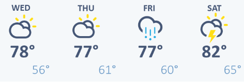
We’ll see who gets there first!
Precipitation forecast
Skies stay dry through Thursday, which for northern Minnesota means an ongoing fire concern. The next opportunity for statewide precipitation moves in Thursday evening, then chances for scattered showers and storms linger through the weekend.
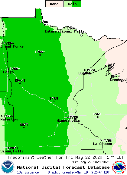
Expected rain totals for the weekend are still uncertain, but any precipitation from that system is very needed in northern Minnesota.
Programming note
You can hear my live weather updates on Minnesota Public Radio at 7:48 a.m. Monday through Friday morning.

