
Dry Thursday before active weather returns
Weekend rain will be beneficial for much of the state
Go Deeper.
Create an account or log in to save stories.
Like this?
Thanks for liking this story! We have added it to a list of your favorite stories.


Thursday brings one last day of dry skies before much more unsettled weather impacts the state through the holiday weekend. Temperatures remain mild.
A few more spots in northern Minnesota saw their first 80s of the season Wednesday, including Ely and Hinckley. For Duluth, where temperatures often stay cooler near Lake Superior, the milestone weather was finally hitting 70 for the first time since October!
Thursday’s forecast
Except for clearer skies in the Arrowhead, most of Minnesota started Thursday cloudy and will see a mix of clouds and sunshine through the day. It stays cloudiest in southern Minnesota, while the northeastern corner of the state sees the most sun.
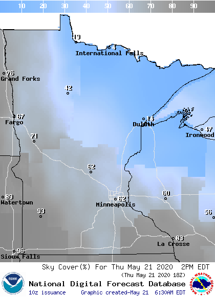
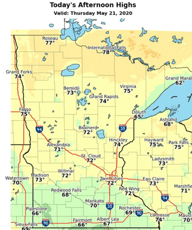
Under this pattern, northern Minnesota will once again see the highest temperatures, which has been the trend all week. Highs will range from the upper 70s north, to 60s in southern Minnesota.
Clouds also increase across western Minnesota through the day ahead of the next weather system. After an otherwise quiet day, that brings windier conditions and a slight chance for showers and storms to our western border by late Thursday.
Turn Up Your Support
MPR News helps you turn down the noise and build shared understanding. Turn up your support for this public resource and keep trusted journalism accessible to all.
Showers and storms with plenty of breaks through the holiday
Let me start by emphasizing that while there will be scattered showers and storms from Friday through Memorial Day, we’re also expecting plenty of breaks in the weather and sunshine, too. It will not be a washout like southern Minnesota saw last weekend.
The showers and storms that move in late Thursday become more scattered throughout the state on Friday. After that point, we stay generally unsettled through the weekend, with occasional chances for showers and storms.
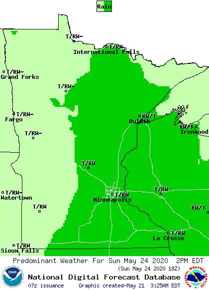
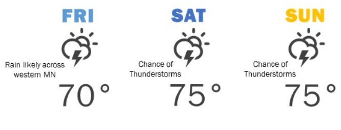
Currently, it looks like it could be a bit more active later Friday and also Sunday, with spottier activity on Saturday, and then isolated rain chances Monday. All the days should have breaks of sunshine, but Monday may be the best bet for the sunniest day. Because a fair amount of sunshine is expected, highs through the weekend remain mostly in the 70s, with a couple isolated 80s possible.
At this time, it looks like most of the rain totals through Monday would be under a half inch, with southern Minnesota possibly seeing slightly higher totals.
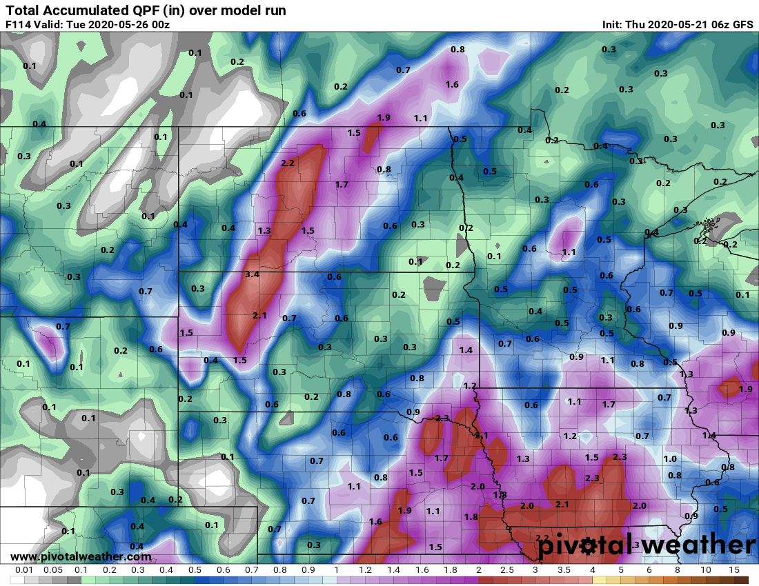
Unfortunately, this is the reverse of where we need the rain most. Because of last weekend’s soaking rain, most of southern Minnesota is above average on rain this spring, while a large part of Minnesota, especially the northern part of the state, has seen less than half its average precipitation over the past three months.

Programming note
You can hear my live weather updates on Minnesota Public Radio at 7:48 a.m. Monday through Friday morning.

