
Thursday stays dry, but rain is on the way
Northern Minnesota sees the warmest weather yet again
Go Deeper.
Create an account or log in to save stories.
Like this?
Thanks for liking this story! We have added it to a list of your favorite stories.


Temperatures remain above average for most of Minnesota Thursday under a mix of clouds and sunshine. Rain starts moving into the western edge of the state by the end of the day.
Thursday’s forecast
For all but the Arrowhead, where clearer skies allowed some temperatures to drop into the 40s, the state is starting off mild Thursday morning with temperatures in the 50s.
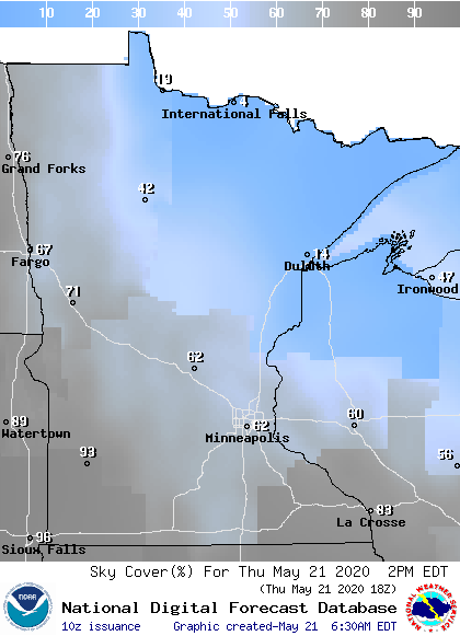
Most areas are beginning the day cloudy and will see a mix of clouds and sunshine through the day. It will be cloudiest in southern Minnesota, while the northeastern corner of the state sees the most sun.
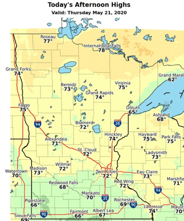
Under this pattern, northern Minnesota will once again see the highest temperatures, which has been the trend all week. Highs will range from the upper 70s north, to 60s in southern Minnesota.
Clouds also increase across western Minnesota through the day ahead of the next weather system. After an otherwise quiet day, that approaching system brings windier conditions and a slight chance for showers and storms to our western border by the end of the day.
Widespread rain chances move in Friday. Your extended forecast for the holiday weekend will be updated around 9 a.m.
Programming note
You can hear my live weather updates on Minnesota Public Radio at 7:48 a.m. Monday through Friday morning.
Turn Up Your Support
MPR News helps you turn down the noise and build shared understanding. Turn up your support for this public resource and keep trusted journalism accessible to all.

