
The holiday weekend brings showers and storms
It also stays warm, with plenty of dry breaks for outdoor activities
Go Deeper.
Create an account or log in to save stories.
Like this?
Thanks for liking this story! We have added it to a list of your favorite stories.


Fridays stays mostly cloudy, with only a slight possibility for rain, then the weather gets more active with chances for showers and storms over the holiday weekend.
If you’ve noticed that Minnesota has seen relatively quiet weather since last weekend’s rain, it’s because we’ve been under a ridge of high pressure. With low pressure west and southeast of our region, and the Midwest under higher pressure, the upper air flow across the country has had a buckling pattern in it that looks like the Greek letter Omega. Here’s how that looked on Thursday:
The stable air sitting over Minnesota has also brought parts of the state more clouds, which we will see again Friday. That pattern is now starting to change, allowing more active weather over the weekend.
Friday’s forecast
Minnesota started off very mild, with morning temperatures in the 50s and even some 60s. Under cloudier skies Friday, temperatures will only rise 10 to 15 degrees during the day. That still puts us at about average highs, with much of the state near 70, and northwestern Minnesota the warmest spot again, in the mid-70s.
Turn Up Your Support
MPR News helps you turn down the noise and build shared understanding. Turn up your support for this public resource and keep trusted journalism accessible to all.

There will be enough instability for just a few spotty showers or sprinkles during the day, and possibly a couple isolated storms in southern Minnesota.
Showers and storms, but not a washout
The Memorial Day weekend brings periods of showers and storms, but there will also be plenty of breaks to get outside.
After only isolated activity Friday, a few more showers and storms start sliding along southern Minnesota Friday night. Then, most of the state could see a few scattered showers or storms Saturday, especially in the afternoon.
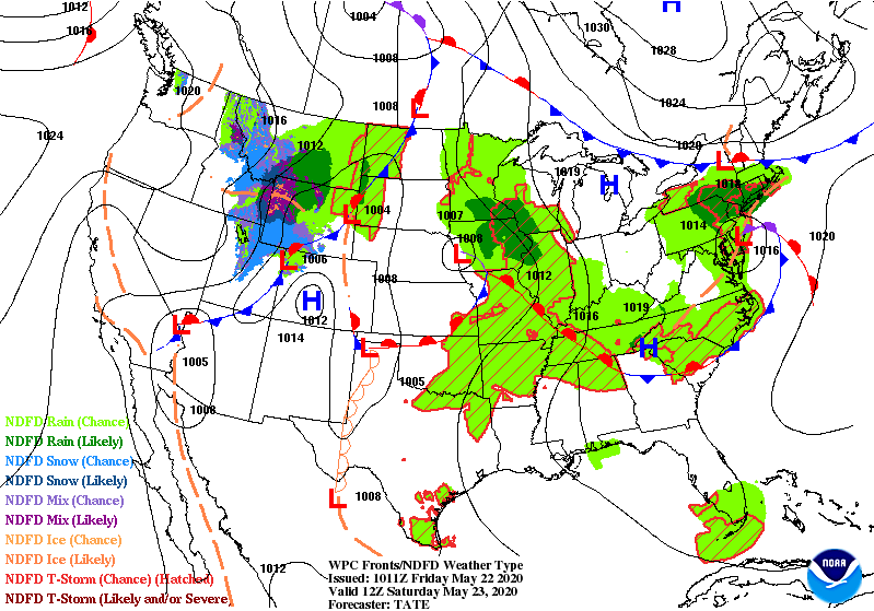
Sunday currently looks like the wettest day of the weekend, with more widespread showers and the best chance for thunderstorms, but we still expect breaks in the wet weather. Showers and storms will likely be spottier again on Memorial Day.
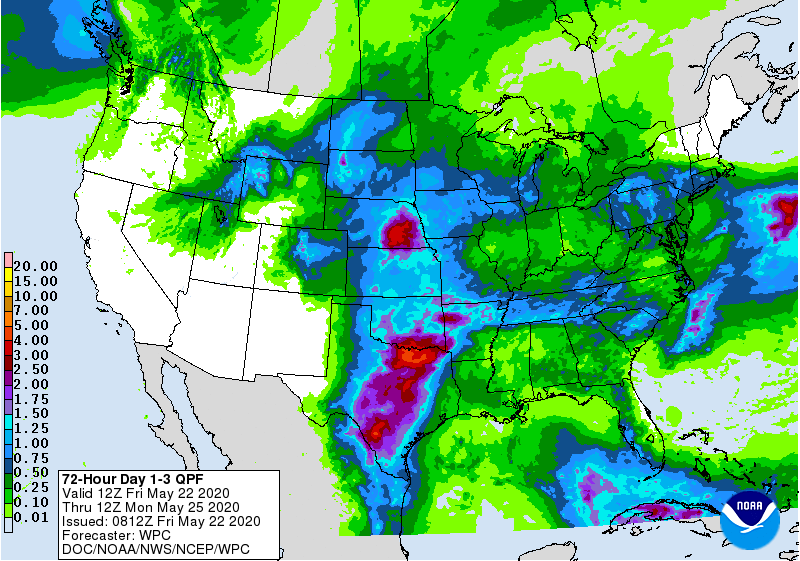
Rain totals for most of the state should stay under a half inch through Monday, with southern Minnesota seeing some totals closer to an inch.
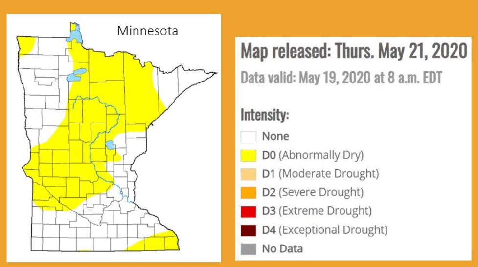
Any rain is very beneficial for most of the state, as the Drought Monitor for Minnesota now has over half the state under “abnormally dry” conditions.
Temperatures
Despite mostly cloudy skies and occasionally wet weather, temperatures over the holiday weekend remain warm, with most of the high in the 70s.
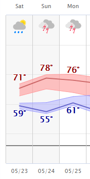
A warm wind flow could even push parts of Minnesota into the 80s, especially on Sunday.
Programming note
You can hear my live weather updates on Minnesota Public Radio at 7:48 a.m. Monday through Friday morning.

