
Chance of scattered showers and some thunder on Memorial Day
An isolated severe storm is possible in southeastern Minnesota and parts of Wis.
Go Deeper.
Create an account or log in to save stories.
Like this?
Thanks for liking this story! We have added it to a list of your favorite stories.


The astronomical beginning of summer doesn’t happen until June 20, but many of us consider Memorial Day to be the start of summer.
It’ll feel kind of summery in many spots this Memorial Day, but it won’t be record warmth. The Minnesota State Climatology Office looked at Memorial Day weekends from 1971 through 2019. I’ve highlighted the Memorial Day stats:

The warmest Memorial Day in Twin Cities weather records was just two years ago, when we hit 100 degrees. The most rain in Twin Cities Memorial Day records (since 1971) was last year, with 1.83 inches of rain.
Rain chances
Turn Up Your Support
MPR News helps you turn down the noise and build shared understanding. Turn up your support for this public resource and keep trusted journalism accessible to all.
The overnight hours of Sunday night could feature some scattered showers in Minnesota and western Wisconsin. There’s also a chance of scattered thunderstorms overnight Sunday night, especially in southeastern Minnesota and parts of west-central and southwestern Wisconsin. Some spots in the Twin Cities metro area could see a thunderstorm overnight too.
The severe weather outlook from the National Weather Service Storm Prediction Center shows a marginal risk of severe weather Sunday evening and overnight Sunday night from the southeastern part of the Twin Cities metro area into parts of southern Minnesota and into western Wisconsin:
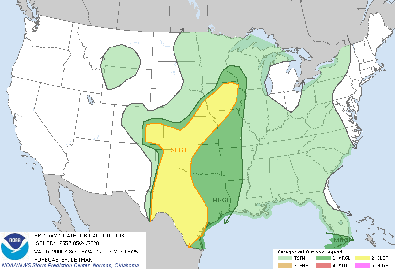
Marginal risk (shaded dark-green) means that an isolated severe thunderstorm is possible. Note the higher chance of severe weather in Iowa.
On Monday, scattered showers and a few embedded thunderstorms will be possible. The National Oceanic and Atmospheric Administration’s North American Mesoscale (NAM) forecast model shows this potential rain pattern Monday and Monday evening:
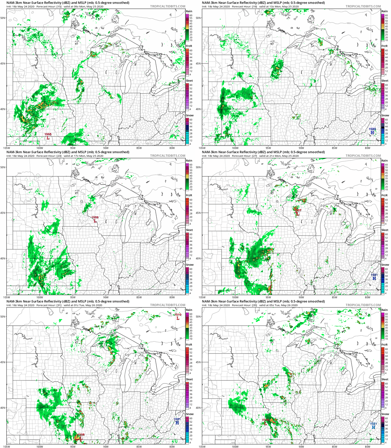
I’d pay more attention to the patchy nature of the rain than the exact location of the rain at any point in the loop. Most spots will see many dry hours on Memorial Day.
The NWS Storm Prediction Center shows a marginal risk of severe weather Monday and Monday night for part of southeastern Minnesota and much of Wisconsin:
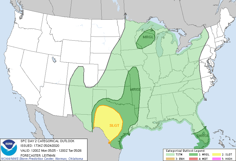
You can hear updated weather information on the MPR network, and you’ll see updated weather info on the MPR News live weather blog.
Temperatures
Our average Twin Cities high temp is 72 degrees on May 25. We could reach 80 degrees this Memorial Day. Monday afternoon highs are forecast to top 80 degrees in parts of southeastern Minnesota and western Wisconsin:
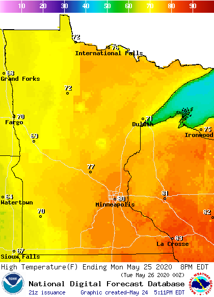
It’ll be coolest in western Minnesota and near Lake Superior.
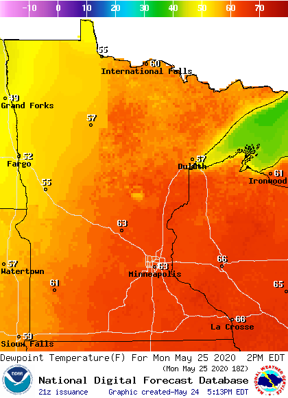
Dew points in the 60s are expected in many locations, including the Twin Cities:
Back to high temperatures, Twin Cities metro area highs are projected to reach the upper 70s on Tuesday, followed by lower 80s Wednesday and upper 70s Thursday and Friday.
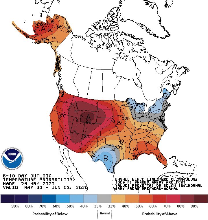
I don’t see any really cool temps in the next 10 days. The NWS Climate Prediction Center temperature outlook for May 30 through June 3 shows a tendency for warmer than normal temps across Minnesota and western Wisconsin:
We’ll see if that pans out.
I hope that you have a safe and relaxing Memorial Day.

