
Active weather continues into Tuesday
Showers and storms bring needed rain to northern Minnesota
Go Deeper.
Create an account or log in to save stories.
Like this?
Thanks for liking this story! We have added it to a list of your favorite stories.


Period of showers and storms continue through Tuesday, including an isolated risk for stronger storms in southeastern Minnesota. Temperatures for the rest of the week remain mostly above average.
Occasional showers and storms continue
The active weather Minnesota experienced through the weekend continues for much of the state through Tuesday. As of 6 p.m. Monday evening, there is widely scattered wet weather in northeastern Minnesota, as well as showers and storms moving into southern Minnesota from Iowa, which become more widespread through the evening.
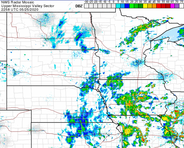
As the storms move into southeastern Minnesota, there is also an isolated risk for strong storms, with wind and hail being the primary risk.

That same part of the state is under a marginal severe weather risk again Tuesday.
While spotty wet weather is possible any time through Tuesday, there is a higher chance for southern Minnesota to see activity this evening into the overnight and for northern Minnesota see it from the overnight into Tuesday morning. Then rain chances diminish across the state Tuesday from west to east through the day, but eastern Minnesota still see another elevated storm chance Tuesday afternoon and evening, before most of the precipitation clears out.
Turn Up Your Support
MPR News helps you turn down the noise and build shared understanding. Turn up your support for this public resource and keep trusted journalism accessible to all.
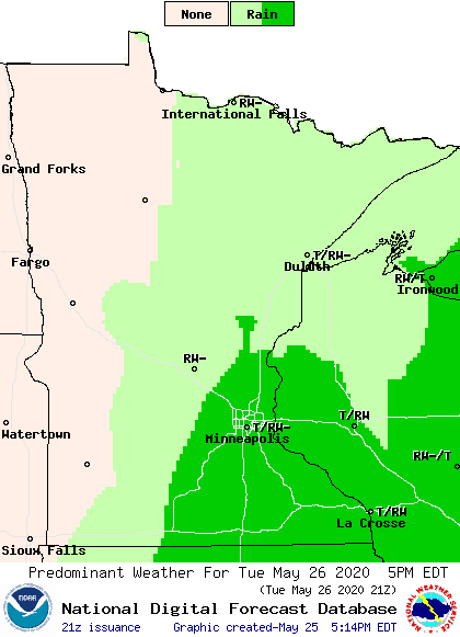
While most of Minnesota sees a half inch or less of additional rain through Tuesday, the northern and southeastern edges of the state likely see slightly higher amounts.
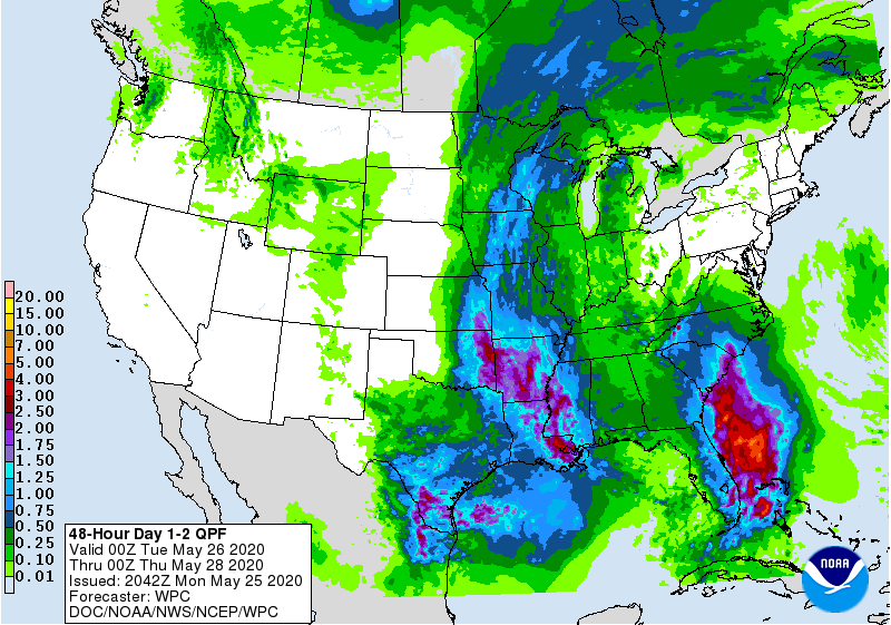
By Wednesday, except for a few isolated showers that may linger in southeastern Minnesota, the state sees drier skies and more sunshine return. Isolated showers are possible again on Thursday, but overall, the second half of the week is far less active and brings much more sunshine!
Temperature forecast
Temperatures Tuesday will stay above average through the day, with morning temperatures in the 50s and 60s, and most places seeing highs in the 70s. A few spots could hit 80 on Wednesday, then the rest of the week remains at or slightly above average, with 60s and 70s for highs.

Programming note
You can hear my live weather updates on Minnesota Public Radio at 7:48 a.m. Monday through Friday morning.

