
Cooler weather begins to move across Minnesota
A couple parts of Minnesota see rain Thursday
Go Deeper.
Create an account or log in to save stories.
Like this?
Thanks for liking this story! We have added it to a list of your favorite stories.


Although much of Minnesota stays dry Thursday, two separate fronts are bringing areas of rain, especially in the morning. Although not as warm as Wednesday, temperatures stay above average again, before cooler air settles across the state Friday.
Thursday’s forecast
Thursday is starting off predominantly dry, but two fronts are bringing showers to parts of the state.
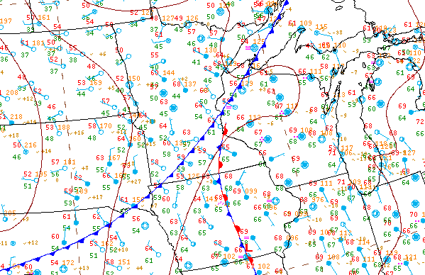
Both associated rain areas are pretty easy to pick out on radar. There is a light band of rain behind a cold front that is passing through the state. That is the line of rain in central Minnesota. Then, a stationary boundary that kept southeastern Minnesota in clouds and rain Wednesday is still bringing showers to the very southeastern corner of the state.

The line of rain should clear through the morning. The area of rain in southeastern Minnesota is expected to diminish through the afternoon, but that corner of the state likely remains mostly cloudy through the day, while the rest of the state sees more sunshine.
Because of the cold front, temperatures will be slightly cooler Thursday, but still above average and mostly in the 70s. The most noticeable temperature drop will be in northern Minnesota, where much of the area saw 80s Wednesday, but may not make it out of the 60s Thursday.

That cooler air continues across Minnesota, putting more of the state in the 60s by Friday. That extended forecast will be updated around 9:30 a.m.
Programming note
You can hear my live weather updates on Minnesota Public Radio at 7:48 a.m. Monday through Friday morning.
Turn Up Your Support
MPR News helps you turn down the noise and build shared understanding. Turn up your support for this public resource and keep trusted journalism accessible to all.

