
Temperatures dip briefly, then rise
Minnesota sees limited rain chances through the weekend
Go Deeper.
Create an account or log in to save stories.
Like this?
Thanks for liking this story! We have added it to a list of your favorite stories.


Behind a cold front, Thursday brings mostly dry, breezy, and slightly cooler weather. Temperatures cool even more by the weekend, before we see a big warmup next week.
Thursday’s forecast
Two different fronts brought rain to Minnesota Thursday morning.
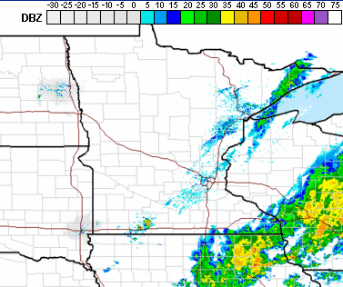
The first is the stationary boundary in southeastern Minnesota that also caused that portion of the state wet weather Wednesday. That area is diminishing and rain should end completely by afternoon. The other was a cold front, which had a line of spotty showers behind it. Some of that rain is still lingering as of 9:30 a.m., especially across the Arrowhead, but it will move out by late morning.
Because of the cold front, temperatures will be slightly cooler Thursday, but still above average and mostly in the 70s.
Turn Up Your Support
MPR News helps you turn down the noise and build shared understanding. Turn up your support for this public resource and keep trusted journalism accessible to all.

The most noticeable temperature drop will be in northern Minnesota, where much of the area saw 80s Wednesday, but may not make it out of the 60s Thursday. Winds also increase in the afternoon, with wind gusts over 20 mph.
Extended forecast
As the cooler air continues to filter in behind Thursday’s cold front, highs Friday and Saturday dip into the 60s for most of the state.
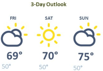
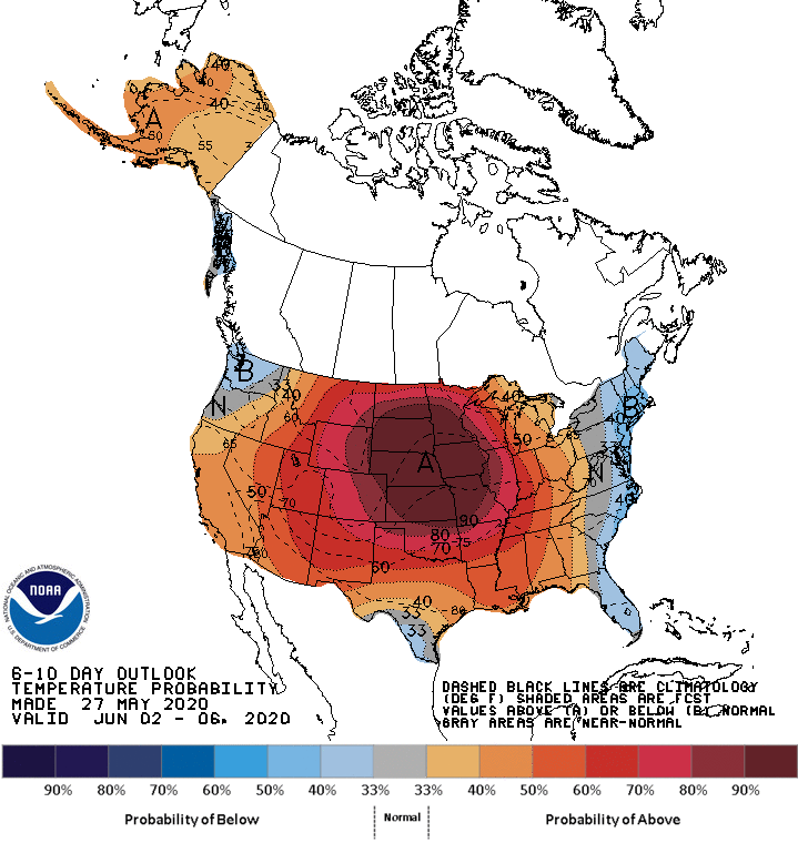
The front is also bringing in drier air and lower humidity. There are no significant rain chances through the weekend, and skies will stay mostly sunny. By Sunday, temperatures start to rise again, and temperatures next week are likely to stay above average. Highs most of the week will be in the 70s and 80s, and a couple 90s in southern Minnesota are not out of the question.
Current Drought Monitor
Drought Monitor updates are issued on Thursday mornings for data compiled through Tuesday mornings.
The current Drought Monitor that was just updated shows an increased area of “abnormally dry” conditions across Minnesota, going from 51 percent of the state last week to 56 percent this week.
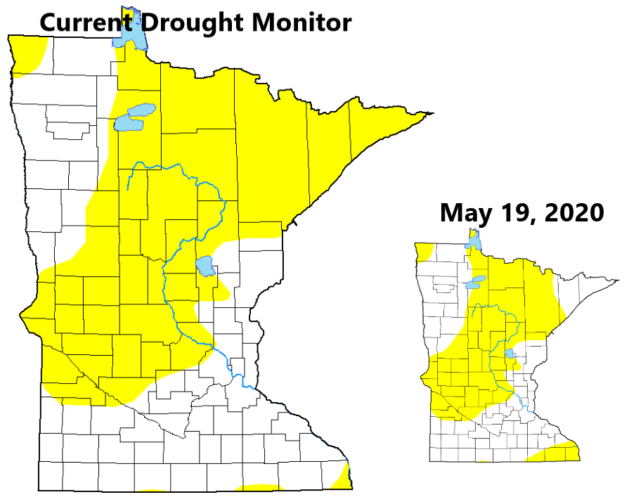
Looking at the map, you can see increasing dry conditions in north central Minnesota and through the Arrowhead, while southeastern Minnesota saw a reduction in dry areas. However, because the data is collected through Tuesday morning, it did not capture a lot of the heavy rain parts of Minnesota saw through Tuesday night. We’ll see next week if that rain brought any improvements as we also head into drier weather again.
Programming note
You can hear my live weather updates on Minnesota Public Radio at 7:48 a.m. Monday through Friday morning.

