
May ends cooler, then June starts off hot
Limited rain chances into next week
Go Deeper.
Create an account or log in to save stories.
Like this?
Thanks for liking this story! We have added it to a list of your favorite stories.


Noticeably cooler air has moved across Minnesota, putting the entire state below average the rest of this week. A complete turn-around comes next week, when temperatures shoot back into the 80s.
Friday’s forecast
Cooler air has spread across Minnesota behind the cold front that passed through the state early Thursday. Morning temperatures are in the 40s and 50s, and high temperatures will be mostly in the 60s, although northern Minnesota may not make it out of the 50s.

That puts temperatures about 5 to 10 degrees below average. High pressure influences our weather the next few days, bringing mostly sunny skies, lower humidity, and slightly breezy conditions Friday. The one exception to the sunshine is that a disturbance could bring a few more clouds to northern Minnesota, and occasional light rain to the Arrowhead. There will be a couple light showers and sprinkles through Friday morning, and there may be additional light precipitation late in the evening.
Temperature Trend
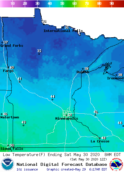
The coldest weather comes Saturday morning, when much of northern Minnesota dips into the 30s, and areas of frost are possible, especially in the northeastern corner of the state.
Turn Up Your Support
MPR News helps you turn down the noise and build shared understanding. Turn up your support for this public resource and keep trusted journalism accessible to all.
Highs Saturday also stay slightly below average, with 60s, but by Sunday, temperatures return closer to average and most of the state make it into the 70s. After that, temperatures soar and most of the state sees 80s by Tuesday and through the end of the week.
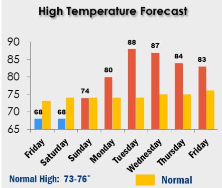
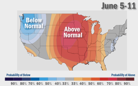
There could even be a couple parts of southern Minnesota that hit 90. It is looking very likely that the warmer weather also continues into the second week of June.
Predominantly dry
Under the influence of high pressure, Minnesota should stay predominantly dry, sunnier, and keep lower humidity through the weekend. Higher humidity returns for southern Minnesota by Monday, as does a spotty chance for showers and storms for the entire state, with a few more showers and storms possible Wednesday.
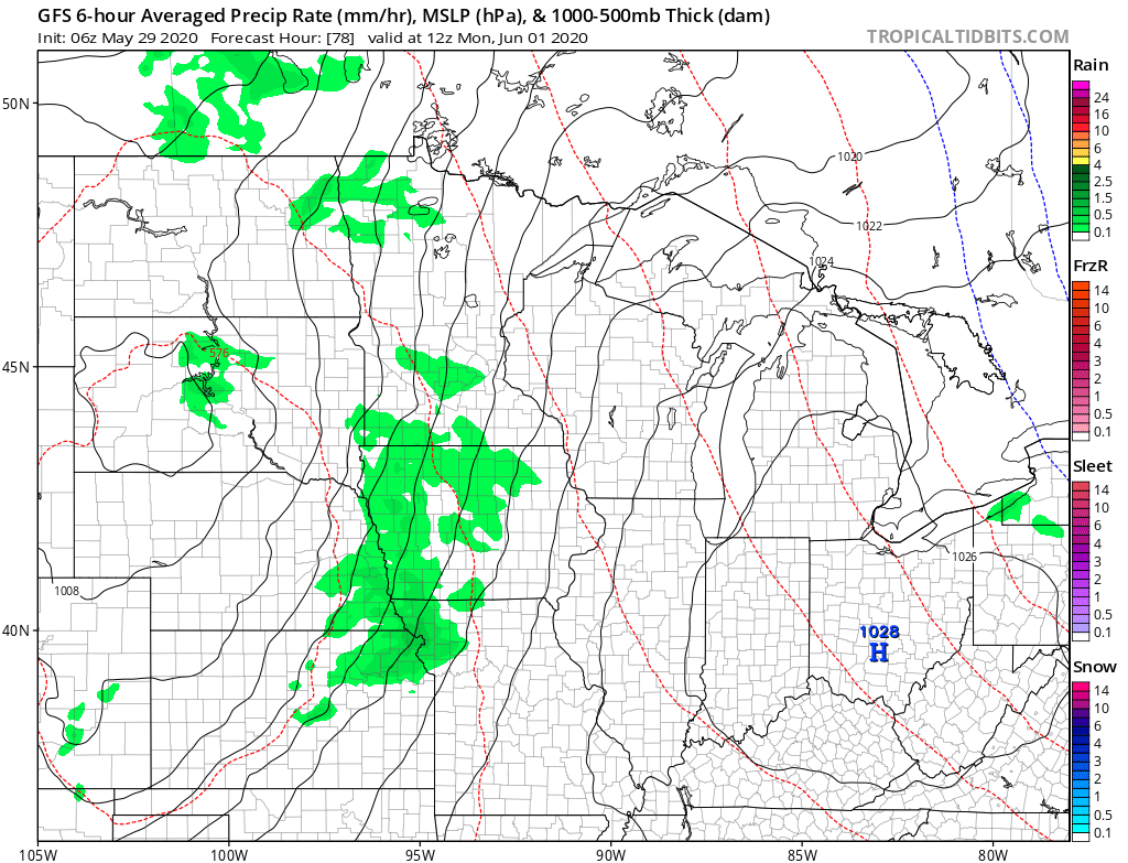
Overall, the pattern looks drier next week, with most of the rain chances remaining light.
Programming note
You can hear my live weather updates on MPR News at 7:48 a.m. Monday through Friday morning.

