
A comfy Thursday, scattered rain showers and thunder favor northern Minnesota
Go Deeper.
Create an account or log in to save stories.
Like this?
Thanks for liking this story! We have added it to a list of your favorite stories.


Our average Twin Cities high temperature is 78 degrees this time of year. We’re expecting highs in the upper 70s this Thursday afternoon in the Twin Cities metro area. Much of Minnesota and western Wisconsin will top out in the 70s:
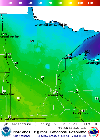
Southwestern Minnesota and south-central Minnesota will see some lower 80s, and far northern Minnesota will have highs in the 60s.
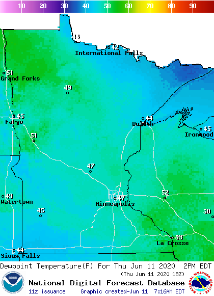
Dew points will be in the comfortable 40s in most spots:
It’ll be breezy, with wind gusts of 25 to 30 mph possible:
Turn Up Your Support
MPR News helps you turn down the noise and build shared understanding. Turn up your support for this public resource and keep trusted journalism accessible to all.
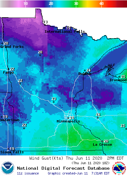
Plotted values are in knots, with 24 knots equal to 28 mph.
Rain chances highest to the north
Scattered showers and thunderstorms are possible in northern Minnesota and northwestern Wisconsin.
The National Oceanic and Atmospheric Administration’s North American Mesoscale (NAM) forecast model shows the potential rain pattern Thursday and Thursday evening:
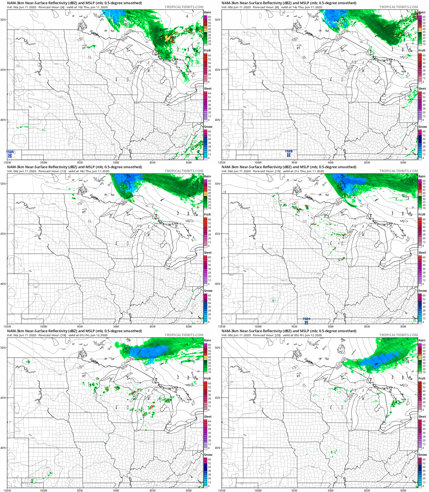
You can see that east-central Minnesota and west-central Wisconsin could be clipped by a shower or a thunderstorm. The northeastern part of the metro area could see a passing thundershower Thursday evening.
You can hear updated weather information on the MPR network, and you’ll see updated weather info on the MPR News live weather blog.
This Updraft blog will be updated by 9:30 a.m. with info on Friday and the weekend.

