
Weekend forecast: Very nice!
Saturday morning shower chance southwestern Minnesota
Go Deeper.
Create an account or log in to save stories.
Like this?
Thanks for liking this story! We have added it to a list of your favorite stories.


I’ll start with a brief note about our Thursday afternoon and evening weather. Forecast models show scattered showers and a few embedded thunderstorms developing over parts of northern Minnesota and northwestern Wisconsin Thursday afternoon, then continuing into Thursday evening.
Portions of east-central Minnesota and west-central Wisconsin may see an isolated shower or thunderstorm later Thursday afternoon and Thursday evening. A few of those could clip the northeastern edge of the Twin Cities metro area.
The National Weather Service Storm Prediction Center shows a marginal risk of severe weather Thursday afternoon and evening in parts of northern and central Minnesota and northern and central Wisconsin:
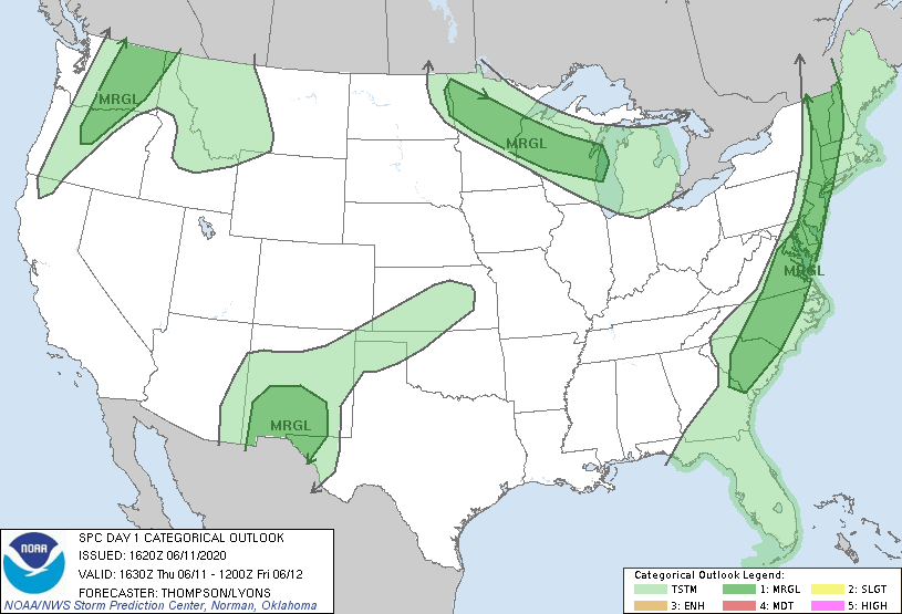
Marginal risk means that an isolated severe thunderstorm is possible. The main severe weather threat later this afternoon and this evening is strong winds.
Turn Up Your Support
MPR News helps you turn down the noise and build shared understanding. Turn up your support for this public resource and keep trusted journalism accessible to all.
You can hear updated weather information on the MPR network, and you’ll see updated weather info on the MPR News live weather blog.
Now, let’s talk about the weekend!
Weekend rain chances are minimal
One forecast model shows scattered showers in southwestern Minnesota Saturday morning. Most of our weekend hours are expected to be dry.
Temps and dew points
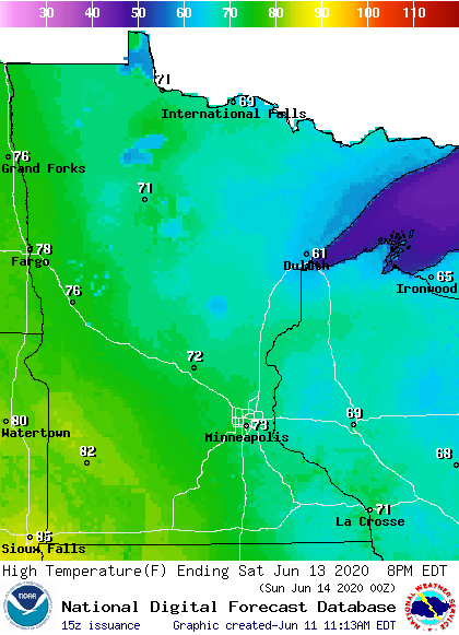
Saturday highs will be mainly in the 70s, with some lower 80s in southwestern Minnesota and 60s to the northeast:
Saturday dew points will be in the comfortable 40s, with some lower 50s southwest:
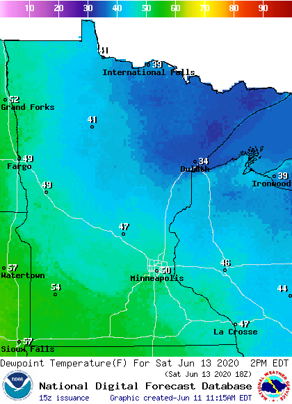
Notice the incredibly dry (for June) dew points in the 30s in northeastern Minnesota.
Saturday afternoon wind gusts will be in the 18-25 mph range:
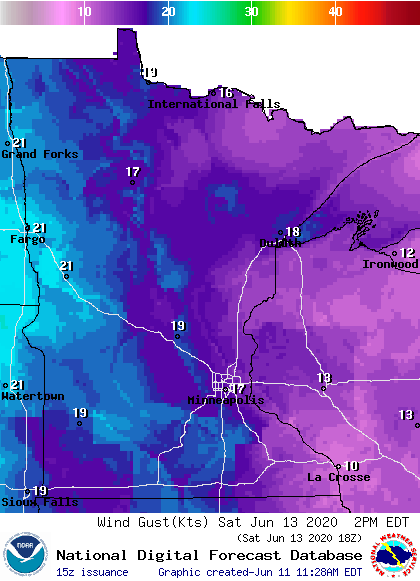
Plotted values are in knots, with 17 knots equal to 20 mph.
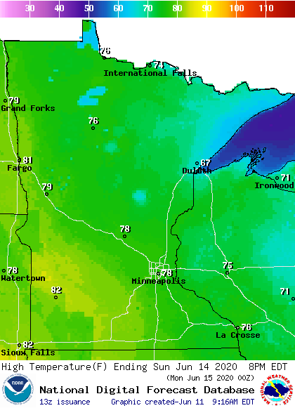
Back to temperatures, Sunday highs will be mainly in the 70s, with some 80s in southwestern Minnesota and cool 60s in parts of the northeast:
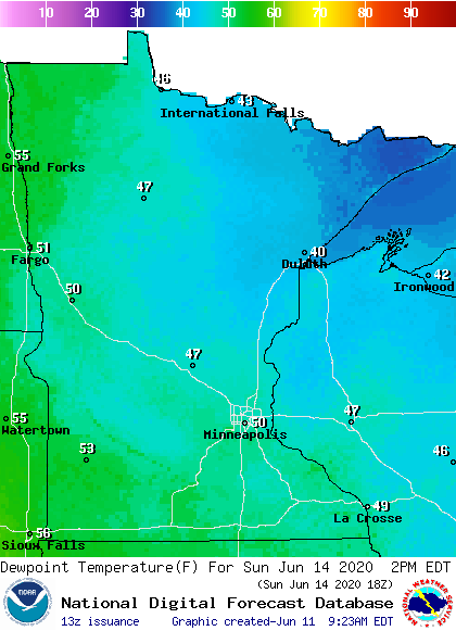
Sunday dew points will be in the comfortable 40s and lower 50s:
If you prefer hot and humid weather, hang in there. It’ll be steamy next Tuesday and Wednesday.

