
Frosty start up north; pleasant Friday in most areas
Go Deeper.
Create an account or log in to save stories.
Like this?
Thanks for liking this story! We have added it to a list of your favorite stories.


Lows in the 30s Friday morning prompted a frost advisory that ended at 7 a.m. in much of northeastern Minnesota.
According to the Duluth office of the National Weather Service, the latest frost advisory of spring in northeastern Minnesota was on June 17, 1999:
Parts of northeastern Minnesota may also see frost late Friday night into early Saturday:
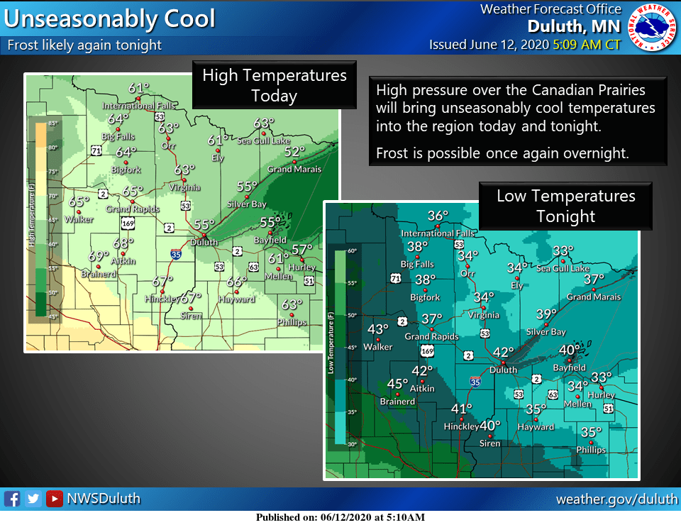
Friday highs in the 60s are expected in the northeast, with 50s near Lake Superior.
Turn Up Your Support
MPR News helps you turn down the noise and build shared understanding. Turn up your support for this public resource and keep trusted journalism accessible to all.
Friday focus
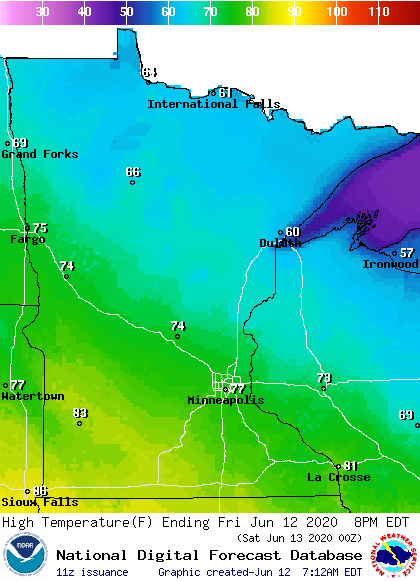
Friday afternoon highs will reach the 70s in central Minnesota and west-central Wisconsin, with 80s in southwestern and south-central Minnesota:
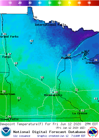
Dew points will be in the comfortable 40s and lower 50s:
Winds will be lighter than Thursday, with Friday afternoon gusts of 12-18 mph:
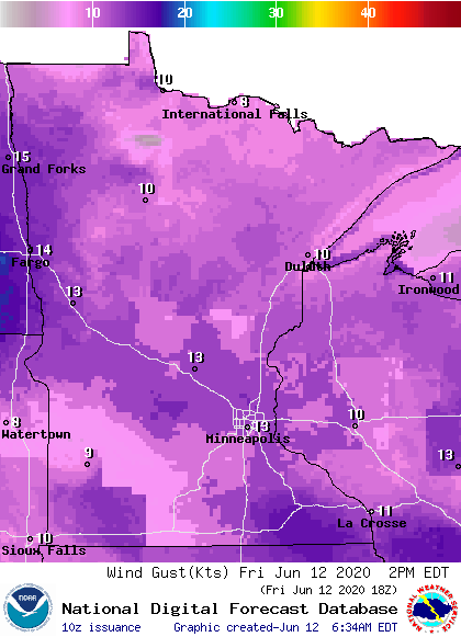
Plotted values are in knots, with 13 knots equal to 15 mph.
You can hear updated weather information on the MPR network, and you’ll see updated weather info on the MPR News live weather blog.
This Updraft blog will be updated by 9:45 a.m. with info on our weekend weather and the warmup that’s coming next week.

