
Weekend forecast: Mostly pleasant, but a frosty start in northeastern Minnesota
90s return on Tuesday
Go Deeper.
Create an account or log in to save stories.
Like this?
Thanks for liking this story! We have added it to a list of your favorite stories.


Much of northeastern Minnesota and parts of north-central Minnesota had temps in the 30s early Friday morning. That’s cold for June 12. Similar low temps are expected in northeastern Minnesota late Friday night into early Saturday morning.
A frost advisory runs from midnight Friday to 7 a.m. Saturday in northeastern Minnesota and parts of northwestern Wisconsin:
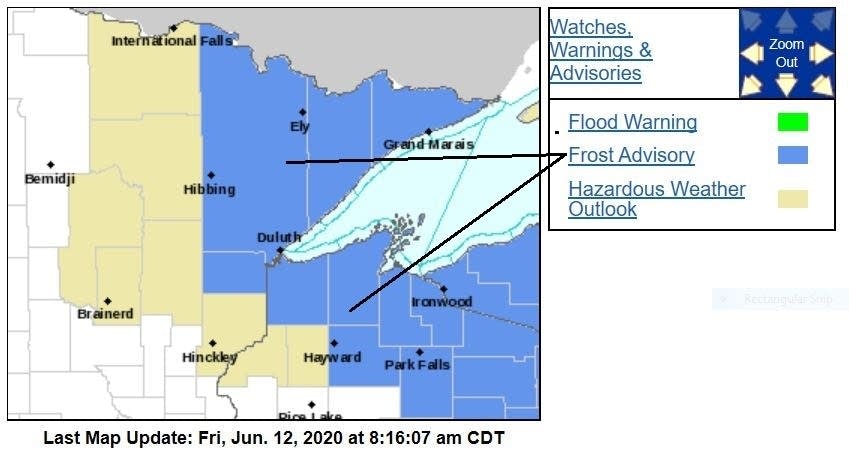
Here are the details of the frost advisory:
MNZ037-WIZ001>004-008-009-130030- /O.NEW.KDLH.FR.Y.0004.200613T0500Z-200613T1200Z/ Carlton and South St. Louis-Douglas-Bayfield-Ashland-Iron-Sawyer- Price- Including the cities of Duluth, Superior, Washburn, Bayfield, Ashland, Hurley, Hayward, and Phillips 722 AM CDT Fri Jun 12 2020
Turn Up Your Support
MPR News helps you turn down the noise and build shared understanding. Turn up your support for this public resource and keep trusted journalism accessible to all.
...FROST ADVISORY IN EFFECT FROM MIDNIGHT TONIGHT TO 7 AM CDT SATURDAY...
* WHAT...Temperatures in the lower to middle thirties will result in frost formation. Frost is not expected along the immediate Lake Superior shoreline.
* WHERE...In Wisconsin, Douglas, Bayfield, Ashland, Iron, Sawyer and Price Counties. In Minnesota, Carlton and South St. Louis County. This includes the Tribal Lands of the Red Cliff Band, the Bad River Reservation and the Fond du Lac Band.
* WHEN...From midnight tonight to 7 AM CDT Saturday.
* IMPACTS...Frost could kill sensitive outdoor vegetation if left uncovered.
PRECAUTIONARY/PREPAREDNESS ACTIONS... Take steps now to protect tender plants from the cold.
Comfortable weekend temps and dew points
Let’s take a walk through the weekend.
Most of our weekend hours will be dry, but a few scattered showers are possible in central and southern Minnesota late Friday evening into Saturday morning. The National Oceanic and Atmospheric Administration’s North American Mesoscale (NAM) forecast model shows the potential rain pattern Friday evening through Saturday afternoon:
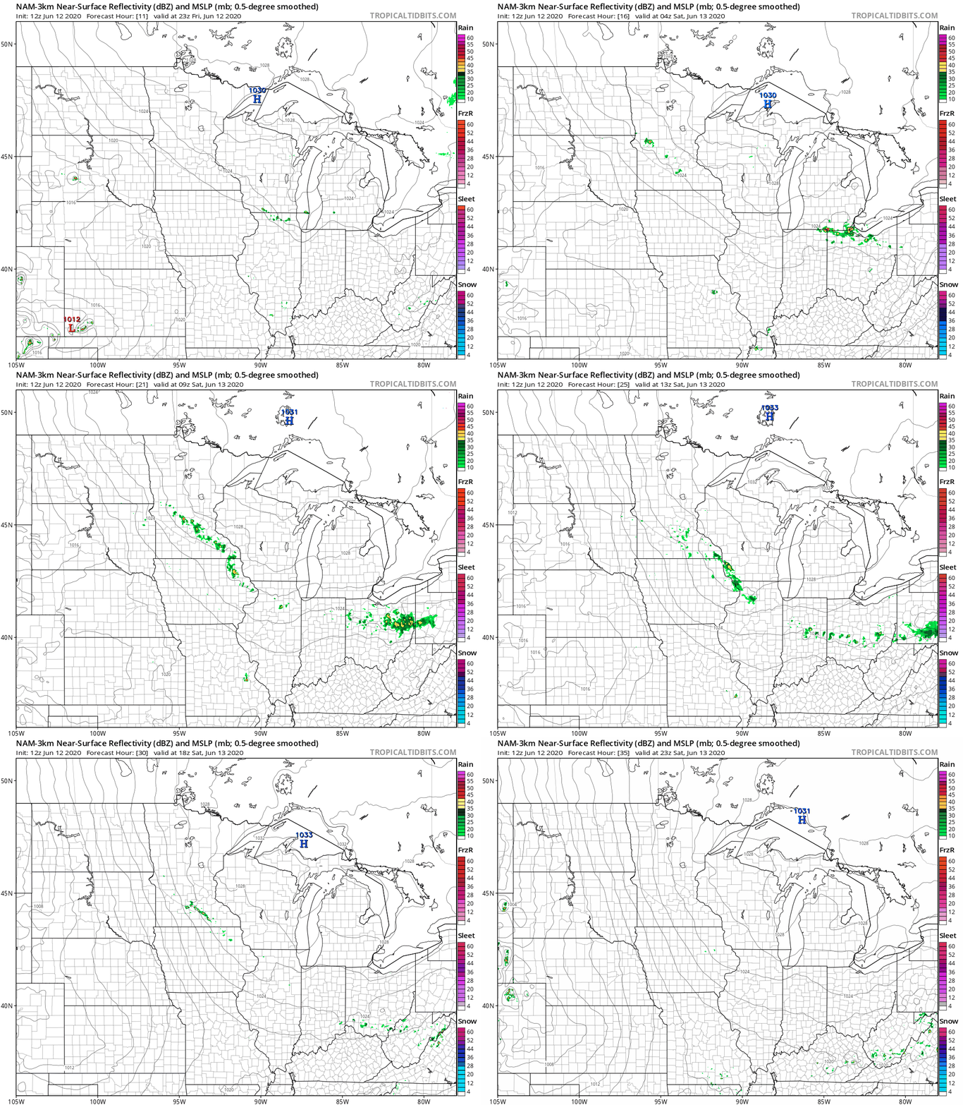
The NAM model also shows scattered showers in south-central Minnesota Saturday afternoon, while other models do not.
You can hear updated weather information on the MPR network, and you’ll see updated weather info on the MPR News live weather blog.
Saturday highs are in the 70s in many areas, with a few 80s in southwestern Minnesota and some 60s northeast:
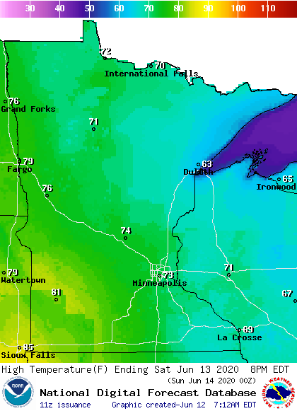
The Twin Cities metro area will top out in the lower 70s on Saturday.
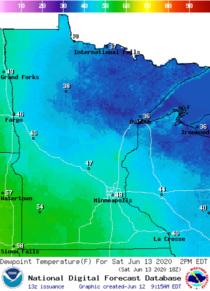
Saturday dew points are mostly in the comfortable 40s, with incredibly dry 30s northeast:
Saturday afternoon wind gusts could reach 20 to 25 mph:
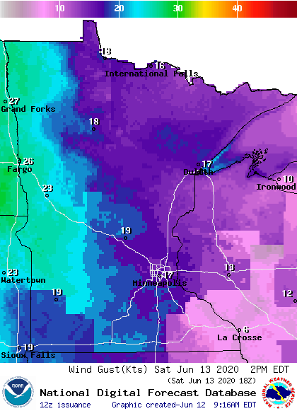
Plotted values are in knots, with 17 knots equal to about 20 mph.
Sunday highs reach the 80s in western Minnesota with mainly 70s elsewhere:
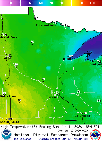
There’ll be some 60s near Lake Superior. Twin Cities metro area highs are expected to reach the upper 70s Sunday.
Sunday dew points are comfortable:

Sunday afternoon wind gusts of 20 to 25 mph are possible, with gusts to around 30 mph possible in the far west:
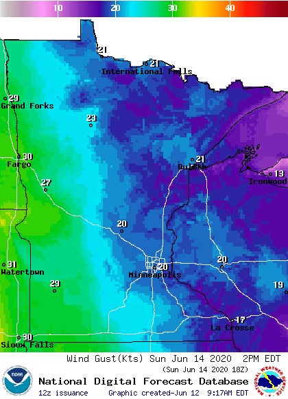
Temps ramp up next week
The Twin Cities metro area will see highs in the upper 80s next Monday, followed by lower 90s Tuesday and possibly mid-90s on Wednesday.
The European Center for Medium-Range Weather Forecasts (ECMWF) model shows temps in the 90s in much of the southern half of Minnesota at 1 p.m. next Tuesday:
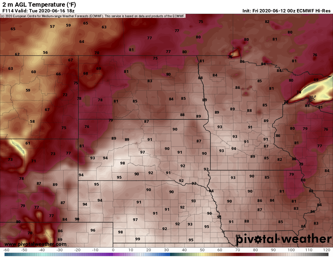
Our highs this time of year often occur around 4 p.m., so Tuesday highs will probably exceed those 1 p.m. temps.
The European forecast model also shows many 90s at 1 p.m. on Wednesday:
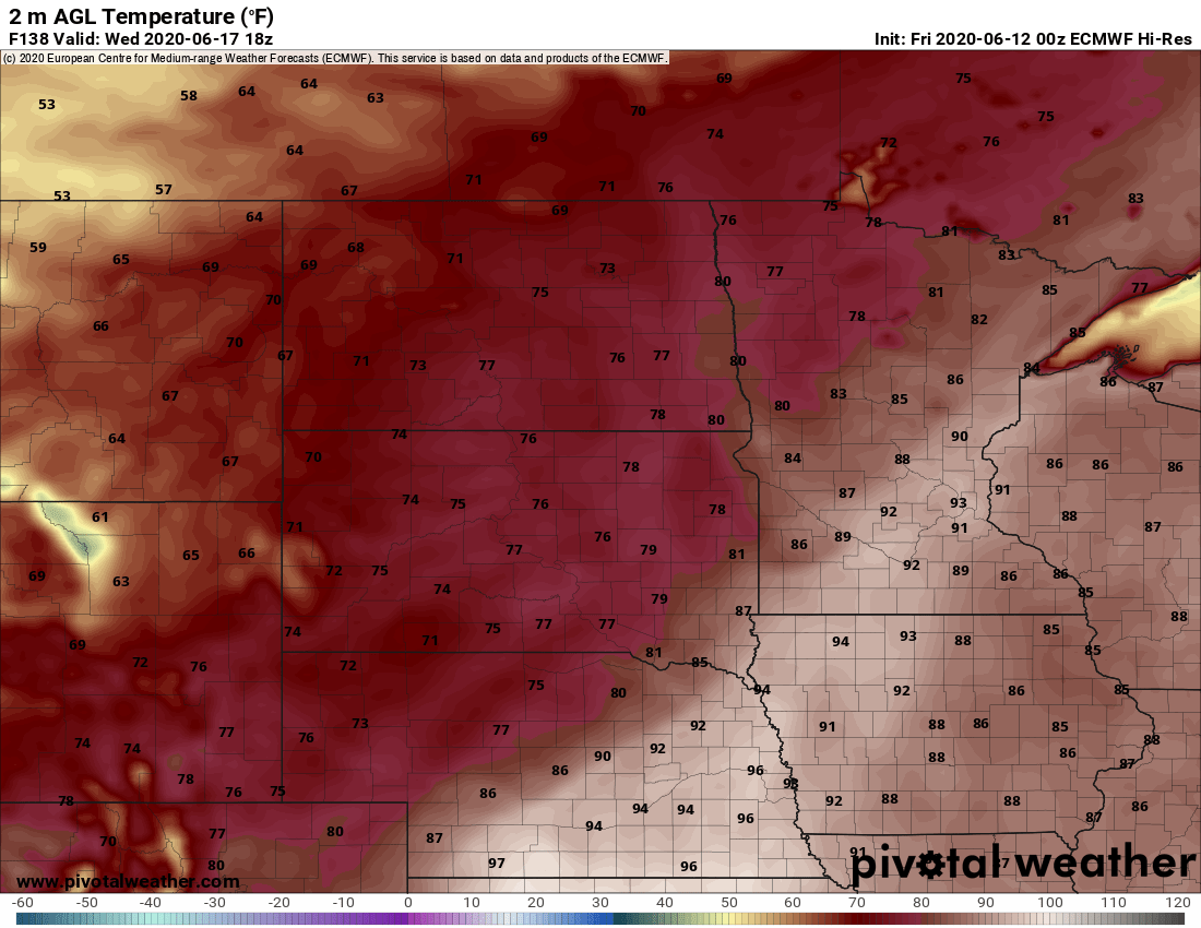
Dew points in the sticky 60s are expected in the hottest areas on Tuesday and Wednesday, so it’ll feel summery.
Programming note
You can hear my live weather updates on MPR News at 7:35 a.m., 9:35 a.m. and 4:35 p.m. each Saturday and Sunday.

