
Breezy with a passing shower possible Saturday; a bit warmer on Sunday
Temps and humidity ramp up next week
Go Deeper.
Create an account or log in to save stories.
Like this?
Thanks for liking this story! We have added it to a list of your favorite stories.


Saturday started out very chilly in northeastern Minnesota, with 30s and even a few 20s:
Saturday afternoon highs will reach the 60s in much of northeastern Minnesota, with some 50s near Lake Superior. Highs will be mainly in the 70s across the remainder of Minnesota plus western Wisconsin. A few spots in southwestern Minnesota may top 80.
Dew points will be comfortable Saturday afternoon, and it’ll be a bit breezy with wind gusts over 20 mph at times.
Temperature trends
Turn Up Your Support
MPR News helps you turn down the noise and build shared understanding. Turn up your support for this public resource and keep trusted journalism accessible to all.
Our average Twin Cities high temperature for June 14 is 79 degrees. We could top 80 Sunday afternoon, and a lot of spots in southwestern Minnesota will have highs in the 80s:
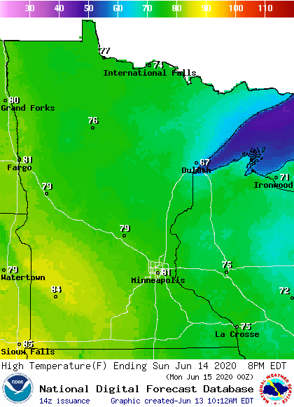
There’ll be many 70s elsewhere in Minnesota plus western Wisconsin, with some 60s near Lake Superior.
Wind gusts of 25 to 35 mph are possible Sunday, with the highest gusts in western Minnesota:
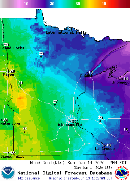
Plotted values are in knots, with 25 knots equal to about 29 mph.
Back to temperatures, Twin Cities metro area highs are projected to reach the mid 80s Monday, followed by lower 90s Tuesday and Wednesday…then back down to mid 80s Thursday and lower 80s Friday.
The European Center for Medium-Range Weather Forecasts (ECMWF) model shows temps in the 90s in much of the southern half of Minnesota at 1 p.m. next Tuesday:
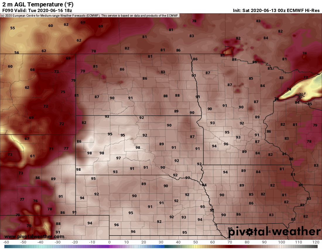
Our highs this time of year often occur around 4 p.m., so Tuesday highs will probably exceed those 1 p.m. temps.
The European forecast model also shows many 90s at 1 p.m. on Wednesday:
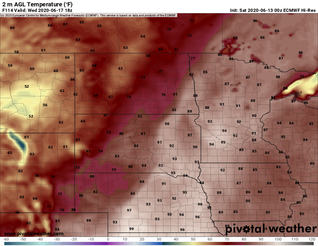
Dew points in the sticky 60s are expected in the hottest areas on Tuesday and Wednesday, so it’ll feel summery.
Rain chances
Some spots in the southern third of Minnesota have seen spotty rain showers this Saturday morning. You might have even seen a rainbow:
A few additional spotty showers could pop up Saturday afternoon, but any shower would not last long at any given location.
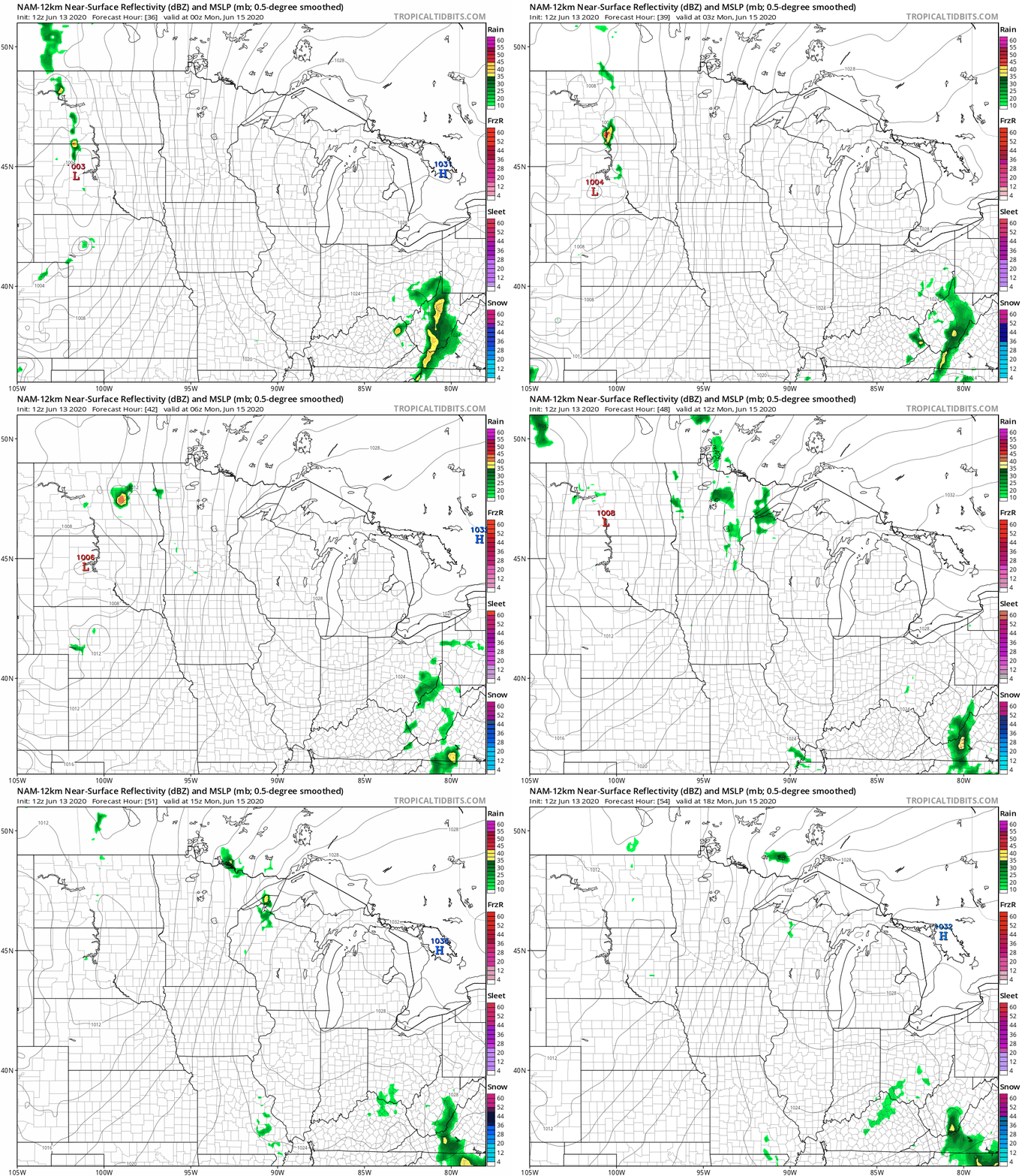
Forecast models show that most areas will see a dry Sunday. Some scattered showers and isolated thunderstorms could develop late Sunday night and linger into Monday morning.
The National Oceanic and Atmospheric Administration’s North American Mesoscale (NAM) forecast model shows the potential rain pattern Sunday evening through Monday morning:
You can hear updated weather information on the MPR network, and you’ll see updated weather info on the MPR News live weather blog.
Programming note
You can hear my live weather updates on MPR News at 7:35 a.m., 9:35 a.m. and 4:35 p.m. each Saturday and Sunday.

