
A couple hot days ahead, then storms return
Western Minnesota under a wind advisory
Go Deeper.
Create an account or log in to save stories.
Like this?
Thanks for liking this story! We have added it to a list of your favorite stories.


Hot, humid, and windy weather persists across Minnesota through Wednesday, then the weather turns more active again by Wednesday evening, bringing periods of showers and storms through the end of the week.
Tuesday into Wednesday morning
Tuesday started off very mild, with most temperatures around the state in the 60s and 70s. Under warm winds from the south and sunny skies, most of the state sees a hot and humid day, with widespread highs in the 90s.
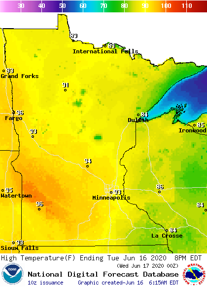
The one exception is that because of a wind flow off Lake Superior, the North Shore only makes it into the 70s and portions of the Arrowhead stay in the 80s.
The southerly winds will be strong again Tuesday, with much of Minnesota getting gusts over 30 mph, and western portions of the state seeing gusts top 40 and even 50 mph.
Turn Up Your Support
MPR News helps you turn down the noise and build shared understanding. Turn up your support for this public resource and keep trusted journalism accessible to all.

That potential for high winds has prompted a wind advisory for much of western Minnesota.
It stays warm overnight, and much of Minnesota will wake up even warmer Wednesday morning than Tuesday morning, especially for the western half of the state, where most of the temperatures stay in the 70s.
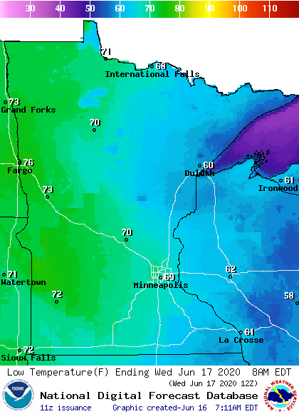
A few locations could set record warm minimum temperatures, including parts of northeastern Minnesota.
Storms return
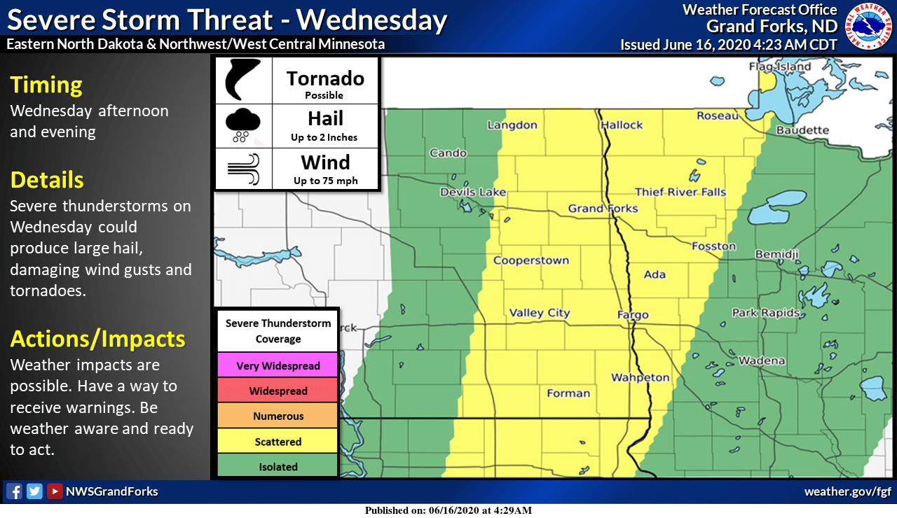
Wednesday’s forecast is similar to Tuesday; starting off warm, getting hot and humid, and although not as windy, it will still be breezy. However, by Wednesday afternoon, showers and storms start to push into northwestern Minnesota, bringing a severe weather risk along with it.
While much of western Minnesota had an isolated risk for stronger storms through Wednesday night, the northwestern corner of the state is more likely to see scattered severe weather, with wind and hail as the primary threat, but isolated tornadoes are also possible.
The storm pushes more widespread showers and storms across Minnesota Thursday, although severe weather is less likely.
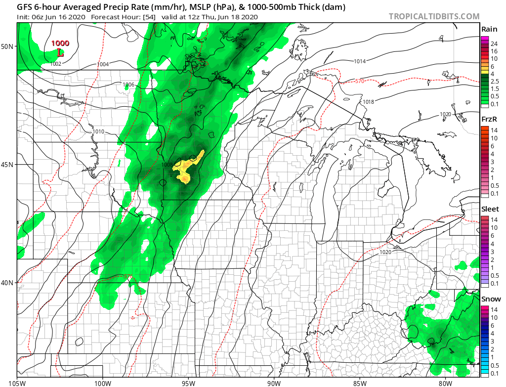
The front associated with the storm system moves through Minnesota Thursday, cooling the northern part of the state Thursday, then dropping temperatures for the rest of the state by Friday.
Here is that temperature trend for the Twin Cities:
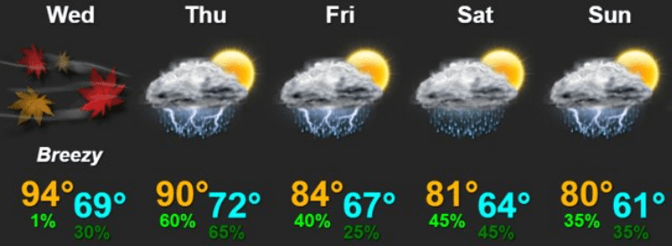
While Thursday brings the highest chance for statewide storms, the weather pattern remains active the second half of the week, with occasional showers and storms possible through the weekend.
Programming note
You can hear my live weather updates on Minnesota Public Radio at 7:48 a.m. Monday through Friday morning.

