
Cooler, drier weather for Friday
Sunny skies across most of the state
Go Deeper.
Create an account or log in to save stories.
Like this?
Thanks for liking this story! We have added it to a list of your favorite stories.


Friday will be drier and slightly cooler behind the cold front that passed through Minnesota bringing showers and storms Thursday.
Friday’s forecast
The cold front that brought widespread showers and storms Thursday has now cleared south of the state. This has moved the wet weather out and is returning most of the state to sunny skies, although the southeastern corner of the state will still see lingering clouds and possibly an isolated shower.
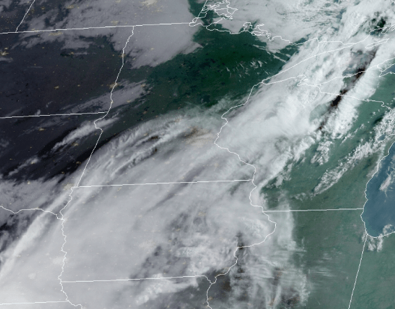
Light winds out of the north and west are pushing cooler, less humid air across the state. Morning temperatures are mostly in the 50s and 60s, and afternoon highs will be predominantly in the 70s.
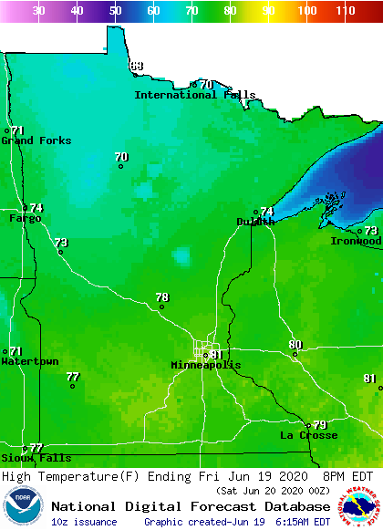
A couple temperatures in the low 80s are possible in southern Minnesota, including the Twin Cities. These temperatures are much more seasonable for mid-June versus the recent heat.
More showers and storms are likely over the weekend. That extended forecast will be updated around 9 a.m.
Programming note
You can hear my live weather updates on Minnesota Public Radio at 7:48 a.m. Monday through Friday morning.
Turn Up Your Support
MPR News helps you turn down the noise and build shared understanding. Turn up your support for this public resource and keep trusted journalism accessible to all.

