
The first week of summer brings active weather
Severe storms likely Sunday evening
Go Deeper.
Create an account or log in to save stories.
Like this?
Thanks for liking this story! We have added it to a list of your favorite stories.


Storms, some of which are occasionally severe, will continue to move across southern Minnesota through the evening. The rest of the week ahead remains active, with seasonable temperatures.
Stormy evening
A cold front has been moving through Minnesota, bringing showers and storms along with it. As of 6 p.m., the front has moved entirely through northwest Minnesota, returning dry skies to that portion of the state, and now extends from the Arrowhead down through southern Minnesota causing active weather in those areas.
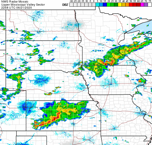
Southern Minnesota has the potential to see occasional severe weather, with wind and hail being the primary threats.
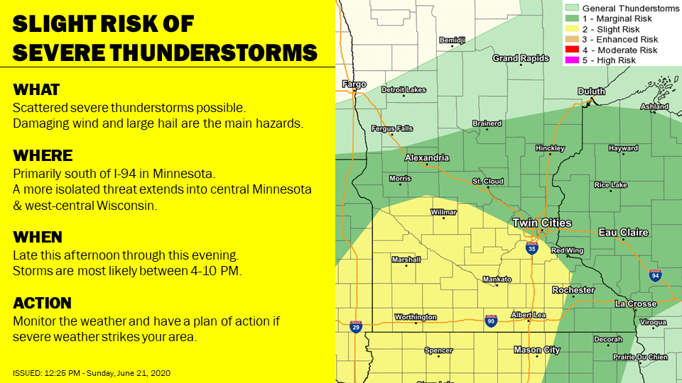
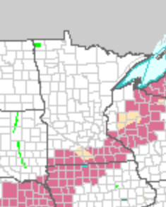
Because of that, much of southern Minnesota is under a Severe Thunderstorm Watch until 11 p.m. Sunday given the potential for strong storms.
Turn Up Your Support
MPR News helps you turn down the noise and build shared understanding. Turn up your support for this public resource and keep trusted journalism accessible to all.
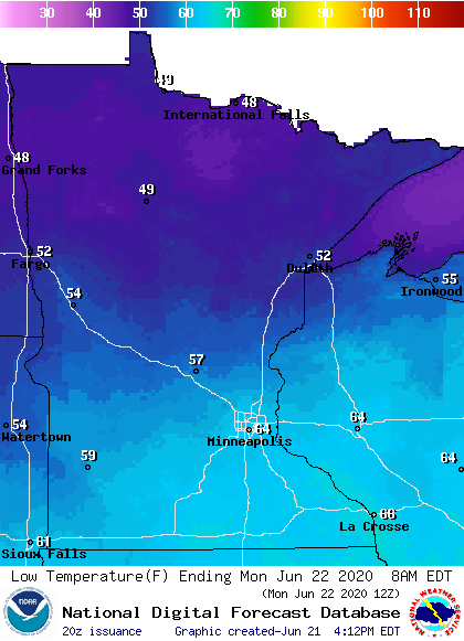
While the severe risk diminishes by late Sunday night, a few scattered showers and storms may linger in southeast Minnesota through Monday morning, until the front finally moves out. Overnight temperatures will vary from the 40s in northern Minnesota, where skies continue to clear, to 60s in southern Minnesota under the lingering clouds and rain chances.
Seasonable temperatures & more storms possible
After the 90s so much of the state saw last week, the first week of summer brings more typical June weather, with most of the highs across the state in the 70s and 80s. Here is the temperature trend for the Twin Cities:

However, the pattern stays much more active, with at least part of Minnesota seeing possible showers and storms every day through the week. Most of the weather looks widely scattered, with plenty of dry breaks, but it currently looks like Friday may bring more widespread showers and storms. We’ll keep you posted as that system approaches!
Programming note
You can hear my live weather updates on Minnesota Public Radio at 7:48 a.m. Monday through Friday morning.

