
Spotty showers Tuesday evening, then widespread rain Friday
Temperatures rise through the weekend
Go Deeper.
Create an account or log in to save stories.
Like this?
Thanks for liking this story! We have added it to a list of your favorite stories.


A few spotty showers and storms will linger across Minnesota through Tuesday evening, but the state stays mostly dry until a storm causes widespread wet weather on Friday.
Tuesday evening through Wednesday
A few spotty showers and storms developed Tuesday afternoon, mostly in north-central Minnesota, and have been making their way south. Here is where the wet weather is as of 5:38 p.m. Tuesday, which shows some of the showers and storms are poised to move through the Twin Cities Tuesday evening.

Strong storms are not expected, and the activity winds down through the evening.
The weather will be unstable enough Wednesday for a few isolated showers and storms to pop-up in the afternoon, but then they are more likely to develop in southern Minnesota.

Most of the state will start Wednesday in the 50s and see highs in the 70s.
Turn Up Your Support
MPR News helps you turn down the noise and build shared understanding. Turn up your support for this public resource and keep trusted journalism accessible to all.
The next storm
After the spotty showers Tuesday and Wednesday, Thursday is likely to stay dry until evening, when the next weather system starts moving into western Minnesota. Showers and storms spread across the state through the night, with most of the state seeing rain by Friday morning.
The entire state can expect mostly cloudy skies, with scattered showers and storms through the day Friday, before everything clears out west to east late Friday and into Saturday morning. Most of the state should see at least a quarter inch precipitation, with high amounts along with storms.
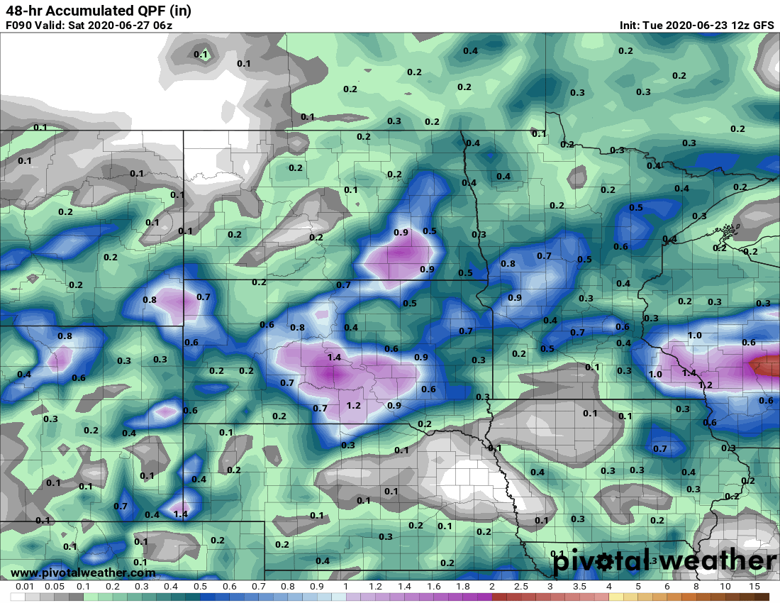
Any rain would be very beneficial for the Arrowhead, which has been dry. For the year-to-date, Duluth is at its third driest on record.

Temperatures rise
By Thursday, most of the state is back in the 80s, and a few 90s are possible in southern Minnesota by Sunday.
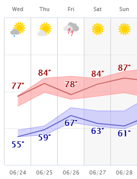
Temperatures are also likely to stay above average through next week. The one possible exception is a brief temperature dip back into the 70s on Friday, especially in any areas seeing more rain. June has been a hot month, with many places seeing several days in the 90s, but we’re not the only place that has seen record heat.
The Arctic Circle just had its first reading above 100 degrees Fahrenheit this past week, which is being verified as what is likely the hottest temperature ever on record that far north.
Programming note
You can hear my live weather updates on Minnesota Public Radio at 7:48 a.m. Monday through Friday morning.

